Federal Capital Territory (Nigeria) facts for kids
Quick facts for kids
Federal Capital Territory
|
|||
|---|---|---|---|
|
Federal territory
|
|||
|
|||
| Nickname(s):
Centre of Unity
|
|||

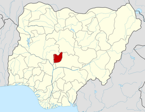
Location of Federal Capital Territory in Nigeria
|
|||
| Country | |||
| Date created | 3 February 1976 | ||
| Capital | Abuja | ||
| Government | |||
| • Body | Federal Capital Territory Administration (FCTA) | ||
| Area | |||
| • Total | 7,315 km2 (2,824 sq mi) | ||
| Population | |||
| • Total | 1,406,239 | ||
| • Estimate
(2011 estimate)
|
2,238,800 | ||
| • Density | 192.240/km2 (497.90/sq mi) | ||
| GDP | |||
| Time zone | UTC+01:00 (WAT) | ||
| ISO 3166 code | NG-FC | ||
| HDI (2021) | 0.646 medium · 7th of 37 |
||
| Website | www.fcta.gov.ng | ||
| Preliminary results | |||
The Federal Capital Territory (FCT) is a special area in central Nigeria. It is home to Abuja, which is the capital city of Nigeria. The FCT was created in 1976. It was formed from parts of old Kaduna, Kwara, Niger, and Plateau states. Most of the land came from Niger state. The FCT is in the North Central part of Nigeria. Unlike other states of Nigeria, which have elected governors, the FCT is managed by the Federal Capital Territory Administration. A minister, chosen by the president, leads this administration.
Contents
History of the FCT
The Federal Capital Territory was created by a special law in 1976. This happened because Lagos, the old capital city, had become very crowded. There was not much room for it to grow. A new capital was needed. The area chosen for the FCT was mainly Gwari Land. This is where the Gbagyis live, and their language is Gwari. This area was picked because it had many Muslims and Christians. It was also seen as a neutral place, not controlled by any of the main ethnic groups.
The 1976 law gave the federal government rights over all the land in the territory. Before the government took over, there were not many people living there. About 120,000 residents lived in 840 villages. Most of them were of Gwari heritage. These residents were moved to nearby towns. Some went to Suleja in Niger state. Others moved to New Karshi in Nasarawa State, just outside the FCT.
Geography of the FCT
The Federal Capital Territory is located just north of where the Niger River and Benue River meet. It shares borders with several states. To the west and north, it borders Niger state. Kaduna is to the northeast. Nasarawa is to the east and south. Kogi is to the southwest.
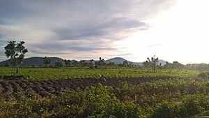
The FCT is located at the very center of Nigeria. It lies between 8.25 and 9.20 degrees north of the equator. It is also between 6.45 and 7.39 degrees east of the Greenwich Meridian. The total land area of the FCT is about 7,315 square kilometers. It is located in the savannah region. This means it has mild weather conditions.
Natural Resources in the FCT
The Federal Capital Territory has several natural resources. These include marble, tin, and clay. You can also find mica and tantalite here.
Wildlife in the FCT
The hills of the FCT are home to many animals. These include bushbuck and forest Black duiker. You can also find bush pigs, chimpanzees, and red-flanked duiker.
Other animals living in the FCT woodlands are leopards and buffaloes. There are also roan antelopes, Western hartebeests, and elephants. You might see warthogs, grey duikers, dog-faced baboons, patas monkeys, and green monkeys.
Climate in the FCT
The climate in the Federal Capital Territory is generally mild. This is similar to some northern states in Nigeria. The FCT is usually very hot from January to April. The average daily high temperature is above 30 degrees Celsius (86 degrees Fahrenheit). March is typically the hottest month of the year.
The rainy season in the territory lasts from July to October each year. December is the coolest month. This is during the harmattan season. During the harmattan, the air is very humid. It is also windy and often foggy.
Subdivisions of the FCT
The Federal Capital Territory minister is in charge of the entire FCT. However, the Federal Capital Development Authority (FCDA) has a special job. It focuses on building and developing the infrastructure in the region.
The FCT is divided into six local government areas. These are:
- Abaji
- Abuja Municipal
- Bwari
- Gwagwalada
- Kuje
- Kwali
Languages Spoken in the FCT
Many different languages are spoken in the Federal Capital Territory. Here are some of the languages found in each local government area:
| LGA | Languages |
|---|---|
| Abaji | Bassa; Dibo, Gupa-Abawa, Ebira, Ganagana |
| Municipal | Gade; Gbagyi, Bassa Gwandara, Nupe, Hausa |
| Bwari | Gwandara; Ashe; Gbagyi |
| Gwagwalada | Bassa; Gbari, Egibra, Hausa |
| Kuje | Gade; Gbagyi, Bassa |
| Kwali | Gwandara; Gbagyi; Bassa, Ebira, Kami, Ganagana, Nupe, Hausa |
The Hausa language is widely spoken throughout the Federal Capital Territory.
Politics in the FCT
The local council members for the Federal Capital Territory were chosen in the 2022 Federal Capital Territory local elections.
See also
 In Spanish: Territorio de la Capital Federal para niños
 | Isaac Myers |
 | D. Hamilton Jackson |
 | A. Philip Randolph |


