Felt, Oklahoma facts for kids
Quick facts for kids
Felt, Oklahoma
|
|
|---|---|

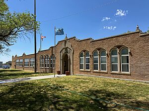
Felt school in 2024
|
|

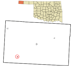
Location in Cimarron County and state of Oklahoma
|
|
| Country | United States |
| State | Oklahoma |
| County | Cimarron |
| Area | |
| • Total | 0.53 sq mi (1.36 km2) |
| • Land | 0.53 sq mi (1.36 km2) |
| • Water | 0.00 sq mi (0.00 km2) |
| Elevation | 4,450 ft (1,360 m) |
| Population
(2020)
|
|
| • Total | 77 |
| • Density | 146.39/sq mi (56.56/km2) |
| Time zone | UTC-6 (Central (CST)) |
| • Summer (DST) | UTC-5 (CDT) |
| ZIP code |
73937
|
| FIPS code | 40-25850 |
Felt is a very small community in Oklahoma, United States. It's located in Cimarron County. In 2020, only 77 people lived there. The town got its name from C.F.W. Felt, who worked for the Santa Fe Railroad. Felt has its own post office and a school.
A famous photo from the Dust Bowl was taken near Felt in 1936. This photo shows how tough life was during the Great Depression. You can also find the Cedar Breaks Archeological District nearby. This area is important for its history.
Contents
Felt's History
Felt became a community because of the railroad. In 1925, the Elkhart and Santa Fe Railway built a line to Felt. This line connected Felt to Elkhart, Kansas and Boise City. Later, in 1932, the railway was extended to Clayton, New Mexico. However, the part of the railway from Boise City to Clayton was no longer used after 1942.
Where is Felt Located?
Felt is in the southwestern part of Cimarron County. This area is at the far western end of the Oklahoma Panhandle. The town is less than five miles north of the Texas border. It is also just over 12 miles east of the New Mexico border.
Felt is the closest Oklahoma community to a special spot called Texhomex. This spot is where the borders of Texas, Oklahoma, and New Mexico meet. It's about 14 miles east-northeast of Felt.
Roads and Nearby Areas
Several U.S. Routes pass through Felt. These include U.S. Route 56, U.S. Route 64, and U.S. Route 412. These roads lead northeast about 20 miles to Boise City. Boise City is the main town in Cimarron County. The roads also go southwest about 24 miles to the larger town of Clayton, New Mexico.
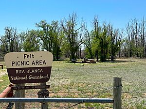
Felt is mostly surrounded by the Rita Blanca National Grassland. This is a large area of protected land. Just south of town, there is a special place called the Felt Picnic Site. It is maintained by the government.
How Many People Live in Felt?
According to the 2020 census, the population of Felt was 77 people.
| Historical population | |||
|---|---|---|---|
| Census | Pop. | %± | |
| 2020 | 77 | — | |
| U.S. Decennial Census | |||
See also
 In Spanish: Felt (Oklahoma) para niños
 | Victor J. Glover |
 | Yvonne Cagle |
 | Jeanette Epps |
 | Bernard A. Harris Jr. |


