
Fish Springs Range facts for kids
Quick facts for kids Fish Springs Range |
|
|---|---|

northeast hills of Fish Springs Range (from Fish Springs)
|
|
| Highest point | |
| Peak | George H. Hansen Peak (Fish Springs Range-(center, slightly south)) |
| Elevation | 5,686 ft (1,733 m) |
| Dimensions | |
| Length | 16 mi (26 km) N-S |
| Width | 4 mi (6.4 km) (at center-south, elsewhere 3-mi surrounded by salt flats or flatlands) |
| Geography | |

Fish Springs Range
Location in Utah
|
|
| Country | United States |
| State | Utah |
| Regions | (Great Basin Desert) (southern)-Great Salt Lake Desert |
| County | Juab |
| Community | Fish Springs (site) |
| Borders on | Snake Valley-NW (Deep Creek Range-NW) Great Salt Lake Desert-NNW, N & NNE Fish Springs National Wildlife Refuge-NE-(attached) (Dugway Range-NE) Fish Springs Flat-E (Thomas Range-E) House Range-SSE Tule Valley-S Snake Valley-W |
The Fish Springs Range is a mountain range in Juab County, Utah. It stretches about 16 miles (26 km) from north to south. This narrow range is located in the western part of Utah.
The northeast side of the Fish Springs Range touches the Fish Springs National Wildlife Refuge. This is a special area where animals are protected. To the east of the range is a flat area called Fish Springs Flat.
The Fish Springs Range is found in the southern part of the Great Salt Lake Desert. Many valleys and other mountain ranges around it also stretch north. These areas often drain towards the Great Salt Lake Desert.
Contents
About the Fish Springs Range
The Fish Springs Range is long and thin. It is mostly 3 to 4 miles wide. The range has a slight curve, bending a little towards the west.
The highest point in the range is George H. Hansen Peak. This peak is located in the center-south part of the range. It stands tall at 5,686 feet (1,733 meters) high.
Nearby Areas and Features
There are other interesting places close to the Fish Springs Range. A smaller mountain area called Middle Range is about 6.5 miles southwest. To the southeast, you can find the northern hills of the House Range.
West of the Fish Springs Range is a unique peak called The Honeycombs. It is also 5,686 feet (1,733 meters) high. These areas show how diverse the landscape is around the Fish Springs Range.
How to Visit the Range
You can reach the Fish Springs Range and the wildlife refuge from different directions. If you are coming from the west, you can access it from Trout Creek.
From the east, there are unpaved roads that lead to the range. These roads come from the Dugway Range area. You can also get there from Delta by taking Utah State Route 174. This route goes through the Sevier Desert.
Images for kids
-
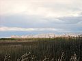
Fish Springs & northern hills of range
-
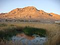
Middle Spring

