Florida Canal facts for kids
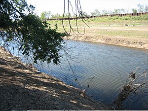
The Florida Canal, also known as the 40 Arpent Canal, is a waterway located in the New Orleans metropolitan area in Louisiana. It flows through the land alongside the Mississippi River. This canal has played an important role in the history and development of the region.
Contents
Building the Canal: A Look at Its History
The Florida Canal was first built a long time ago, in the 1700s. This was during the time when Louisiana was a colony, controlled by other countries. The canal started near what is now the Faubourg Marigny area of New Orleans. It then ran alongside the Mississippi River on its east side. The canal continued through areas that are now Saint Bernard Parish and part of Plaquemines.
Why Was It Called the 40 Arpent Canal?
In colonial times, land was often given out in grants. These grants usually stretched about 40 arpents back from the Mississippi River. An arpent is an old French unit of measurement, roughly equal to 192 feet or about 60 meters. So, the canal was built to mark the back edge of these properties. Most of these lands were originally large farms called plantations.
The canal was built where the higher land near the river ended and the swamp began. This area was usually the limit of land that was good for farming.
Early Uses of the Canal
The "40 Arpent Canal" was used by small boats. These boats helped with trade between nearby plantations. Larger boats and ships that traveled longer distances used the Mississippi River instead. The dirt dug out to make the canal was used to build a raised road. This road was on the river side of the canal and was called the "Florida Walk."
How the Canal Changed Over Time
Over the years, the area around the canal grew. More canals were built that crossed the old 40 Arpent Canal. Because of this, the original canal became broken up into several parts. These parts are not connected anymore.
The "Florida Walk" road also changed. It became "Florida Avenue." However, in some places, this road disappeared. It was either built over or allowed to return to nature. In some areas, like New Orleans, the remaining parts of the canal are now known as the "Florida Canal." But in parts of Saint Bernard and Plaquemines, people still call it the "40 Arpent Canal."
The Canal Today: Drainage and Recreation
The canal is no longer used for shipping goods. However, it is still very important for drainage. This means it helps to carry away extra water from the land. This is especially important in a low-lying area like New Orleans. In some places, people also use the canal for small pleasure boats and for fishing.
Protecting Communities from Flooding
Downriver from the Industrial Canal, the Florida Canal still marks a boundary. It forms the inland edge of the Lower 9th Ward neighborhood in New Orleans. It also borders communities like Arabi and Chalmette.
There are levees and floodwalls built along the back side of the canal. These structures help protect nearby towns from flooding. During Hurricane Katrina in 2005, these levees were topped by the strong storm surge. This happened after the storm surge first went over larger levees and through wetlands. In December 2005, plans were made to make the 40 Arpent Canal back levee taller in Saint Bernard Parish. This was to offer temporary protection until more permanent flood control work could be done.
 | Frances Mary Albrier |
 | Whitney Young |
 | Muhammad Ali |


