Cross Florida Barge Canal facts for kids
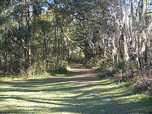
The Cross Florida Barge Canal was a huge project planned to connect the Gulf of Mexico and the Atlantic Ocean across Florida. It was meant to create a shortcut for boats and barges. However, the project was never fully built. Today, the land where the canal was planned is a protected area called the Marjorie Harris Carr Cross Florida Greenway. It's a wide, natural corridor named after Marjorie Harris Carr, who led the effort to stop the canal.
The canal project was stopped mainly because people worried about its impact on Florida's environment. They wanted to protect the state's water supply and the natural areas like the Ocklawaha River. People also felt it was too expensive and not worth the cost. Now, the Greenway is part of Florida State Parks and is managed by the Florida Department of Environmental Protection.
Contents
Why Was the Canal Planned?
The idea for a canal across Florida is very old. It was first suggested by Philip II of Spain way back in 1567! Over hundreds of years, many people thought about it. They hoped it would help ships avoid dangerous routes and piracy.
Early Ideas for a Florida Canal
In 1818, John C. Calhoun, who was the Secretary of War, suggested the canal again. He wanted to prevent shipwrecks and attacks by pirates. Later, the Florida Railroad was built in 1861. It connected the Atlantic Ocean at Fernandina to the Gulf of Mexico at Cedar Key, serving a similar purpose to a canal.
Starting the Canal Project in the 1930s
In the 1930s, during a tough economic time, politicians in Florida pushed for the canal. They saw it as a way to create jobs and help the economy. President Franklin D. Roosevelt approved money for the project in 1935. The whole canal was estimated to cost $143 million.
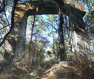
Work began, and by 1936, a lot of dirt had been dug up. About 5,000 acres of land were cleared, and some bridge supports were built near Ocala. But then, a senator from Michigan, Arthur H. Vandenberg, questioned if Congress had even approved the project. Funds ran out, and construction stopped.
Restarting and Stopping Again
The project was approved again in 1942 as a national defense effort during World War II. More money was set aside. Engineers planned to use Dams and locks to protect the underground water supply. However, the money was never actually given to the Army Corps to start building again.
Why Was the Canal Stopped?
The canal project got a new start in 1963 with support from President John F. Kennedy. The next year, President Lyndon B. Johnson even set off the explosives to begin construction. The goal was to finish the canal by 1971, making shipping faster and safer.
Environmental Concerns Grow
As construction continued, many people became worried about the environment. They formed groups like the Florida Defenders of the Environment. These groups argued that the canal would harm Florida's natural areas, especially the Ocklawaha River. They were concerned about pollution and the destruction of wildlife habitats.
A Lawsuit and Presidential Order
In 1969, a lawsuit was filed against the Army Corps of Engineers. This lawsuit led to a temporary order in January 1971 that stopped all construction. Just a few days later, President Richard Nixon signed an executive order to officially halt the project. By this time, about $74 million had been spent.
The Canal Becomes a Greenway
The canal project was officially canceled by Congress in 1990. The land that had been acquired for the canal was then given to the state of Florida. In 1991, it became the Cross Florida Greenway State Recreation and Conservation Area. In 1998, it was renamed the Marjorie Harris Carr Cross Florida Greenway. This honored Marjorie Harris Carr, who had worked so hard to protect Florida's environment from the canal. She passed away the year before at age 82.
What Was the Canal Route?
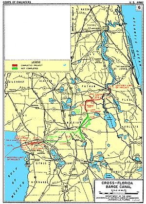
The canal was planned to be 107 miles (172 km) long. It would have followed the St. Johns River from the Atlantic coast to Palatka. Then it would have gone through the Ocklawaha River valley and the Withlacoochee River to the Gulf of Mexico.
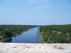
Only about 28% of the canal was actually built. This included a section from the St. Johns River to the Ocklawaha River, part of the route along the Ocklawaha, and a small section near the Gulf of Mexico end, up to Lake Rousseau.
How Would the Canal Help Shipping?
The canal was meant to connect the Atlantic Intracoastal Waterway with the Gulf Intracoastal Waterway. This would have saved ships a lot of time and distance. Instead of going all the way around the tip of Florida through the Straits of Florida, ships could cut straight across. This was expected to be a big boost for national defense and for moving goods.
Bridges and Other Structures
Along the planned route, several bridges and structures were built or planned. Some bridges over the St. Johns River were made high enough for ships to pass under. Other high bridges were built over the canal itself.
Major Crossings and Structures
Here are some of the main roads, railroads, and water control structures along the canal's path:
- Buckman Lock (a lock for boats to change water levels)
- SR 19 (a high bridge)
- George Kirkpatrick Dam (a dam on the Ocklawaha River that created Rodman Reservoir)
- Eureka Lock & Dam (this one was never finished)
- SR 40, Bert Dosh Memorial Bridge (a high bridge)
- US 27-301-441 (this area has some unused bridge supports)
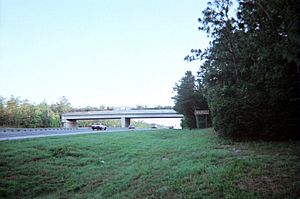
- I-75 (a new land bridge was built here for trail users)
- Inglis Lock (another lock, near the Gulf of Mexico end)
- US 19-98 (twin bridges over the Withlacoochee River)
Between Lake Rousseau and the Ocklawaha River, you can still see parts of the canal that were dug but never filled with water. These unfinished sections and different plant patterns show where the canal was planned.
Timeline of the Canal Project
- May 1933 - The Canal Authority of the State of Florida was created to build the canal.
- 1935-1936 - Construction began, but stopped when money ran out.
- July 1942 - Congress approved building the canal again.
- February 1964 - The U.S. Army Corps of Engineers started construction once more.
- 1969 - Environmental groups filed a lawsuit to stop the canal.
- January 15, 1971 - A court ordered a temporary halt to construction.
- January 19, 1971 - President Richard Nixon signed an order to stop all work on the canal. About $74 million had been spent.
- May 22, 1990 - A new federal bill was proposed to cancel the canal and create a greenway.
- October 27, 1990 - Congress passed the bill to officially cancel the project.
- November 28, 1990 - President George Bush signed the bill into law, changing the land's purpose to recreation and conservation.
- January 22, 1991 - Florida's Governor and Cabinet officially agreed to the terms, leading to the creation of the Cross Florida Greenway State Recreation and Conservation Area.
- 1998 - The Greenway was renamed the Marjorie Harris Carr Cross Florida Greenway to honor Marjorie Harris Carr.
|
 | James Van Der Zee |
 | Alma Thomas |
 | Ellis Wilson |
 | Margaret Taylor-Burroughs |


