Gulf Intracoastal Waterway facts for kids
Quick facts for kids Gulf Intracoastal Waterway |
|
|---|---|

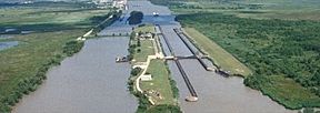
Leland Bowman Lock near Intracoastal City, Louisiana, on the Gulf Intracoastal Waterway
|
|
| Location | Gulf Coast of the United States |
| Country | United States |
| Specifications | |
| Length | 1,050 miles (1,690 km) |
| History | |
| Date completed | June 18, 1949 |
| Geography | |
| Start point | Brownsville, Texas |
| End point | Carrabelle, Florida |
| Branch of | Intracoastal Waterway |
| Connects to | Various |
The Gulf Intracoastal Waterway is a very important water highway. It runs along the Gulf Coast of the United States. This waterway is part of a bigger system called the Intracoastal Waterway.
It's about 1,050 miles long! That's like driving from Carrabelle, Florida all the way to Brownsville, Texas. This water highway is mostly used by large barges. These barges carry lots of goods. The waterway is 12 feet deep, which is perfect for these big boats.
People thought about building this waterway a long time ago, in the early 1800s. But it wasn't finished until 1949.
How We Measure Along the Waterway
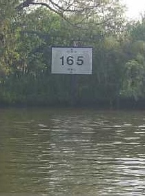
Locations on the Gulf Intracoastal Waterway are measured in miles. These are "statute miles," which are different from "nautical miles" used for most sea routes.
The main starting point for measuring is a place called Harvey Lock. This is a special navigation lock near New Orleans. Locations are measured "East of Harvey Lock" (EHL) or "West of Harvey Lock" (WHL).
For example, the Hathaway Bridge in Panama City, Florida is at mile 284.6 EHL. This means it's 284.6 miles east of Harvey Lock. The Queen Isabella Causeway at South Padre Island is at mile 665.1 WHL. This means it's 665.1 miles west of Harvey Lock.
Connecting Waterways
The Gulf Intracoastal Waterway connects with many other rivers and waterways. It's like a main road that has many smaller roads joining it. These connections help boats travel to even more places.
Some of the waterways that connect to it include:
- Apalachicola River
- Atchafalaya River
- Bayou Lafourche
- Bayou Terrebonne
- Calcasieu River
- Calcasieu Ship Channel
- Delcambre Canal
- Houston Ship Channel
- Industrial Canal
- Lower Mississippi River
- Mississippi River–Gulf Outlet Canal
- Mobile Bay (which connects to the Tennessee–Tombigbee Waterway)
- Pearl River
- Sabine–Neches Waterway (which includes parts of the Neches River, Sabine Lake, and Sabine River)
- Santa Rosa Sound
- The Rigolets
- Vermilion River
Important Ports and Harbors
Many of the busiest ports in the United States are located on or near the Gulf Intracoastal Waterway. Ports are like big docks where ships load and unload cargo. These ports are very important for trade and moving goods across the country.
Here are some of the notable ports on or near the waterway: Florida
- Apalachicola, Florida
- Carrabelle, Florida
- Panama City, Florida
- Pensacola, Florida
Alabama
- Mobile, Alabama - This is one of the busiest ports, ranked 9th in the U.S.
Mississippi
- Gulfport, Mississippi
- Pascagoula, Mississippi - Ranked 21st busiest.
Louisiana
- Baton Rouge, Louisiana - Ranked 10th busiest.
- Houma, Louisiana - Ranked 88th busiest.
- Intracoastal City, Louisiana
- Lake Charles, Louisiana - Ranked 12th busiest.
- Larose, Louisiana
- Morgan City, Louisiana
- New Orleans, Louisiana - Ranked 7th busiest.
- Port Allen, Louisiana
- Port of South Louisiana - This is ranked as the busiest port in the entire United States!
Texas
- Beaumont, Texas - Ranked 4th busiest.
- Brownsville, Texas - Ranked 72nd busiest.
- Corpus Christi, Texas - Ranked 8th busiest.
- Galveston, Texas - Ranked 48th busiest.
- Houston, Texas - Ranked 2nd busiest.
- Port Arthur, Texas - Ranked 18th busiest.
- Port Lavaca - Point Comfort, Texas - Ranked 50th busiest.
- Texas City, Texas - Ranked 14th busiest.
- Victoria, Texas - Ranked 73rd busiest.
 | Anna J. Cooper |
 | Mary McLeod Bethune |
 | Lillie Mae Bradford |


