Sabine–Neches Waterway facts for kids
Quick facts for kids Sabine–Neches Waterway |
|
|---|---|

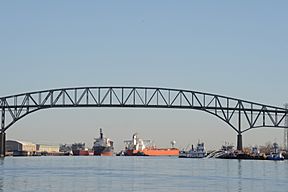
Sabine–Neches Waterway near Port Arthur
|
|
| Lua error in Module:Location_map at line 420: attempt to index field 'wikibase' (a nil value). | |
| Location | Southeast Texas Calcasieu Parish, Louisiana, U.S. |
| Type | Waterway |
| Primary inflows | Neches River Sabine River Taylor Bayou |
| River sources | Neches River Sabine River |
| Primary outflows | Sabine Lake |
| Ocean/sea sources | Gulf of Mexico |
| Basin countries | United States |
| Managing agency | Sabine–Neches Navigation District |
| Built | 1909 |
| Max. length | 79 mi (127 km)miles |
| Max. width | 400 ft (120 m) |
| Average depth | 40 ft (12 m) |
| Max. depth | 40 ft (12 m) |
| Settlements | Beaumont, Texas Orange, Texas Port Arthur, Texas |
The Sabine–Neches Waterway is a very important water highway. It is located in southeast Texas and Calcasieu Parish, Louisiana, in the United States. This waterway connects parts of the Neches River, Sabine River, Sabine Lake, and Taylor Bayou. It is a vital route for ships carrying goods.
This waterway is one of the busiest in the U.S. for moving cargo. It is especially important for liquid cargo like oil. It brings in a lot of crude oil to the U.S. Soon, it is expected to become the biggest exporter of LNG (natural gas turned into liquid) in the country. Another big waterway, the Gulf Intracoastal Waterway, crosses it near Port Arthur.
Contents
Busy Ports Along the Waterway
The Sabine–Neches Waterway serves several major ports. Two of the top 20 busiest ports in the U.S. are found here. These ports handle huge amounts of goods.
Port of Beaumont
The Port of Beaumont is at the northern end of the waterway. In 2013, it was ranked as the fourth busiest port in the U.S. by the amount of cargo it handled. It is a very important hub for trade.
Port of Port Arthur
The Port of Port Arthur is located closer to the southern end. In the same 2013 survey, it was ranked as the eighteenth busiest port. This port also plays a big role in shipping.
Port of Orange
The Port of Orange is another important port that uses this waterway. All these ports help move goods across the country and around the world.
Deepening the Waterway
The Sabine–Neches Waterway is currently at least 40 feet deep and 400 feet wide. This allows large ships to pass through.
Future Deepening Project
In 2014, the U.S. government approved a plan to make the waterway even deeper. The goal is to deepen it to 48 feet. This big project started in 2019. It is expected to take about 12 to 15 years to finish. Making it deeper will allow even larger ships to use the waterway. This will help move more goods and support trade.
History of the Waterway
The organization that manages the waterway is called the Sabine–Neches Navigation District. It was created in 1909.
Channel Depth Changes Over Time
Over the years, the channel has been made deeper several times to allow bigger ships to pass:
- In 1912, the channel was deepened to 25 feet.
- In 1925, it was increased to 30 feet deep.
- By 1935, the channel reached a depth of 35 feet.
- In 1962, it was deepened to at least 40 feet.
Recent Deepening Efforts
In late 2018, the U.S. Army Corps of Engineers approved funding for a new project. This project, called the Sabine-Neches Waterway Channel Improvement Project, began in early 2019. It will increase the channel depth to 48 feet. It will also make the waterway longer, from 64 miles to 77 miles. This ongoing work helps the waterway stay important for shipping.
 | Stephanie Wilson |
 | Charles Bolden |
 | Ronald McNair |
 | Frederick D. Gregory |


