Southeast Texas facts for kids
Quick facts for kids
Southeast Texas
|
|
|---|---|
|
|
|

Southeast Texas counties in red
|
|
| Country | |
| State | |
| Largest city | |
| Population
(2020)
|
|
| • Total | 7,662,325 |
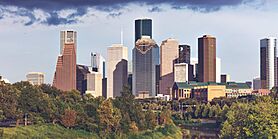
Southeast Texas is a special area in the state of Texas. It shares a border with Southwest Louisiana to the east. This region is part of East Texas. It mainly includes the big cities of Houston and the Beaumont–Port Arthur area. In 2020, about 7.6 million people lived here.
Contents
Exploring Southeast Texas Geography
Southeast Texas has a part of the Gulf of Mexico coast. It also includes most of the Texas section of the Intracoastal Waterway. Many rivers and streams flow through this area. The three largest rivers are the Sabine River, the Neches River, and the Trinity River.
In Southeast Texas, small rivers and creeks flow into swampy areas called "bayous." These bayous mix with the surrounding forests. The only large natural bodies of water here are Galveston Bay and Sabine Lake. However, there are many large man-made lakes (reservoirs) just north of the region. The eastern part of Southeast Texas is very similar to Southwest Louisiana in its geography and culture. But the western, southern, and northern parts have their own unique Texan traditions.
Close to the coast, the land is very flat and often marshy. The Piney Woods forest stretches into the northern parts of Southeast Texas. It reaches down to the rice paddies and marshlands between Houston and Beaumont. The highest point along the coast is at High Island. Here, a natural salt dome raises the land to about 40 feet (12 meters) above sea level.
Away from the coast, the land starts to have rolling hills. These hills are like those found in Northeast and Central Texas. As you move towards Central Texas, the mixed pine and hardwood forests change. They become East Central Texas forests with post oak trees and grasslands.
The Golden Triangle Area
The Golden Triangle is a special area in Southeast Texas. It is very close to the Louisiana border. The "triangle" is made up of three main cities: Beaumont, Port Arthur, and Orange. These are the biggest cities in this part of the region. The name "Golden" comes from the huge amount of wealth. This wealth came from the Spindletop oil discovery near Beaumont in 1901.
Some people tried to change the name to "Triplex." They wanted to move away from the idea of the petrochemical industry. But this new name did not become popular. Local people still call it the Golden Triangle. Some residents of the Golden Triangle believe that the Houston area is not part of Southeast Texas. They often say the western border of the region is around the Trinity River. This river is about 30 miles from downtown Houston.
This area also hosts the yearly South Texas State Fair in Beaumont.
Exploring the Big Thicket
The Big Thicket is a large, dense forest area. It is located just north and northwest of Beaumont. Many small towns are found within this forest. These include Woodville and Kountze.
The Big Thicket National Preserve protects a part of this old forest. It shows off the amazing variety of plants and animals in the area. The preserve is 97,000 acres (390 square kilometers) big. It has many different types of environments. These include piney woods, swamps, and coastal prairies. You can find a huge range of plant species here. Orchids, cactus, cypress, and pine trees grow very close to each other. About 65,000 people visit this special area every year.
Two important historical roads cross the Big Thicket. To the north is the old cattle route, or Beef Trail. This trail went from Tyler County to Louisiana. To the south is the Spanish Trail, also known as the Atascosito Road. This road runs parallel to modern Highway 90 and Interstate 10, from Liberty to Orange.
All About Galveston Bay
Galveston Bay is a large estuary on the upper coast of Texas. An estuary is where a river meets the sea. The bay gets its water from the Trinity River and the San Jacinto River. Many smaller bayous also feed into it. Water also comes in from the Gulf of Mexico with the tides.
The bay covers about 600 square miles (1,500 square kilometers). It is 30 miles (50 kilometers) long and 17 miles (27 kilometers) wide. On average, Galveston Bay is about 7–9 feet (2-3 meters) deep. It has three openings to the Gulf of Mexico. These are Bolivar Roads, San Luis Pass, and Rollover Pass.
The Houston Ship Channel goes through Galveston Bay. This channel connects the Port of Houston to the Gulf. Houston is the biggest city on the bay. Other smaller cities include Galveston, Pasadena, Baytown, and Texas City. The bay is a very important place for sea creatures. It provides areas for them to lay eggs and for young fish to grow. This makes it important for both commercial and fun fishing.
Weather and Climate
Compared to other parts of Texas, Southeast Texas has a different climate. Winters are warmer, and summers are a bit cooler. This region usually gets more rain than other areas of the state. It has a wet season and a dry season, much like places in the tropics. This can make the air feel very humid. The mild and wet weather is mostly because of the nearby Gulf of Mexico.
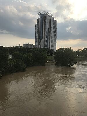
The climate in Southeast Texas is similar to that of Southern Louisiana. The Golden Triangle area gets about 60 inches (1,500 mm) of rain each year. Other parts of Southeast Texas get less rain, but still more than 40 inches (1,000 mm) per year. In 1979, during Tropical Storm Claudette, the city of Alvin recorded 42 inches (1,067 mm) of rain in just 24 hours. This was the most rain ever measured in one day in the United States. Nederland received 66 inches of rain during Hurricane Harvey.
Houston is sometimes called the "Lightning Capital of Texas." This is because it has more lightning strikes than other parts of the state. This area of high lightning activity stretches from Houston eastward into Southwest Louisiana. Many thunderstorms naturally form here, especially during the wet season. However, researchers think that a mix of urban heat islands (cities being hotter than surrounding areas) and air pollution might be causing even more lightning strikes.
Southeast Texas is often affected by hurricanes. Big hurricanes that have hit the area in recent years include:
- Hurricane Rita in 2005
- Hurricane Ike in 2008, which passed over Houston
- Hurricane Harvey in 2017, which caused massive flooding
Weaker storms also hit the area regularly. Some, like Tropical Storm Allison and Tropical Storm Claudette, have caused a lot of damage.
| Climate data for Houston (Intercontinental Airport), 1981–2010 normals, extremes 1888–present | |||||||||||||
|---|---|---|---|---|---|---|---|---|---|---|---|---|---|
| Month | Jan | Feb | Mar | Apr | May | Jun | Jul | Aug | Sep | Oct | Nov | Dec | Year |
| Record high °F (°C) | 84 (29) |
91 (33) |
96 (36) |
95 (35) |
99 (37) |
107 (42) |
105 (41) |
109 (43) |
109 (43) |
99 (37) |
89 (32) |
85 (29) |
109 (43) |
| Mean maximum °F (°C) | 78.4 (25.8) |
80.8 (27.1) |
84.8 (29.3) |
88.9 (31.6) |
93.6 (34.2) |
97.0 (36.1) |
98.4 (36.9) |
100.4 (38.0) |
96.9 (36.1) |
91.8 (33.2) |
85.0 (29.4) |
80.0 (26.7) |
101.0 (38.3) |
| Mean daily maximum °F (°C) | 62.9 (17.2) |
66.3 (19.1) |
73.0 (22.8) |
79.6 (26.4) |
86.3 (30.2) |
91.4 (33.0) |
93.7 (34.3) |
94.5 (34.7) |
89.7 (32.1) |
82.0 (27.8) |
72.5 (22.5) |
64.3 (17.9) |
79.7 (26.5) |
| Daily mean °F (°C) | 53.1 (11.7) |
56.4 (13.6) |
62.7 (17.1) |
69.5 (20.8) |
76.9 (24.9) |
82.4 (28.0) |
84.4 (29.1) |
84.6 (29.2) |
79.8 (26.6) |
71.5 (21.9) |
62.3 (16.8) |
54.4 (12.4) |
69.9 (21.1) |
| Mean daily minimum °F (°C) | 43.2 (6.2) |
46.5 (8.1) |
52.5 (11.4) |
59.4 (15.2) |
67.6 (19.8) |
73.5 (23.1) |
75.1 (23.9) |
74.8 (23.8) |
69.8 (21.0) |
60.9 (16.1) |
52.1 (11.2) |
44.6 (7.0) |
60.0 (15.6) |
| Mean minimum °F (°C) | 26.7 (−2.9) |
29.5 (−1.4) |
34.0 (1.1) |
42.0 (5.6) |
53.3 (11.8) |
65.2 (18.4) |
69.4 (20.8) |
68.6 (20.3) |
55.7 (13.2) |
43.4 (6.3) |
34.5 (1.4) |
27.5 (−2.5) |
23.5 (−4.7) |
| Record low °F (°C) | 5 (−15) |
6 (−14) |
21 (−6) |
31 (−1) |
42 (6) |
52 (11) |
62 (17) |
54 (12) |
45 (7) |
29 (−2) |
19 (−7) |
7 (−14) |
5 (−15) |
| Average precipitation inches (mm) | 3.38 (86) |
3.20 (81) |
3.41 (87) |
3.31 (84) |
5.09 (129) |
5.93 (151) |
3.79 (96) |
3.76 (96) |
4.12 (105) |
5.70 (145) |
4.34 (110) |
3.74 (95) |
49.77 (1,264) |
| Average precipitation days (≥ 0.01 in) | 9.6 | 9.2 | 8.8 | 6.8 | 8.0 | 10.6 | 9.1 | 8.3 | 8.0 | 7.9 | 8.2 | 9.5 | 104.0 |
| Average relative humidity (%) | 74.7 | 73.4 | 72.7 | 73.1 | 75.0 | 74.6 | 74.4 | 75.1 | 76.8 | 75.4 | 76.0 | 75.5 | 74.7 |
| Mean monthly sunshine hours | 143.4 | 155.0 | 192.5 | 209.8 | 249.2 | 281.3 | 293.9 | 270.5 | 236.5 | 228.8 | 168.3 | 148.7 | 2,577.9 |
| Percent possible sunshine | 44 | 50 | 52 | 54 | 59 | 67 | 68 | 66 | 64 | 64 | 53 | 47 | 58 |
| Source: NOAA (relative humidity 1969–1990, sun 1961–1990) | |||||||||||||
| Climate data for Beaumont, Texas (1991–2020 normals, extremes 1901–present) | |||||||||||||
|---|---|---|---|---|---|---|---|---|---|---|---|---|---|
| Month | Jan | Feb | Mar | Apr | May | Jun | Jul | Aug | Sep | Oct | Nov | Dec | Year |
| Record high °F (°C) | 86 (30) |
90 (32) |
95 (35) |
97 (36) |
101 (38) |
106 (41) |
108 (42) |
105 (41) |
108 (42) |
99 (37) |
94 (34) |
86 (30) |
108 (42) |
| Mean daily maximum °F (°C) | 62.6 (17.0) |
65.8 (18.8) |
72.1 (22.3) |
78.3 (25.7) |
85.2 (29.6) |
90.4 (32.4) |
92.0 (33.3) |
92.8 (33.8) |
88.6 (31.4) |
81.5 (27.5) |
71.4 (21.9) |
64.2 (17.9) |
78.7 (25.9) |
| Daily mean °F (°C) | 52.9 (11.6) |
56.6 (13.7) |
62.9 (17.2) |
68.9 (20.5) |
76.6 (24.8) |
82.3 (27.9) |
83.7 (28.7) |
84.1 (28.9) |
79.3 (26.3) |
71.0 (21.7) |
61.3 (16.3) |
54.7 (12.6) |
69.5 (20.8) |
| Mean daily minimum °F (°C) | 43.3 (6.3) |
47.4 (8.6) |
53.7 (12.1) |
59.4 (15.2) |
68.1 (20.1) |
74.1 (23.4) |
75.5 (24.2) |
75.3 (24.1) |
70.1 (21.2) |
60.6 (15.9) |
51.2 (10.7) |
45.1 (7.3) |
60.3 (15.7) |
| Record low °F (°C) | 11 (−12) |
10 (−12) |
20 (−7) |
36 (2) |
43 (6) |
53 (12) |
64 (18) |
57 (14) |
44 (7) |
33 (1) |
23 (−5) |
20 (−7) |
10 (−12) |
| Average precipitation inches (mm) | 5.38 (137) |
3.66 (93) |
3.73 (95) |
3.93 (100) |
5.24 (133) |
7.04 (179) |
6.48 (165) |
7.19 (183) |
7.36 (187) |
5.38 (137) |
4.42 (112) |
5.26 (134) |
65.07 (1,653) |
| Average snowfall inches (cm) | — | — | — | — | 0.0 (0.0) |
0.0 (0.0) |
0.0 (0.0) |
0.0 (0.0) |
0.0 (0.0) |
0.0 (0.0) |
0.0 (0.0) |
0.1 (0.25) |
0.1 (0.25) |
| Average precipitation days (≥ 0.01 in) | 10.3 | 9.5 | 8.2 | 7.2 | 7.2 | 10.6 | 12.0 | 10.4 | 9.2 | 7.2 | 7.9 | 10.0 | 109.7 |
| Source 1: NOAA | |||||||||||||
| Source 2: NOAA: Snow Climatology for Southeast Texas & Southwest Louisiana | |||||||||||||
Culture and Traditions
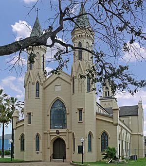
The culture of Southeast Texas is quite similar to Acadiana in Louisiana. It also shares traits with the Gulf Coast of Mississippi. Some people here have kept their Cajun and Creole traditions. You can see this during celebrations like Mardi Gras.
Much of today's Southeast Texas culture comes from traditions passed down through many generations. This region is part of the Bible Belt. This means many people here have strong traditional Protestant Christian beliefs. Also, the Catholic Church in the United States has been important since Spanish explorers came here. In the larger cities of East Texas, outside of Houston, many people still live a rural Southern lifestyle. This is clear in how they speak, their manners, and their food.
Economy and Jobs
In the cities of Southeast Texas, many important industries thrive. These include energy, healthcare, manufacturing, and technology. Houston is the largest city and the main economic hub of Southeast Texas. It has the third-highest number of Fortune 500 company headquarters in the U.S. as of 2021.
Big companies in the region include APA Corporation, Chevron Corporation, and Sysco. Outside of the cities, farming, tourism, and small businesses have always been key parts of the economy.
Colleges and Universities
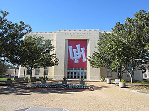
The University of Houston System is the largest university system in Southeast Texas. Other important universities in the region include Texas Southern University, Prairie View A&M University, and Rice University. Rice University in Houston was ranked 15th nationally by U.S. News & World Report in 2022. Closer to Beaumont, Lamar University is the main center for higher education.
Sports and Recreation
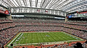
The city of Houston and its surrounding area have a strong sports culture. People here enjoy watching and playing many different sports. Fans attend games for four major professional sports teams. They also cheer for college sports teams. Beaumont is another important place for college sports.
People who like to play sports can run in Memorial Park. They can also go sailing on Galveston Bay and Clear Lake. There are also many other sports activities available. For example, there are several fencing clubs for all skill levels.
Major League Sports Teams
| Club | League | Sport | Venue | Founded | Titles | Attendance |
|---|---|---|---|---|---|---|
| Houston Texans | NFL | Football | NRG Stadium | 2002 | 0 | 71,644 |
| Houston Astros | MLB | Baseball | Minute Maid Park | 1962 | 2 (2017, 2022) | 31,628 |
| Houston Dynamo FC | MLS | Soccer | Shell Energy Stadium | 2006 | 2 (2006, 2007) | 20,117 |
| Houston Rockets | NBA | Basketball | Toyota Center | 1967 | 2 (1994, 1995) | 16,672 |
College Sports Teams
| School | Nickname | Major Venues | Conference |
|---|---|---|---|
| University of Houston | Cougars | TDECU Stadium, Fertitta Center | Big 12 (FBS) |
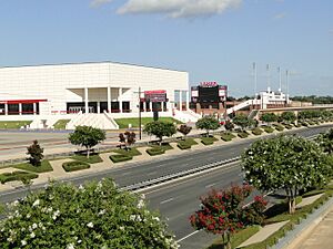
| Lamar University | Cardinals | Provost Umphrey Stadium | Southland (FCS) |
| Rice University | Owls | Rice Stadium, Tudor Fieldhouse | American (FBS) |
| Houston Christian University | Huskies | Husky Stadium, Sharp Gymnasium | Southland (FCS) |
| Texas Southern University | Tigers | Health and Physical Education Arena | SWAC (FCS) |
| Prairie View A&M University (in Prairie View) | Panthers | Panther Stadium at Blackshear Field, William Nicks Building | SWAC (FCS) |
Getting Around: Transportation
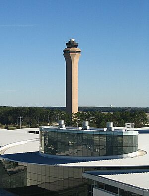
Many highways connect the Houston and Beaumont areas. These roads link the communities to the rest of the Gulf Coast region and the Texas Triangle. For air travel, the largest airports in Southeast Texas are all located in Houston.
 | James Van Der Zee |
 | Alma Thomas |
 | Ellis Wilson |
 | Margaret Taylor-Burroughs |


