
Sabine River (Texas–Louisiana) facts for kids
Quick facts for kids Sabine River |
|
|---|---|

Sabine River at Logansport, Louisiana
|
|

Sabine River (right) and Neches River (left)
|
|

Location of the mouth of the Sabine River in Texas
|
|
| Other name(s) | Río Sabine (Spanish) Fleuve Sabine (French) |
| Country | United States |
| State | Texas, Louisiana |
| Physical characteristics | |
| Main source | Iron Bridge Dam Lake Tawakoni, Van Zandt County, Texas 423 ft (129 m) 32°48′29″N 95°55′14″W / 32.80806°N 95.92056°W |
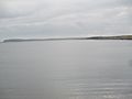
| River mouth | Sabine Lake Texas–Louisiana border, near Orange, Orange County, Texas and Cameron Parish, Louisiana 0 ft (0 m) 29°59′08″N 93°47′26″W / 29.98556°N 93.79056°W |
| Length | 510 mi (820 km) |
| Basin features | |
| Basin size | 9,756 sq mi (25,270 km2) |
The Sabine River is a long river, about 510 miles (820 km) in length. It flows through the southern United States, specifically in the states of Texas and Louisiana. For a good part of its journey, the river acts as a natural border between these two states. It eventually empties into Sabine Lake, which is a type of estuary connected to the Gulf of Mexico.
In the early 1800s, the Sabine River was a very important boundary. It marked the border between Spain and the United States. Later, it became the border between Mexico and the U.S., and then between the Republic of Texas and the U.S. The upper parts of the river flow through the open prairie lands of northeast Texas. Further down, it travels through thick pine forests along the Texas–Louisiana border. Closer to the Gulf Coast, it flows through bayou country, which is an area with slow-moving water and wetlands.
The river collects water from a large area, covering about 9,756 square miles (25,270 km²). Most of this area, about 7,426 square miles (19,230 km²), is in Texas. The rest, about 2,330 square miles (6,030 km²), is in Louisiana. This region gets a lot of rain. Because of this, the Sabine River carries more water than any other river in Texas.
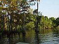
The name "Sabine" comes from the Spanish words Río de Sabinas. This means "River of Cypresses." The name was chosen because many bald cypress trees grow along the lower parts of the river. The area around the river is also important for producing petroleum (oil). The lower part of the river, near the Gulf, is one of the most developed industrial areas in the southeastern United States.
Images for kids
-
The Sabine forms the Louisiana/Texas boundary at Toledo Bend Reservoir west of Many, Louisiana.
-
The Sabine River in Orange, Texas


See also
 In Spanish: Río Sabine para niños
