
Vermilion River (Louisiana) facts for kids
Quick facts for kids Vermilion River |
|
|---|---|

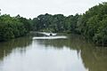
Vermilion River in Abbeville.
|
|

Vermilion River watershed
|
|
| Country | United States |
| State | Louisiana |
| City | Lafayette, LA |
| Physical characteristics | |
| Main source | Confluence of bayous Saint Landry Parish, LA, United States |
| River mouth | Gulf of Mexico Intracoastal, Vermilion Parish, LA, United States |
| Length | 70 mi (110 km) |
The Vermilion River is a 70-mile (110 km) long bayou in southern Louisiana, United States. It is also known as the Bayou Vermilion or Rivière Vermilion in French. This river starts where several small bayous meet in St. Landry Parish.
The Vermilion River then flows south through Lafayette and Vermilion parishes. It passes by the cities of Lafayette and Abbeville. The river eventually flows into Vermilion Bay, which is an inlet of the Gulf of Mexico.
Contents
How the Vermilion River Was Formed
The Vermilion River is a special type of river called a "consequent stream" or a "tidal river". This means it formed from the bottom up, starting from the bay. The tides and natural actions in Vermilion Bay slowly wore away the land. This process created the river channel, which grew northward all the way to Lafayette, Louisiana.
Later, a branch of Bayou Teche flowed south and connected with this channel. This created the true north-south flowing river we see today.
Why the River Sometimes Flows Backward
Sometimes, during very heavy rains, parts of the Vermilion River can actually flow backward, or north. This happens because the areas around the city of Lafayette are very developed. Rainwater runs off these urban areas quickly and in large amounts.
This fast runoff raises the water level in the Vermilion River in southern Lafayette. When this water level gets higher than the water upstream, the river reverses its direction. The water then flows north instead of south. The nearby Bayou Tortue Swamp also helps this reverse flow. It can hold a lot of water, which adds to the effect.
The River's History and Uses
In the past, the Vermilion River was very important for transportation. The Pinhook Bridge area in Lafayette was a key spot for water travel. Steamboats used to travel on the bayou. However, low water levels and hidden logs made it hard for them to move around.
Changes in Transportation
The river's importance for travel and trade decreased over time. This happened when railroads were built and highways leading into Lafayette were paved in 1936.
Dredging and Water Use
The Army Corps of Engineers also changed the bayou. In 1944, they dredged the river, making it 9 feet (2.7 meters) deep and 100 feet (30 meters) wide at the bottom. Today, water from the Vermilion River is mainly used to water rice fields. It also helps to dilute (make weaker) wastewater from cities and industries.
Bringing in Fresh Water
A pumping station was built near Krotz Springs to help the river. This station can pump a lot of fresh water from the Atchafalaya River into Bayou Courtableu, which then flows into the Vermilion River. This project, called the Teche-Vermilion Freshwater Project, started in 1976 and finished in 1982. It helps keep the river healthy with fresh water.
Improving the River's Health
In the 1970s, the Vermilion River was known for being very polluted. But things have changed a lot since then! Better sewage treatment and regular trash cleanups have greatly improved the river's health.
Now, people see the Vermilion River as a great place for fun activities. A Bayou Vermilion Paddle Trail map has been created. This map helps people enjoy paddling and exploring the river.
Towns Along the River
- Lafayette Parish
- Lafayette, Louisiana
- Milton, Louisiana
- Pont Des Mouton, Louisiana
- Anse La Butte, Louisiana
- Long Bridge, Louisiana
- Vermilion Parish
- Abbeville, Louisiana
- Perry, Louisiana
- Rose Hill, Louisiana
- Banker, Louisiana
Images for kids
-
Vermilion River viewed from the Milton bridge.

See also
 In Spanish: Río Vermilion (Luisiana) para niños
