Atchafalaya River facts for kids
Quick facts for kids Atchafalaya River |
|
|---|---|
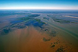
Atchafalaya River delta on the Gulf of Mexico; view upriver to the northwest.
|
|
 |
|
| Country | United States |
| State | Louisiana |
| City | Morgan City, Louisiana |
| Physical characteristics | |
| Main source | Mississippi River |
| 2nd source | Red River of the South |
| River mouth | Morgan City, Louisiana |
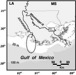
The Atchafalaya River is a long river in south central Louisiana, United States. It is about 137 miles (220 km) long. This river is a "distributary" of the Mississippi River and Red River. A distributary is like a branch that flows away from a main river.
The Atchafalaya River flows south, west of the Mississippi River. It is the fifth largest river in North America by how much water it carries. The name Atchafalaya comes from the Choctaw language. It means 'long river'. Hachcha means 'river', and falaya means 'long'.
Contents
The Atchafalaya Basin: A Special Place
The Atchafalaya River is important for shipping. Large boats can travel on it. This makes it a key waterway for Louisiana's industries. The river also runs through the heart of Cajun Country. This area is famous for its unique culture and history.
Keeping the river open for boats and controlling floods has been a big job. The U.S. Army Corps of Engineers has worked on it for over 100 years. They have built levees and channels. These projects help manage the river's flow.
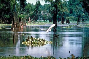
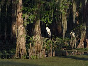
The river valley is known as the Atchafalaya Basin. It includes the Atchafalaya Swamp. This large wetland is located in southern Louisiana. It is close to the Gulf of Mexico. The Atchafalaya became a main branch of the Mississippi River a long time ago. This happened between 1839 and 1849. People removed a huge pile of logs, called the Great Raft, that was blocking the river.
Controlling the River's Flow
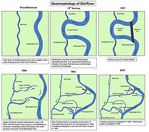
The Atchafalaya River starts near Simmesport. This is where the Red River meets the Mississippi. The Mississippi River connects to the Red River through a 7-mile (11 km) long canal. This canal is part of the Old River Control Structure.
The Atchafalaya River gets about 30% of the water from the combined flow of the Red and Mississippi Rivers. The other 70% continues down the Mississippi River. The amount of water the Atchafalaya receives is carefully controlled. This is done by the Old River Control Structure. It is a system of dams, gates, and a navigation lock. There is also a power plant nearby.
During very big floods, another structure is used. It's called the Morganza Spillway. It is located further downstream. This spillway helps to release extra water. In 1942, some of the Atchafalaya River's water was sent through Wax Lake. This diverted water to the Gulf of Mexico further west.
In 2011, there were huge floods on the Mississippi River. The Old River complex released a lot of water into the Atchafalaya River. The Morganza Floodway also opened to release some water. If the Mississippi River were allowed to flow freely, the Atchafalaya might take over. The Atchafalaya is shorter and steeper. This could make it the main path for the Mississippi. If this happened, the river would bypass important cities like Baton Rouge and New Orleans. Even with all the control efforts, some scientists think this could still happen over time. This is because of how river deltas naturally change.
The Atchafalaya River winds south. It flows through many levees and floodways. It passes Morgan City. Finally, it empties into the Gulf of Mexico. This happens in Atchafalaya Bay. This bay is about 15 miles (24 km) south of Morgan City. Since the late 1900s, the river has been forming a new delta in the bay. This is special because it's the only place on the Louisiana coast that is growing new land. Most of the coastline is actually eroding away.
Atchafalaya National Heritage Area
The river's valley was named the Atchafalaya National Heritage Area in 2006. This means it's recognized for its special natural and cultural importance.
See also
 In Spanish: Río Atchafalaya para niños
 | Anna J. Cooper |
 | Mary McLeod Bethune |
 | Lillie Mae Bradford |


