Cedar Key, Florida facts for kids
Quick facts for kids
Cedar Key, Florida
|
|
|---|---|
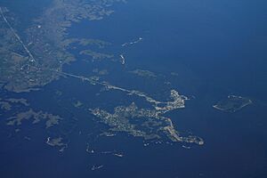
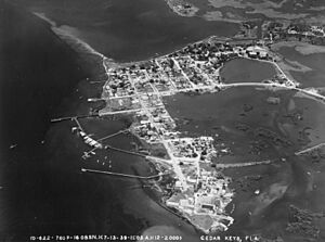
Aerial view of Cedar Key and its outlying islands, illustrating the extremely small size of the city: The fork at State Road 24 and County Road 347 (the only two access roads) can be seen in the upper left.
|
|
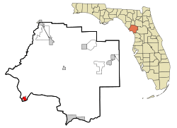
Location in Levy County, Florida
|
|
| Country | |
| State | |
| County | Levy |
| Settled | 1840–1858 |
| Incorporated (City of Astena Otie) |
1859 |
| Incorporated (Town of Cedar Keys) |
1869 |
| Incorporated (City of Cedar Key) |
1923 |
| Government | |
| • Type | Mayor-Commission |
| Area | |
| • Total | 2.17 sq mi (5.63 km2) |
| • Land | 1.01 sq mi (2.62 km2) |
| • Water | 1.16 sq mi (3.01 km2) |
| Elevation | 10 ft (3 m) |
| Population
(2020)
|
|
| • Total | 687 |
| • Density | 680.20/sq mi (262.65/km2) |
| Time zone | UTC-5 (Eastern (EST)) |
| • Summer (DST) | UTC-4 (EDT) |
| ZIP code |
32625
|
| Area code(s) | 352 |
| FIPS code | 12-11225 |
| GNIS ID | 280208 |
Cedar Key is a small city in Levy County, Florida, United States. In 2020, about 687 people lived there. It's part of the wider Gainesville area. Cedar Key is actually a group of islands near the mainland. Most of the city is built on an island called Way Key. The area is named after the eastern red cedar trees that used to grow there in large numbers.
The city has been recovering from Hurricane Helene, which hit on September 26, 2024. This storm caused a huge storm surge of 10 feet, breaking the previous record from Hurricane Idalia in August 2023.
Contents
History of Cedar Key
Early Days and Discoveries
People have lived in the Cedar Key area for a very long time, possibly since 500 BC. The first maps of the area were made by Spain in 1542. They called the islands "Las Islas Sabines," which means "The Cedar Keys" in Spanish.
Archaeologists found old items dating back to 500 BC at a place called Shell Mound, about 9 miles north of Cedar Key. In 1999, a 2,000-year-old skeleton was found in Cedar Key. You can see arrowheads and spear points, some as old as 12,000 years, at the Cedar Key Museum State Park. These were collected by local historian St. Clair Whitman.
In 1801, a group led by William Augustus Bowles built a watchtower near Cedar Key. Spanish forces destroyed it in 1802. Later, in the 1820s, the Cedar Keys might have been a safe place for people seeking freedom. It was also a spot for illegal trade.
The Indian War Period
During the Second Seminole War, the United States Army built Fort No. 4 on the mainland near Cedar Key. In 1840, General Zachary Taylor wanted the Cedar Keys to be used by the military. He also wanted Seahorse Key to have a lighthouse.
A hospital was built on an island called Depot Key. This island was an important supply point for the Army in Florida. By 1841, Cantonment Morgan was set up on Seahorse Key. It was used to hold Seminole people who had been captured or surrendered before they were sent west.
A powerful hurricane hit the Cedar Keys on October 4, 1842. It caused a 27-foot storm surge, destroying Cantonment Morgan and damaging Depot Key. After this, the Army left Depot Key.
Before the Civil War
In 1842, a law was passed to encourage more people to settle in Florida. After the Army left Depot Key, people could settle there. Augustus Steele, a customs officer, got a permit for Depot Key and renamed it Atsena Otie Key. He bought buildings and built cottages for visitors. In 1845, a post office opened on Atsena Otie Key. The "City of Atsena Otie" was officially formed in 1859.
Cedar Key became a busy port. It shipped lumber and other goods from the mainland. By 1860, two mills on Atsena Otie Key were making cedar slats for pencil factories in the North. Because of this growth, a lighthouse was built on Seahorse Key in 1854. The light was 75 feet above sea level and could be seen for 16 miles.
In 1860, Cedar Key became the end point of the Florida Railroad. This railroad connected it to Fernandina Beach on Florida's east coast. David Levy Yulee, a U.S. senator, owned most of Way Key, where the railroad's facilities were built. A new town was planned on Way Key in 1859. The first train arrived in Cedar Key on March 1, 1861, just before the Civil War started.
The Civil War Years
When the American Civil War began in 1861, Confederate soldiers turned off the lighthouse at Seahorse Key. They also took its oil supply. On July 3, 1861, Confederate forces captured four Federal ships near Cedar Key. This was the first time a U.S. Naval officer was captured at sea during the war.
In January 1862, the USS Hatteras attacked Cedar Key. They burned ships and destroyed railroad property on Way Key. Cedar Key was an important source of salt for the Confederacy. In October 1862, Union forces destroyed 60 salt-making kettles on Salt Key. The Union Army occupied the Cedar Keys in early 1864 and stayed until the war ended.
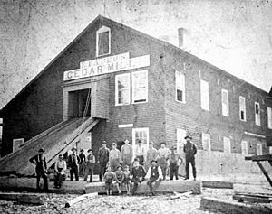
After the war, in 1865, the Eberhard Faber mill was built on Atsena Otie Key. The Eagle Pencil Company mill was built on Way Key. Way Key, with its railroad, grew larger than Atsena Otie Key. The Florida Railroad was repaired in 1868, and trains started running again. The "Town of Cedar Keys" was officially formed in 1869.
The famous naturalist John Muir visited Cedar Key in 1867. He walked 1,000 miles from Kentucky to Cedar Key. He wrote about seeing the Gulf of Mexico for the first time. He later sailed from Cedar Key to Cuba.
Decline and Recovery
In 1886, a new railroad line to Tampa opened. This took away shipping business from Cedar Key, causing its economy to slow down. The town limits had grown in 1881 and 1884, but they shrank in 1890 due to the economic decline. Also in 1890, the mayor, William Cottrell, misused his power. He was removed from office by U.S. Marshals who came by boat.
The 1896 Cedar Keys hurricane caused even more damage. On September 29, 1896, a 10-foot storm surge swept over the town, killing over 100 people. The hurricane destroyed all the remaining cedar trees and mills. A fire in December 1896 caused more harm. After this, buildings were rebuilt on Way Key, which was more protected. Today, only a few signs of the old town on Atsena Otie Key remain, like stone water tanks and a graveyard with headstones from before 1896.
At the start of the 1900s, fishing, sponge diving, and oystering became the main jobs. But around 1909, the oyster beds ran out. In 1929, President Herbert Hoover created the Cedar Keys National Wildlife Refuge. He made three islands a protected area for birds. The lighthouse was no longer used in 1952, but it is now a marine biology research center for the University of Florida.
Cedar Key Today
Today, Cedar Key is a popular place for tourists. It has many seafood restaurants that are well-known in the region. The city hosts two festivals each year: the Spring Sidewalk Art Festival and the Fall Seafood Festival. Thousands of visitors come for these events.
In 1950, Hurricane Easy hit Cedar Key. It was a strong storm that looped around the city three times. It brought 38 inches of rain and destroyed two-thirds of the homes. In 1985, Hurricane Elena followed a similar path, causing damage to waterfront businesses.
After a ban on large-scale net fishing in 1995, many local fishermen started farming clams. Now, clam farming is a very successful business in Cedar Key.
Cedar Key is also home to the George T. Lewis Airport (CDK).
Recent hurricanes have impacted Cedar Key. Hurricane Eta made landfall near Cedar Key in November 2020. On August 30, 2023, Hurricane Idalia caused major damage with record storm surge levels. Then, on September 26, 2024, Hurricane Helene brought even higher storm surge levels, reaching a new record of 9.2 feet above high tide.
Historic Sites and Museums
|
Cedar Keys Historic and Archaeological District
|
|
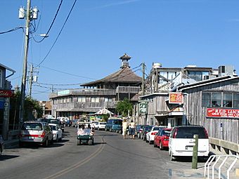
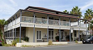
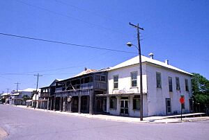
Dock Street in Cedar Key
|
|
| Location | Cedar Key, Florida |
|---|---|
| NRHP reference No. | 88001449 |
| Added to NRHP | October 3, 1989 |
Cedar Key's long history was recognized by the government on October 3, 1989. About 8,000 acres in and around the town were added to the National Register of Historic Places. This area is called the Cedar Keys Historic and Archaeological District.
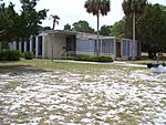
The Cedar Key Museum State Park shows what the town was like in the 1800s. It has seashells and old Native American items collected by Saint Clair Whitman. You can also tour Whitman's restored 1920s house. The museum building was built to withstand hurricanes, which are common in the area.
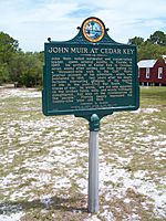
John Muir, the famous naturalist, wrote about his visit to Cedar Key in 1867. He said: "For nineteen years my vision was bounded by forests, but today, emerging from a multitude of tropical plants, I beheld the Gulf of Mexico stretching away unbounded, except by the sky." A historic marker honoring his visit was placed at the museum in 1983.
Geography of Cedar Key
Cedar Key is located at coordinates 29°08′44″N 83°02′30″W / 29.145558°N 83.041544°W.
The city covers an area of about 2.17 square miles (5.63 square kilometers). About 1.01 square miles (2.62 square kilometers) is land, and 1.16 square miles (3.01 square kilometers) is water. This means more than half of the city's area is water!
Climate in Cedar Key
Cedar Key has a humid subtropical climate. This means it has hot, humid summers and generally mild winters.
| Climate data for Cedar Key 1 WSW, Florida, 1907–1976 normals and extremes | |||||||||||||
|---|---|---|---|---|---|---|---|---|---|---|---|---|---|
| Month | Jan | Feb | Mar | Apr | May | Jun | Jul | Aug | Sep | Oct | Nov | Dec | Year |
| Record high °F (°C) | 84 (29) |
85 (29) |
89 (32) |
90 (32) |
98 (37) |
100 (38) |
102 (39) |
99 (37) |
103 (39) |
99 (37) |
92 (33) |
86 (30) |
103 (39) |
| Mean daily maximum °F (°C) | 66.6 (19.2) |
67.6 (19.8) |
72.2 (22.3) |
78.8 (26.0) |
84.8 (29.3) |
88.9 (31.6) |
89.5 (31.9) |
89.9 (32.2) |
88.8 (31.6) |
83.2 (28.4) |
74.6 (23.7) |
67.7 (19.8) |
79.4 (26.3) |
| Daily mean °F (°C) | 57.6 (14.2) |
59.0 (15.0) |
63.7 (17.6) |
70.6 (21.4) |
76.7 (24.8) |
81.4 (27.4) |
82.4 (28.0) |
82.5 (28.1) |
80.9 (27.2) |
74.1 (23.4) |
65.1 (18.4) |
58.9 (14.9) |
71.1 (21.7) |
| Mean daily minimum °F (°C) | 48.8 (9.3) |
50.4 (10.2) |
55.2 (12.9) |
62.2 (16.8) |
68.7 (20.4) |
73.9 (23.3) |
75.4 (24.1) |
75.2 (24.0) |
73.0 (22.8) |
65.0 (18.3) |
55.7 (13.2) |
50.1 (10.1) |
62.8 (17.1) |
| Record low °F (°C) | 8 (−13) |
20 (−7) |
23 (−5) |
37 (3) |
47 (8) |
58 (14) |
62 (17) |
64 (18) |
51 (11) |
38 (3) |
25 (−4) |
15 (−9) |
8 (−13) |
| Average precipitation inches (mm) | 2.70 (69) |
2.84 (72) |
3.19 (81) |
2.46 (62) |
2.30 (58) |
4.32 (110) |
7.64 (194) |
7.78 (198) |
5.82 (148) |
2.75 (70) |
1.62 (41) |
2.66 (68) |
46.07 (1,170) |
| Average precipitation days (≥ 0.01 in) | 5 | 5 | 5 | 3 | 4 | 7 | 10 | 10 | 7 | 4 | 3 | 5 | 69 |
| Source: WRCC | |||||||||||||
People of Cedar Key
The population of Cedar Key has changed over the years. In 1870, there were 440 people. By 1930, it grew to 1,066. In 2020, the population was 687.
In 2020, there were 687 people living in Cedar Key. There were 316 households and 218 families. Most residents were White (89.96%). There were also Black or African American, Native American, and people of two or more races. About 4.37% of the population was Hispanic or Latino.
Education in Cedar Key
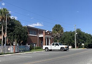
The School Board of Levy County runs Cedar Key School. This school teaches students from kindergarten all the way through 12th grade.
Local Library
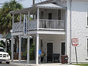
Levy County has a public library branch in Cedar Key. The Cedar Key Public Library is located in the old, historic Schlemmer Rooming House.
Famous People from Cedar Key
- W. Randolph Hodges - He used to be the President of the Florida Senate.
- Gene Hodges - He was a member of the Florida House of Representatives.
See also
 In Spanish: Cedar Key para niños
 | Tommie Smith |
 | Simone Manuel |
 | Shani Davis |
 | Simone Biles |
 | Alice Coachman |


