Forestville, Wisconsin facts for kids
Quick facts for kids
Forestville, Wisconsin
|
|
|---|---|

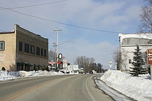
Looking north at downtown Forestville
|
|

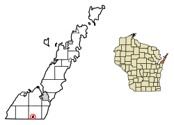
Location of Forestville in Door County, Wisconsin.
|
|
| Country | |
| State | |
| County | Door |
| Area | |
| • Total | 0.52 sq mi (1.35 km2) |
| • Land | 0.52 sq mi (1.35 km2) |
| • Water | 0.00 sq mi (0.00 km2) |
| Elevation | 719 ft (219 m) |
| Population
(2020)
|
|
| • Total | 482 |
| • Density | 927/sq mi (357.0/km2) |
| Time zone | UTC-6 (Central (CST)) |
| • Summer (DST) | UTC-5 (CDT) |
| ZIP code |
54213
|
| Area code(s) | 920 |
| FIPS code | 55-26625 |
| Website | Village of Forestville |
Forestville is a small village in Door County, Wisconsin, USA. It sits right next to the Ahnapee River. In 2020, about 482 people lived there. The village is part of a larger area also called the Town of Forestville. You can find it by its 54213 ZIP code. A fun path called the Ahnapee State Trail goes through the village, perfect for walking or biking!
Contents
History of Forestville
The first European-American settler in Forestville was a man named Major Joseph McCormick. He was a military leader from the Mexican War. Major McCormick was of Scotch-Irish background.
He thought he found a layer of marble in the area. Major McCormick told many people about the marble quarries. He also spoke about the good water power and lots of timber. Because of his stories, many new settlers came to Forestville.
Geography of Forestville
Forestville is located in a specific spot on the map. Its coordinates are 44.689462 degrees North and -87.480758 degrees West.
The United States Census Bureau says the village covers a total area of 0.52 square miles. All of this area is land. There is no water within the village limits.
Population and People
| Historical population | |||
|---|---|---|---|
| Census | Pop. | %± | |
| 1970 | 349 | — | |
| 1980 | 455 | 30.4% | |
| 1990 | 470 | 3.3% | |
| 2000 | 429 | −8.7% | |
| 2010 | 430 | 0.2% | |
| 2020 | 482 | 12.1% | |
| U.S. Decennial Census | |||
How Many People Live Here?
In 2010, a census counted 430 people living in Forestville. These people lived in 183 different homes. About 129 of these were families.
The village had about 827 people per square mile. There were 206 housing units in total.
Who Lives in Forestville?
About 34% of homes had children under 18 living there. Most homes, about 57%, were married couples living together. Some homes, about 9%, had a female head of household without a husband. About 4% had a male head of household without a wife.
The average age of people in the village was 43.6 years old. About 21% of residents were under 18. About 18% were 65 years old or older. The village had slightly more females than males.
Images for kids
See also
 In Spanish: Forestville (Wisconsin) para niños
 | Selma Burke |
 | Pauline Powell Burns |
 | Frederick J. Brown |
 | Robert Blackburn |


