
Foristell, Missouri facts for kids
Quick facts for kids
Foristell, Missouri
|
|
|---|---|

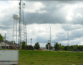
Forristel in May 2024
|
|

Location of Foristell, Missouri
|
|
| Country | United States |
| State | Missouri |
| Counties | St. Charles, Warren |
| Named for | Pierre Foristell |
| Area | |
| • Total | 6.16 sq mi (15.96 km2) |
| • Land | 6.06 sq mi (15.70 km2) |
| • Water | 0.10 sq mi (0.26 km2) |
| Elevation | 705 ft (215 m) |
| Population
(2020)
|
|
| • Total | 550 |
| • Density | 90.71/sq mi (35.02/km2) |
| Time zone | UTC-6 (Central (CST)) |
| • Summer (DST) | UTC-5 (CDT) |
| ZIP code |
63348
|
| Area code(s) | 636 |
| FIPS code | 29-25120 |
| GNIS feature ID | 2394791 |
Foristell is a small city in Missouri, a state in the United States. It's located in both St. Charles and Warren counties. You can find it about 43 miles west of St. Louis. In 2020, about 550 people lived in Foristell.
Contents
Geography of Foristell
Foristell is situated right along I-70, a major highway. To its west is Wright City, and to its east is Wentzville. A creek called Peruque Creek flows past the southern part of the city.
The United States Census Bureau reports that Foristell covers a total area of about 6.16 square miles (15.96 square kilometers). Most of this area is land, with a small part being water.
Population and People
Foristell has grown quite a bit over the years. Here's how its population has changed:
| Historical population | |||
|---|---|---|---|
| Census | Pop. | %± | |
| 1980 | 119 | — | |
| 1990 | 144 | 21.0% | |
| 2000 | 331 | 129.9% | |
| 2010 | 505 | 52.6% | |
| 2020 | 550 | 8.9% | |
| U.S. Decennial Census | |||
Foristell's Population in 2010
In 2010, there were 505 people living in Foristell. These people made up 192 households, with 151 of them being families. The city had about 91 people living in each square mile.
Most of the people in Foristell were White (93.3%). There were also African American, Native American, and Asian residents. A small number of people were from other backgrounds or more than one race. About 0.8% of the population was Hispanic or Latino.
Many households (31.8%) had children under 18 living there. Most households (69.3%) were married couples. The average household had about 2.63 people, and the average family had 2.98 people.
The average age of people in Foristell was 44.8 years old. About 23% of residents were under 18. Around 14.3% were 65 years old or older. The city had slightly more males (51.5%) than females (48.5%).
History of Foristell
The area that is now Foristell began as a community called "Millville" in 1856. That year, the first homes were built, and a railroad was constructed. Millville even got its first post office in 1858.
The community grew quickly during the American Civil War. A mill and a tobacco factory were opened. During this time, a man named Pierre Foristell became very respected in the community. Because of his influence, the town of Millville officially changed its name to Foristell in 1875.
In 1979, Foristell became an official village. However, just nine years later, in 1988, residents voted to change its status to a fourth-class city. This change officially happened in 1989.
Fun Things to Do in Foristell
Foristell is home to two great parks that are managed by St. Charles County. These are Indian Camp Creek Park and Towne Park. They offer places for outdoor activities and relaxation.
Images for kids
-
Forristel in May 2024
See also
 In Spanish: Foristell (Misuri) para niños
