Fort Sullivan (Maine) facts for kids
Quick facts for kids |
|
|
Fort Sullivan
|
|
 |
|
| Location | Moose Island; barracks, 74 Washington St., Eastport, Maine |
|---|---|
| Area | 1.8 acres (0.73 ha) |
| Built | 1808 |
| NRHP reference No. | 70000081 |
| Added to NRHP | January 26, 1970 |
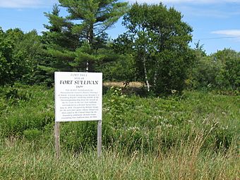
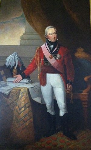
Fort Sullivan, also known for a short time as Fort Sherbrooke, was an important military fort in the 1800s. It was located in Eastport, Maine, right across from New Brunswick, Canada. This fort helped protect the eastern edge of the United States of America for many years. During the War of 1812, British forces took control of the fort in 1814. They renamed it Fort Sherbrooke after John Coape Sherbrooke, who was the Governor of Nova Scotia at the time.
Contents
Building Fort Sullivan
In 1808, the United States Army decided to build a fort in Eastport. At that time, Eastport was part of Massachusetts, before Maine became its own state. The fort was needed to defend against possible attacks from Britain and other European countries. These countries were often fighting each other during the Napoleonic Wars.
Major Lemuel Trescott led the building of the fort in 1808 or 1809. It was built on top of Clark's Hill in the village. The fort had a round earth wall with four cannons. It also included a wooden blockhouse and buildings for soldiers to live in. The fort was officially named Fort Sullivan around March 1813.
British Take Control
During the War of 1812, the British wanted to create a new area called New Ireland. On July 11, 1814, a British fleet led by Commodore Sir Thomas Hardy, 1st Baronet forced the American soldiers at Fort Sullivan to give up. The British navy then took control of the entire coast east of Penobscot Bay. They called this new territory New Ireland.
Even after the war ended, Britain claimed that Moose Island, Maine, where Fort Sullivan and Eastport are located, belonged to them. They said it was on the British side of the border with their colony of New Brunswick. So, they kept about 800 soldiers at the fort. They renamed it Fort Sherbrooke after John Coape Sherbrooke to show their claim.
The British asked the people living in Eastport to promise loyalty to the British crown. Some people did, others tried to avoid it, and many moved to parts of America that were clearly not claimed by Britain. After talks with the British in 1817, Americans gave up their claims to some larger islands further east. In return, the United States got control of Eastport back on June 30, 1818.
Fort Life and Later Years
In 1822, a doctor at the fort started keeping records of the weather. This was an early form of weather observation.
An officer named Nathaniel Dana was stationed at Fort Sullivan in 1822. His son, Napoleon Jackson Tecumseh Dana, who later became a major general, was born there.
First Lieutenant George Sears Greene commanded Fort Sullivan from 1831 to 1835. He later became a famous major general in the Union Army during the American Civil War. He was known for his brave defense at the Battle of Gettysburg. Sadly, while he was at Fort Sullivan, his wife and three children passed away from a serious illness.
The fort had a small group of soldiers until the late 1830s. At that time, there were disagreements over the border between Maine and New Brunswick. This dispute, known as the Aroostook War, almost led to another war. The border issue was finally settled peacefully by the Webster–Ashburton Treaty in 1842.
During the American Civil War, new earthwork defenses were built in the area around Fort Sullivan. A group of soldiers from the Maine Coast Guard Companies was stationed at Fort Sullivan from May 16, 1864, to September 6, 1865.
Closing Down the Fort
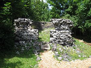
The Army stopped using Fort Sullivan in 1873. In 1877, the government sold the land where the fort stood. The new owners moved one of the old barracks buildings to its current spot at 74 Washington Street. Over time, other parts of the fort fell apart. Today, you can still see the ruins of an old powder magazine near McKinley Street. This is the only part of the original fort that remains in its first location.
Barracks Museum
One of the old officers' quarters from the early 1800s is now the Barracks Museum. The Border Historical Society owns and runs this museum. It is listed on the National Register of Historic Places listings in Washington County, Maine.
The museum has exhibits about the history of Fort Sullivan. You can also learn about the local fishing industries, like sardine and ground fishing. It also shares information about local history and genealogy (family history). The museum is open to visitors in July and August.
See also
 | Jessica Watkins |
 | Robert Henry Lawrence Jr. |
 | Mae Jemison |
 | Sian Proctor |
 | Guion Bluford |


