Franchère Lake facts for kids
Quick facts for kids Franchère Lake |
|
|---|---|
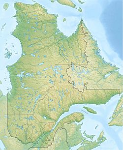
| Location | Lac-Jacques-Cartier (TNO), La Côte-de-Beaupré Regional County Municipality, Capitale-Nationale, Quebec, Canada |
| Coordinates | 47°44′07″N 71°26′38″W / 47.73528°N 71.44389°W |
| Lake type | Natural |
| Primary inflows | Rivière aux Écorces du Milieu, discharge of lac Ballon. |
| Primary outflows | Rivière aux Écorces du Milieu |
| Basin countries | Canada |
| Max. length | 2.7 km (1.7 mi) |
| Max. width | 0.9 km (0.56 mi) |
| Surface elevation | 803 m (2,635 ft) |
The Franchère Lake (also called Lac Franchère in French) is a beautiful freshwater lake in Quebec, Canada. It is located in a special natural area called the Laurentides Wildlife Reserve. This lake is an important part of the region. It helps support activities like forestry (cutting down trees for wood) and fun outdoor tourism.
The land around the lake has special roads. These roads are used for forestry work and for people visiting for fun. Forestry is the main activity here. Tourism is also very important.
The surface of Franchère Lake usually freezes over in early December. It stays frozen until the end of March. It is generally safe to walk or play on the ice from mid-December to mid-March.
About Franchère Lake
Let's learn more about where Franchère Lake is and how its water flows.
Location and Size
Franchère Lake is found in a large natural area in Quebec. It is about 2.7 kilometres (1.7 mi) (1.7 miles) long. The lake is also about 0.9 kilometres (0.56 mi) (0.6 miles) wide. It sits high up, at an altitude of 803 metres (2,635 ft) (2,635 feet) above sea level.
Water Flow
The lake gets its water mainly from other smaller lakes. These include Lac Ballon, as well as Lakes Day and Germain.
Water flows out of Franchère Lake into the rivière aux Écorces du Milieu. This river then joins the rivière aux Écorces. From there, the water travels through several other rivers. It flows into the Pikauba River, then Kenogami Lake, and the Chicoutimi River. Finally, the water reaches the Saguenay River. The Saguenay River then flows all the way to the Saint Lawrence estuary.
How Franchère Lake Got Its Name
The name "Lac Franchère" was officially recognized on December 5, 1968. This was done by the Commission de toponymie du Québec. This commission is in charge of naming places in Quebec.


