Franekeradeel facts for kids
Quick facts for kids
Franekeradeel
Frentsjerteradiel
|
|||
|---|---|---|---|
|
Former municipality
|
|||

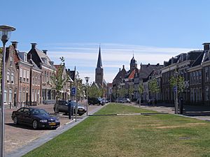
City of Franeker
|
|||
|
|||

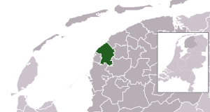
Location in Friesland
|
|||
| Country | Netherlands | ||
| Province | Friesland | ||
| Municipality | Waadhoeke | ||
| Area | |||
| • Total | 109.17 km2 (42.15 sq mi) | ||
| • Land | 102.73 km2 (39.66 sq mi) | ||
| • Water | 6.44 km2 (2.49 sq mi) | ||
| Elevation | 1 m (3 ft) | ||
| Population
(May 2014)
|
|||
| • Total | 20,445 | ||
| • Density | 199/km2 (520/sq mi) | ||
| Time zone | UTC+1 (CET) | ||
| • Summer (DST) | UTC+2 (CEST) | ||
| Postcode |
8800–8814, 8850–8859
|
||
| Area code | 0517, 0518 | ||
Franekeradeel was a former municipality located in the northern part of the Netherlands. It was part of the province of Friesland. The name Franekeradeel comes from the city of Franeker, which was its main town.
Contents
About Franekeradeel
A municipality is like a local government area. It helps manage towns and villages within its borders. Franekeradeel was created in 1984. It was formed by joining an older Franekeradeel area with the city of Franeker. Parts of another former municipality called Barradeel also joined.
The Merger in 2018
On January 1, 2018, Franekeradeel stopped being a separate municipality. It merged with several other municipalities. These were het Bildt, Menameradiel, and parts of Littenseradiel. Together, they formed a new, larger municipality. This new area is now called Waadhoeke.
Towns and Villages
Franekeradeel included several towns and villages. These communities were part of the municipality before it merged. They are now part of the new Waadhoeke municipality.
List of Communities
Here are some of the places that were part of Franekeradeel:
- Achlum
- Boer
- Dongjum
- Firdgum
- Franeker
- Herbaijum
- Hitzum
- Klooster-Lidlum
- Oosterbierum
- Peins
- Pietersbierum
- Ried
- Schalsum
- Sexbierum
- Tzum
- Tzummarum
- Zweins
Images for kids
See also
 In Spanish: Franekeradeel para niños
 | Bessie Coleman |
 | Spann Watson |
 | Jill E. Brown |
 | Sherman W. White |


