Menameradiel facts for kids
Quick facts for kids
Menameradiel
Menaldumadeel
|
|||
|---|---|---|---|
|
Former municipality
|
|||

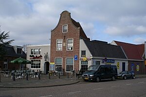
Town square in Berlikum
|
|||
|
|||

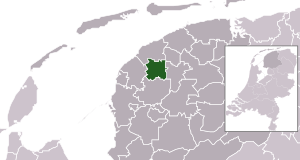
Location in Friesland
|
|||
| Country | Netherlands | ||
| Province | Friesland | ||
| Municipality | Waadhoeke | ||
| Area | |||
| • Total | 70.03 km2 (27.04 sq mi) | ||
| • Land | 68.87 km2 (26.59 sq mi) | ||
| • Water | 1.16 km2 (0.45 sq mi) | ||
| Elevation | 1 m (3 ft) | ||
| Population
(May 2014)
|
|||
| • Total | 13,614 | ||
| • Density | 198/km2 (510/sq mi) | ||
| Time zone | UTC+1 (CET) | ||
| • Summer (DST) | UTC+2 (CEST) | ||
| Postcode |
8816, 9030–9045
|
||
| Area code | 0517, 0518, 058 | ||
Menameradiel (West Frisian: [məˈnaːməraˌdiəl]; Dutch: Menaldumadeel [meːˈnɑldʏmaːˌdeːl]) was a special area in Friesland, Netherlands. It was like a local government area, called a municipality. On January 1, 2018, Menameradiel joined with other nearby municipalities. These were Franekeradeel, het Bildt, and parts of Littenseradiel. Together, they formed a brand new municipality called Waadhoeke.
Discovering Menameradiel's Towns
Menameradiel was home to several towns and villages. Each place had its own number of people living there. Here are the population numbers from January 1, 2007:
- Beetgum (754 people)
- Beetgumermolen (944 people)
- Berlikum (2,492 people)
- Blessum (92 people)
- Boksum (449 people)
- Deinum (1,071 people)
- Dronryp (3,427 people)
- Engelum (415 people)
- Kleaster-Anjum (50 people)
- Marssum (1,156 people)
- Menaam (2,612 people)
- Schingen (108 people)
- Slappeterp (80 people)
- Wier (207 people)
Exploring the Landscape
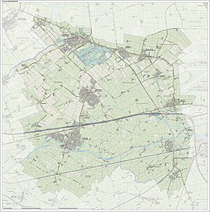
Menameradiel had a unique landscape. You can see what the area looked like on a special map. This map shows the different features of the land.
See also
 In Spanish: Menameradiel para niños
Black History Month on Kiddle
Famous African-American Artists:
 | Delilah Pierce |
 | Gordon Parks |
 | Augusta Savage |
 | Charles Ethan Porter |

All content from Kiddle encyclopedia articles (including the article images and facts) can be freely used under Attribution-ShareAlike license, unless stated otherwise. Cite this article:
Menameradiel Facts for Kids. Kiddle Encyclopedia.


