Franklin Springs, Georgia facts for kids
Quick facts for kids
Franklin Springs, Georgia
|
|
|---|---|

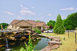
City hall
|
|

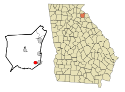
Location in Franklin County and the state of Georgia
|
|
| Country | United States |
| State | Georgia |
| County | Franklin |
| Area | |
| • Total | 2.20 sq mi (5.69 km2) |
| • Land | 2.18 sq mi (5.64 km2) |
| • Water | 0.02 sq mi (0.05 km2) |
| Elevation | 817 ft (249 m) |
| Population
(2020)
|
|
| • Total | 1,155 |
| • Density | 530.06/sq mi (204.64/km2) |
| Time zone | UTC−5 (Eastern (EST)) |
| • Summer (DST) | UTC−4 (EDT) |
| ZIP code |
30639
|
| Area code | 706 |
| FIPS code | 13-31320 |
| GNIS feature ID | 0331767 |
Franklin Springs is a small city in Franklin County, Georgia, in the United States. In 2020, about 1,155 people lived there. It's also home to Emmanuel University, a college that helps students learn and grow.
Contents
History of Franklin Springs
Early Days and City Growth
Franklin Springs began a long time ago in the 1800s. It was a popular place for people to visit because of its special springs. People believed the water had healing powers! The area officially became a city in 1924.
Emmanuel University's Beginning
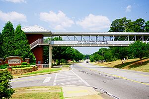
In 1919, a high school called Franklin Springs Institute opened here. Over time, it grew and started offering college-level classes. In 1939, its name changed to Emmanuel College, and today it's known as Emmanuel University.
A Big Storm in 2004
On September 16, 2004, a strong tornado hit Franklin Springs. It caused damage to many buildings, including the city hall, fire station, and police station. About 25 homes were also damaged. The storm was part of a larger group of tornadoes caused by Hurricane Ivan.
Geography of Franklin Springs
Franklin Springs is located in the southeastern part of Franklin County. It is right next to Royston on its eastern side.
Roads and Nearby Towns
U.S. Route 29 runs through the middle of Franklin Springs. This road can take you about 2 miles (3.2 km) east to Royston. If you head southwest on the same road, you'll reach Athens, which is about 28 miles (45 km) away. Carnesville, the main town of Franklin County, is about 9 miles (14 km) to the northwest.
Size of the City
According to the United States Census Bureau, the city of Franklin Springs covers a total area of about 2.2 square miles (5.7 square kilometers). A very small part of this area, about 0.02 square miles (0.05 square kilometers), is water.
Population and People
| Historical population | |||
|---|---|---|---|
| Census | Pop. | %± | |
| 1930 | 75 | — | |
| 1940 | 116 | 54.7% | |
| 1950 | 182 | 56.9% | |
| 1960 | 278 | 52.7% | |
| 1970 | 501 | 80.2% | |
| 1980 | 797 | 59.1% | |
| 1990 | 475 | −40.4% | |
| 2000 | 762 | 60.4% | |
| 2010 | 952 | 24.9% | |
| 2020 | 1,155 | 21.3% | |
| U.S. Decennial Census | |||
In 2000, there were 762 people living in Franklin Springs. By 2010, the population grew to 952, and by 2020, it reached 1,155 people.
Most people living in Franklin Springs are White, with smaller groups of African American and Asian residents. Some people also identify as Hispanic or Latino.
The city has a mix of families and individuals. In 2000, about 23% of households had children under 18 living with them. The average age of people in Franklin Springs was 22 years old.
See also
 In Spanish: Franklin Springs para niños
 | Percy Lavon Julian |
 | Katherine Johnson |
 | George Washington Carver |
 | Annie Easley |


