Frastanz facts for kids
Quick facts for kids
Frastanz
|
||
|---|---|---|

View of the town
|
||
|
||

Location in the district
|
||
| Country | Austria | |
| State | Vorarlberg | |
| District | Feldkirch | |
| Area | ||
| • Total | 32.3 km2 (12.5 sq mi) | |
| Elevation | 510 m (1,670 ft) | |
| Time zone | UTC+1 (CET) | |
| • Summer (DST) | UTC+2 (CEST) | |
| Postal code |
6820
|
|
| Area code | 05522 | |
| Vehicle registration | FK | |
| Website | www.frastanz.at | |
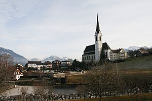
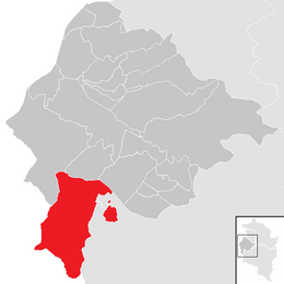
Frastanz is a small, interesting market town located in the western part of Austria. It's found in the state of Vorarlberg, within the Feldkirch area. Long ago, Frastanz was famous for making tobacco products.
Contents
What is Frastanz Like?
Frastanz is a town that sits high up, about 510 meters (or 1,673 feet) above sea level. The total area of the town is about 32.25 square kilometers. A large part of Frastanz, about 61.2%, is covered by forests.
A Look Back in Time: Frastanz's History
Frastanz has a long and interesting history. In ancient times, a Roman Road passed right through the area where Frastanz is today. This means it was an important place for travel and trade even thousands of years ago.
The Battle of Frastanz
A very important event in Frastanz's history was the Battle of Frastanz. This battle happened in the year 1499. It was a significant moment in the region's past.
How Many People Live Here?
The number of people living in Frastanz has changed a lot over the years. Here's a quick look at how the population has grown:
| Historical population | ||
|---|---|---|
| Year | Pop. | ±% |
| 1869 | 1,664 | — |
| 1880 | 1,580 | −5.0% |
| 1890 | 1,814 | +14.8% |
| 1900 | 2,021 | +11.4% |
| 1910 | 2,364 | +17.0% |
| 1923 | 2,111 | −10.7% |
| 1934 | 2,572 | +21.8% |
| 1939 | 2,836 | +10.3% |
| 1951 | 3,530 | +24.5% |
| 1961 | 4,221 | +19.6% |
| 1971 | 5,174 | +22.6% |
| 1981 | 5,413 | +4.6% |
| 1991 | 5,881 | +8.6% |
| 2001 | 6,214 | +5.7% |
| 2011 | 6,153 | −1.0% |
Getting Around: Transport in Frastanz
Frastanz has its own Frastanz railway station. This station is on a main train route that connects the western and eastern parts of Austria.
Train Connections
The railway line, called the Vorarlberg railway, goes in two main directions. You can travel north towards Bregenz or south towards Bludenz. From Bludenz, the train line continues eastward over the Arlberg Railway to Innsbruck and beyond.
Who Runs the Trains?
The train system in Frastanz is managed by the Austrian Federal Railways (ÖBB). This includes local train services that are part of the Vorarlberg S-Bahn network.
See also
 In Spanish: Frastanz para niños
 | Valerie Thomas |
 | Frederick McKinley Jones |
 | George Edward Alcorn Jr. |
 | Thomas Mensah |


