Frith Lake (Thunder Bay District) facts for kids
Quick facts for kids Frith Lake |
|
|---|---|
| lac Frith | |
| Location | Thunder Bay District, Ontario |
| Coordinates | 49°52′29″N 88°40′42″W / 49.87472°N 88.67833°W |
| Type | Lake |
| Part of | Great Lakes Basin |
| Primary outflows | unnamed creek |
| Basin countries | Canada |
| Max. length | 1.9 kilometres (1.2 mi) |
| Max. width | 1.1 kilometres (0.68 mi) |
| Surface elevation | 293 metres (961 ft) |
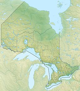
Frith Lake, also known as lac Frith in French, is a cool lake located in the northwestern part of Ontario, Canada. It's found in an "Unorganized Part" of the Thunder Bay District. This means it's a wild area without many towns or cities. What makes Frith Lake really special is its location: it sits on Kelvin Island, which is a big island inside another much larger lake called Lake Nipigon. Because of this, Frith Lake is part of the huge Great Lakes Basin.
About Frith Lake
Frith Lake is about 1.9 kilometres (1.2 mi) (1.2 miles) long and 1.1 kilometres (0.68 mi) (0.7 miles) wide. It sits at an elevation of 293 metres (961 ft) (961 feet) above sea level. Imagine a lake that is on an island, and that island is inside another lake! That's exactly what Frith Lake is. It even has its own tiny island, called an islet, right in the middle of it.
Water Flow and Connections
Frith Lake gets its water from three small, unnamed streams. These streams flow into the lake from the west, southwest, and east sides. The main way water leaves Frith Lake is through an unnamed creek. This creek flows out from the northwest side of the lake.
The water from this creek then travels to the northwest part of Lake Nipigon. From Lake Nipigon, the water flows into the Nipigon River. The Nipigon River is important because it carries the water all the way to Lake Superior, one of the five Great Lakes. This shows how Frith Lake is connected to a much larger water system!
Nature and Protection
Frith Lake is part of a protected area called the Lake Nipigon Conservation Reserve. This means the land and water around the lake are kept safe and natural. It helps protect the plants, animals, and the beautiful environment of the area.


