Lake Nipigon facts for kids
Quick facts for kids Lake Nipigon |
|
|---|---|
 |
|
| Location | Ontario |
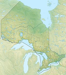
| Coordinates | 49°50′N 88°30′W / 49.833°N 88.500°W |
| Lake type | Glacial |
| Primary outflows | Nipigon River |
| Catchment area | 25,400 km2 (9,800 sq mi) |
| Basin countries | Canada |
| Surface area | 4,848 km2 (1,872 sq mi) |
| Average depth | 54.9 m (180 ft) |
| Max. depth | 165 m (541 ft) |
| Water volume | 248 km3 (59 cu mi; 201×106 acre⋅ft) |
| Shore length1 | 1,044 km (649 mi) |
| Surface elevation | 260 m (850 ft) |
| Islands | Caribou Island, Geikie Island, Katatota Island, Kelvin Island, Logan Island, Murchison Island, Murray Island, and Shakespeare Island |
| 1 Shore length is not a well-defined measure. | |
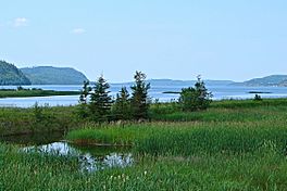
Lake Nipigon (which is lac Nipigon in French and Animbiigoo-zaaga'igan in Ojibwe) is a very important lake in Ontario, Canada. It's the biggest lake that is completely inside Ontario. This huge lake is also part of the Great Lakes water system.
Contents
Geography of Lake Nipigon
Lake Nipigon sits about 260 meters (853 feet) above sea level. Its water flows into the Nipigon River, which then empties into Lake Superior. Both the lake and the river are the largest sources of water for Lake Superior.
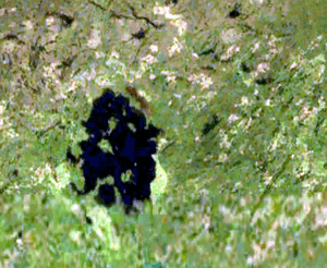
The lake is located about 120 kilometers (75 miles) northeast of the city of Thunder Bay, Ontario. Lake Nipigon covers a huge area of 4,848 square kilometers (1,872 square miles). This makes it the 32nd largest lake in the world!
Many islands dot the lake. Some of the biggest ones are Caribou Island, Geikie Island, Katatota Island, Kelvin Island, Logan Island, Murchison Island, Murray Island, and Shakespeare Island. The deepest part of Lake Nipigon is about 165 meters (541 feet) deep.
How Lake Nipigon Formed
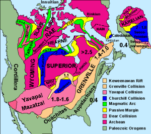
Lake Nipigon sits in a basin, which is like a giant bowl in the ground. This bowl was formed over millions of years. Strong forces from inside the Earth caused the land to crack and sink, creating a "rift basin."
Later, during the Ice Ages, huge sheets of ice called glaciers moved across the land. As they moved, these glaciers scraped away softer rocks and soil. This repeated scraping helped to carve out and deepen the lake's basin.
The rocks under Lake Nipigon are very old. Some are from the Proterozoic Eon, which was billions of years ago. These rocks include layers of sedimentary rock (like sandstone and shale) and igneous rock (formed from cooled lava). There are also very old Archean rocks, which are even older.
About 1.1 billion years ago, hot molten rock pushed up from deep within the Earth. This molten rock spread out in flat layers, forming what are called "diabase sills." These sills are very hard and can be up to 250 meters (820 feet) thick. They form cliffs around the lake and help define its shape.
Scientists are still exploring the area around Lake Nipigon. They believe these ancient rocks might contain valuable minerals like yttrium, zirconium, and copper.
History of Lake Nipigon
After the last Ice Age ended, Lake Nipigon was sometimes part of the path for a massive ancient lake called Lake Agassiz.
Early Explorers and Names
A French Jesuit priest named Claude-Jean Allouez held the first Christian religious service near the Nipigon River on May 29, 1667. He visited the Nipissing Indians who had found safety there.
In old records, the lake was called lac Alimibeg, and later Alemipigon or Alepigon. In the 1800s, it was often spelled Lake Nepigon. The name "Nipigon" likely comes from the Ojibwe word Animbiigoong. This means 'at continuous water' or 'at waters that stretch far away'. Today, the Ojibwa people call Lake Nipigon Animbiigoo-zaaga'igan.
Old maps show different names for the lake and river. A 1778 map called it Lago Nepigon. An 1807 map named it Lake St Ann or Winnimpig. By 1883, maps consistently used the name Lake Nipigon.
French Fur Trading Era
In 1683, a French fur trader named Daniel Greysolon, Sieur du Lhut set up a fur trading post on Lake Nipigon. He named it Fort la Tourette. This fort was likely in Ombabika Bay, at the northeast end of the lake. The French king ordered many western trading posts, including this one, to close in 1696. This was because there was too much beaver fur at the time.
British, Ojibwe, and Canadian Control
After the Treaty of Paris (1763), the area around Lake Nipigon became British territory. The Hudson's Bay Company then expanded its fur trading into this region.
In 1850, the Ojibwe people formally gave the land around Lake Superior, including Lake Nipigon, to the Province of Canada. This agreement is known as the Robinson Superior Treaty. A special area was set aside for Chief Mishe-muckqua (meaning "Great Bear") near the Gull River. In 1871, Lake Nipigon became part of the new Thunder Bay District, Ontario.
The town of Nipigon was created in 1908. Later, in 2001, the Municipality of Greenstone was formed. It includes several communities around the lake.
In 1943, Canada and the United States agreed to change the flow of some rivers. This "Ogoki diversion" sends water from the Ogoki River into Lake Nipigon. This water then helps power three hydroelectric plants on the Nipigon River, which create electricity.
Lake Nipigon Provincial Park is on the east side of the lake. In 1999, part of the park was changed to become a reserve for the Sand Point First Nation.
First Nations Communities
The original people of the Lake Nipigon area are mainly the Ojibwe people. Several First Nations communities live around the lake. These include the Animbiigoo Zaagi'igan Anishinaabek (Lake Nipigon Ojibway) First Nation, the Biinjitiwaabik Zaaging Anishinaabek (Rocky Bay) First Nation, the Bingwi Neyaashi Anishinaabek (Sand Point) First Nation, the Red Rock (Lake Helen) First Nation, and the Gull Bay First Nation. The Whitesand First Nation also used to live on the northwestern shores of Lake Nipigon until 1942.
Together, these First Nations have about 5,000 members. There are also three Indian Reserves near Lake Nipigon: McIntyre Bay IR 54, Jackfish Island IR 57, and Red Rock (Parmachene) IR 53.
The CBC TV show Spirit Bay, which was about First Nations life, was filmed on the lake at the Biinjitiwaabik Zaaging Anishinaabek First Nation Reserve in the 1980s.
Transportation Around Lake Nipigon
The main railway line of the Canadian National Railway (CNR) runs north of Lake Nipigon. Another CNR line goes along the southeastern part of the lake, near Orient Bay and Macdiarmid. Ontario Highway 11 also follows the southeastern shore of the lake.
It is not possible to travel by boat directly between Lake Nipigon and Lake Superior. This is because there are three dams on the Nipigon River that block navigation.
Images for kids
-
The Prince of Wales at Lake Nipigon, 1919
See also
 In Spanish: Lago Nipigon para niños
 | Sharif Bey |
 | Hale Woodruff |
 | Richmond Barthé |
 | Purvis Young |


