
Gall–Peters projection facts for kids

The Gall–Peters projection is a special way to draw a map of the world. It's known as an equal-area map. This means that every country or continent on the map has the correct size compared to others. However, this map style cannot be used for navigating, like finding your way on a ship. On this map, areas near the equator (the imaginary line around the middle of the Earth) might look smaller than they are. Areas closer to the poles (the very top and bottom of the Earth) might look larger. This map projection was named after two people: James Gall and Arno Peters.
Contents
What is a Map Projection?
A map projection is a way to show the round Earth on a flat map. Imagine trying to flatten an orange peel without tearing it. It's impossible! The same is true for the Earth. When you make a flat map from a round globe, some things have to change. Mapmakers have to choose what to keep accurate. Some maps keep shapes accurate, while others keep sizes accurate. The Gall-Peters projection is designed to keep the sizes of landmasses accurate.
Why is "Equal-Area" Important?
An "equal-area" map means that if one country is twice as big as another in real life, it will also appear twice as big on the map. This is very useful for comparing the actual sizes of different countries or continents. Many common maps, like the Mercator projection, make countries near the poles look much bigger than they really are. For example, Greenland looks huge on a Mercator map, but it's actually much smaller than Africa. The Gall-Peters map shows their true sizes relative to each other.
Who Created the Gall-Peters Map?
The Gall-Peters projection is named after two different people who came up with similar ideas.
James Gall's Idea
James Gall was a Scottish clergyman and cartographer (mapmaker). He first described a similar map projection in 1855. His goal was to create a map that showed the correct sizes of land areas. He wanted to make maps that were more fair in how they showed different parts of the world.
Arno Peters' Contribution
Arno Peters was a German historian and filmmaker. In 1973, he presented his own version of an equal-area map. He strongly promoted his map, arguing that traditional maps were unfair. He believed they made wealthy countries in the Northern Hemisphere look bigger and more important. Peters wanted his map to show the true proportions of all countries. This would help people understand the world better.
The Map Controversy
In the late 20th century, there was a big discussion about map design. This is sometimes called the "map controversy." Arno Peters argued that many maps used for a long time were misleading. He said they made countries near the equator, often poorer nations, look smaller. This could make them seem less important. He believed his map helped correct this bias.
Political Implications of Map Design
The idea that maps could have "political implications" was new to many people. It meant that the way a map is drawn could affect how people think about the world. If a map makes certain areas look bigger or smaller, it might change how people view their importance. Peters argued that his map was more fair and showed the world as it truly is in terms of land area.
Where is the Gall-Peters Map Used?
Maps based on the Gall-Peters projection have become quite popular in some places. The UNESCO (United Nations Educational, Scientific and Cultural Organization) has promoted these maps. They are also widely used in British schools. This is because they help students learn about the true sizes of countries and continents. It encourages a more balanced view of the world.
Images for kids
-
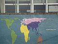
Mural at a school depicting the Gall–Peters projection, with continents coloured.

See also
 In Spanish: Proyección de Peters para niños
