
Garcia River facts for kids
Quick facts for kids Garcia River |
|
|---|---|
| Native name |
|
| Country | United States |
| State | California |
| Region | Mendocino County |
| Physical characteristics | |
| Main source | Pardaloe Creek 38°52′02″N 123°17′0″W / 38.86722°N 123.28333°W |
| 2nd source | Mill Creek 38°54′41″N 123°17′33″W / 38.91139°N 123.29250°W |
| River mouth | Pacific Ocean Point Arena 0 ft (0 m) 38°57′16″N 123°44′1″W / 38.95444°N 123.73361°W |
| Length | 44 mi (71 km) |
| Basin features | |
| Basin size | 144 sq mi (370 km2) |
| Tributaries |
|
The Garcia River is a river located on the northern coast of California. You can find it in the southern part of Mendocino County. The area of land that drains into the river, called its watershed, covers about 144 square miles (373 km²). The main part of the river is 44 miles (71 km) long.
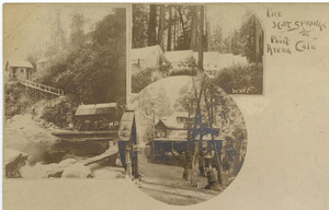
The watershed gets a lot of rain each year. Near the coast, it receives about 45 inches (1,100 mm) of precipitation. Further inland, it can get up to 75 inches (1,900 mm) of rain. The land in the watershed ranges from sea level near the ocean to 2,470 feet (750 m) high in the Coast Range mountains. The Garcia River flows into the Pacific Ocean just north of Point Arena. The Native California Indians who live near the river's mouth call this place P'da Hau.
The river was named after Rafael Garcia, a settler who was given ownership of the land in 1844.
Contents
Why the Garcia River is Important
The Garcia River is very important to the local area. People use it for fun activities like recreation. It also provides water for farms and industries in the community of Point Arena, California.
The river is a vital home for many animals. It provides a cool, fresh water habitat for fish. This includes special areas where fish like salmon can travel and lay their eggs.
Challenges Facing the River
One of the biggest problems for the Garcia River is too much erosion. Erosion happens when soil and rock are worn away, often by water. This erosion has been made worse by certain activities in the area.
Past Problems and Their Impact
- Logging: Cutting down trees for wood.
- Grazing: Animals like cows eating plants.
- Gravel Mining: Digging up gravel from the riverbed.
Logging in the area started in the 1800s. However, the most damage happened after World War II. During this time, new machines made it easier to cut down many trees quickly. But there were not many environmental regulations or good practices in place yet.
The river and its smaller streams often became blocked with "logging slash." This is the leftover branches and debris from cut trees. Also, dragging logs over streams destroyed the plants that protected the banks. Over time, this debris was removed, both naturally and by people.
Unfortunately, now there isn't enough large woody debris in the streams. This debris is important for salmon to reproduce. It also helps stop erosion and creates deep pools. These pools are important habitat for many water-dwelling creatures.
Land Ownership and Access
Most of the land in the Garcia River watershed is privately owned. About 80 percent of the land belongs to private owners. Coast Forestlands is the biggest landowner. Other large landowners include Louisiana Pacific and Mailliard Ranch.
Some of the land also has private homes and small farms. Because most of the land is privately owned, it can be difficult for the public to access the river and its watershed.
River's Journey
The Garcia River begins where Pardaloe Creek and Mill Creek meet. This spot is about 8 miles (13 km) south of Boonville, California. From there, the river flows west.
After Inman Creek joins it, the river turns northwest. It then follows the San Andreas Fault rift zone. Next, the North Fork Garcia River flows into it from the right. Just south of Mountain View Road, the river turns west again. It flows under State Route 1 at milepost 18.5. Finally, the Garcia River empties into the Pacific Ocean. This happens between Point Arena and Manchester State Beach.
