
Genoa, Wisconsin facts for kids
Quick facts for kids
Genoa, Wisconsin
|
|
|---|---|

Welcome sign and downtown
|
|

Location of Genoa in Vernon County, Wisconsin
|
|
| Country | |
| State | |
| County | Vernon |
| Area | |
| • Total | 0.36 sq mi (0.95 km2) |
| • Land | 0.36 sq mi (0.93 km2) |
| • Water | 0.01 sq mi (0.02 km2) |
| Elevation | 653 ft (199 m) |
| Population
(2020)
|
|
| • Total | 232 |
| • Density | 731.09/sq mi (281.91/km2) |
| Time zone | UTC-6 (Central (CST)) |
| • Summer (DST) | UTC-5 (CDT) |
| ZIP code |
54632
|
| Area code(s) | 608 |
| FIPS code | 55-28650 |
| GNIS feature ID | 1565460 |
Genoa is a small village in Vernon County, Wisconsin, in the United States. In 2020, about 232 people lived there. It is part of the larger Town of Genoa.
Contents
History of Genoa
Genoa was first called Bad Axe. This name came from a nearby river. In 1868, the village changed its name to Genoa.
Where is Genoa Located?
Genoa is found at 43°34′36″N 91°13′27″W / 43.57667°N 91.22417°W. This means it's in the southwestern part of Wisconsin.
The village covers a total area of about 0.31 square miles (0.80 square kilometers). Most of this area is land. Only a tiny part, about 0.01 square miles (0.03 square kilometers), is water.

Genoa's Climate and Weather
Genoa has a hot-summer humid continental climate. This means it has warm, humid summers and cold winters. On climate maps, this is shown as "Dfa".
The hottest temperature ever recorded in Genoa was 109°F (43°C). This happened on July 13, 1995. The coldest temperature recorded was -43°F (-42°C). This was on January 30, 1951.
| Climate data for Genoa, Wisconsin, 1991–2020 normals, extremes 1939–present | |||||||||||||
|---|---|---|---|---|---|---|---|---|---|---|---|---|---|
| Month | Jan | Feb | Mar | Apr | May | Jun | Jul | Aug | Sep | Oct | Nov | Dec | Year |
| Record high °F (°C) | 55 (13) |
64 (18) |
81 (27) |
93 (34) |
96 (36) |
101 (38) |
109 (43) |
101 (38) |
97 (36) |
91 (33) |
75 (24) |
69 (21) |
109 (43) |
| Mean maximum °F (°C) | 45.4 (7.4) |
49.6 (9.8) |
65.0 (18.3) |
78.7 (25.9) |
85.9 (29.9) |
90.5 (32.5) |
92.0 (33.3) |
90.8 (32.7) |
86.9 (30.5) |
79.4 (26.3) |
63.7 (17.6) |
49.1 (9.5) |
94.3 (34.6) |
| Mean daily maximum °F (°C) | 27.3 (−2.6) |
32.1 (0.1) |
44.7 (7.1) |
59.2 (15.1) |
71.0 (21.7) |
80.1 (26.7) |
83.7 (28.7) |
81.5 (27.5) |
74.2 (23.4) |
60.9 (16.1) |
45.3 (7.4) |
32.3 (0.2) |
57.7 (14.3) |
| Daily mean °F (°C) | 19.1 (−7.2) |
23.2 (−4.9) |
35.6 (2.0) |
48.8 (9.3) |
60.5 (15.8) |
70.2 (21.2) |
74.0 (23.3) |
71.9 (22.2) |
64.3 (17.9) |
51.5 (10.8) |
37.5 (3.1) |
25.3 (−3.7) |
48.5 (9.1) |
| Mean daily minimum °F (°C) | 10.9 (−11.7) |
14.3 (−9.8) |
26.4 (−3.1) |
38.4 (3.6) |
50.0 (10.0) |
60.3 (15.7) |
64.2 (17.9) |
62.4 (16.9) |
54.3 (12.4) |
42.0 (5.6) |
29.8 (−1.2) |
18.2 (−7.7) |
39.3 (4.1) |
| Mean minimum °F (°C) | −14.3 (−25.7) |
−8.4 (−22.4) |
3.4 (−15.9) |
23.7 (−4.6) |
35.5 (1.9) |
47.6 (8.7) |
54.3 (12.4) |
52.5 (11.4) |
38.8 (3.8) |
26.9 (−2.8) |
12.7 (−10.7) |
−4.5 (−20.3) |
−17.7 (−27.6) |
| Record low °F (°C) | −43 (−42) |
−38 (−39) |
−31 (−35) |
5 (−15) |
26 (−3) |
36 (2) |
46 (8) |
41 (5) |
28 (−2) |
15 (−9) |
−9 (−23) |
−26 (−32) |
−43 (−42) |
| Average precipitation inches (mm) | 1.26 (32) |
1.18 (30) |
2.09 (53) |
3.87 (98) |
4.73 (120) |
5.88 (149) |
4.31 (109) |
4.82 (122) |
4.16 (106) |
2.64 (67) |
1.94 (49) |
1.52 (39) |
38.40 (975) |
| Average snowfall inches (cm) | 9.1 (23) |
9.3 (24) |
4.9 (12) |
1.3 (3.3) |
0.0 (0.0) |
0.0 (0.0) |
0.0 (0.0) |
0.0 (0.0) |
0.0 (0.0) |
0.1 (0.25) |
1.5 (3.8) |
8.6 (22) |
34.8 (88.35) |
| Average precipitation days (≥ 0.01 in) | 8.7 | 7.5 | 9.4 | 11.5 | 12.8 | 12.2 | 10.0 | 9.6 | 9.3 | 9.3 | 8.4 | 9.2 | 117.9 |
| Average snowy days (≥ 0.1 in) | 4.7 | 4.3 | 1.7 | 0.4 | 0.0 | 0.0 | 0.0 | 0.0 | 0.0 | 0.1 | 1.0 | 4.7 | 16.9 |
| Source 1: NOAA | |||||||||||||
| Source 2: National Weather Service | |||||||||||||
People Living in Genoa
| Historical population | |||
|---|---|---|---|
| Census | Pop. | %± | |
| 1880 | 150 | — | |
| 1890 | 185 | 23.3% | |
| 1900 | 219 | 18.4% | |
| 1910 | 267 | 21.9% | |
| 1920 | 304 | 13.9% | |
| 1930 | 351 | 15.5% | |
| 1940 | 339 | −3.4% | |
| 1950 | 340 | 0.3% | |
| 1960 | 325 | −4.4% | |
| 1970 | 305 | −6.2% | |
| 1980 | 283 | −7.2% | |
| 1990 | 266 | −6.0% | |
| 2000 | 263 | −1.1% | |
| 2010 | 253 | −3.8% | |
| 2020 | 232 | −8.3% | |
| U.S. Decennial Census | |||
Genoa's Population in 2010
In 2010, the village had 253 people. There were 110 households, which are groups of people living together. About 73 of these were families.
The village had about 843 people per square mile. Most residents, 97.2%, were White. A small number were Native American or Asian. Some people were from two or more racial backgrounds.
- About 24.5% of households had children under 18.
- More than half, 52.7%, were married couples.
- About 7.3% had a female head of household with no husband.
- About 6.4% had a male head of household with no wife.
- About 33.6% were not families.
The average age in Genoa was 43.8 years old.
- About 23.3% of residents were under 18.
- About 22.5% were 65 or older.
- The village had slightly more males (51.8%) than females (48.2%).
Economy and Power
The La Crosse Boiling Water Reactor was once in Genoa. This was a type of power plant. It stopped working in 1987.
Now, the Genoa Generating Station is at the same location. This was a power plant that used coal. It operated for over 50 years. It was officially closed on June 1, 2021.

Schools in Genoa
Students in Genoa attend schools that are part of the De Soto Area Schools district.
Getting Around: Transportation
Bus service is available in Genoa. Buses travel towards La Crosse and Prairie du Chien. The Scenic Mississippi Regional Transit provides this service. Buses run three times a day in each direction.
Gallery
-
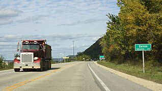
DOT sign along WIS 35
-
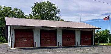
Genoa Fire Station


See also
 In Spanish: Genoa (Wisconsin) para niños
