Gleaston Castle facts for kids
Quick facts for kids Gleaston Castle |
|
|---|---|
| Cumbria, England | |
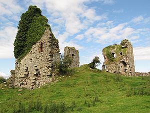
Gleaston Castle's ruined north-west tower in 2015
|
|
| Coordinates | 54°08′02″N 3°07′54″W / 54.1340°N 3.1317°W |
| Type | Enclosure castle |
| Height | c.19 m (62 ft) (south-west tower) |
| Site information | |
| Owner | Private |
| Open to the public |
No |
| Condition | Ruin – At Risk |
| Site history | |
| Built | 14th century |
| Built by | John Harington, 1st Baron Harington |
| Materials | Limestone (main material) and sandstone (details) |
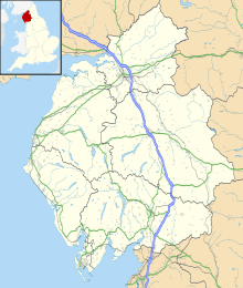
Gleaston Castle is an old castle from the Middle Ages. It sits in a valley about 1 kilometre (0.6 miles) north-east of Gleaston village. This village is located between Ulverston and Barrow-in-Furness in the Furness peninsula, Cumbria, England. Gleaston Castle has a square-like shape with a tower at each corner. The biggest tower, in the north-west, probably held a large hall for gatherings.
The castle was likely built for John Harington, 1st Baron Harington in the 1300s. It took the place of an older castle nearby called Aldingham Motte. Gleaston Castle stayed with the Harington family until 1458. Then, it passed to William Bonville, 6th Baron Harington through marriage and was later left empty. The castle then went to the Grey family. But in 1554, Henry Grey, 1st Duke of Suffolk was executed for treason. This meant Gleaston Castle became property of the king or queen. Later, the Preston family bought it in the 1600s, and it then passed to the Cavendish family.
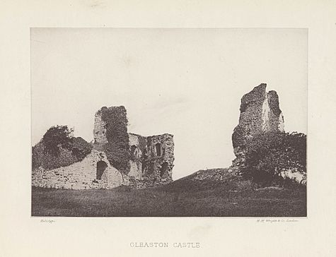
Since the castle was not used from the mid-1400s, it slowly fell apart. Old drawings from the 1700s show Gleaston already in ruins. Even though you can't go inside, people have studied the castle's history and archaeology in the 1900s and 2000s.
Castle History
From the 1100s, the area known as Muchland was managed from Aldingham Castle. This area later became known as Aldingham manor. In 1291, the Harington family took ownership of it. In the 1300s, Scottish armies attacked the Furness peninsula during the Wars of Scottish Independence. Around the same time, the sea was wearing away the land near Aldingham Motte.
These reasons might have made the Harington family leave Aldingham. They then set up their main base at the newly built Gleaston Castle. However, building a new castle might also have shown their growing importance. They might have needed more space for their many servants too.
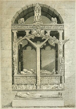
The castle was probably built for John Harington, 1st Baron Harington (born 1281, died 1347). Gleaston Castle is first mentioned in records from 1389. However, it is said that John Harington, 2nd Baron Harington died there in 1363. In 1415, John Harington received special permission from the Pope. This allowed him to have a private chapel and a portable altar for church services. But it's likely the castle had its own chapel even before this date.
The Harington family owned Gleaston Castle until William Harington, 5th Baron Harington died in 1458. The castle then passed to William Bonville, 6th Baron Harington through marriage. He died in 1460, and the castle went to Thomas Grey, 1st Marquess of Dorset, again through marriage. It is thought that Gleaston Castle was left empty around this time. In 1540, a historian named John Leland wrote about it. He noted "there is a ruine and waulles of a castell... cawlyd Gleston Castell". Other historians also wrote about the site.
When Henry Grey, 1st Duke of Suffolk was executed for treason in 1554, his property was taken by the king or queen. In 1671, Thomas Preston, 3rd Baronet Preston bought Aldingham manor, which included Gleaston Castle. The property was passed down through the Preston family. It then went to the Cavendish family. Today, the castle is part of a working farm that started in the 1800s. Some of the farm buildings use parts of the old castle walls. The Prestons owned the castle until 1922. Then, it was sold to the family who owns it now.
An old picture of the castle was made by Samuel and Nathaniel Buck in 1727. This is one of the earliest drawings of the castle. Later pictures were made by William Close (1805), William Green (1809), and Edwin Waugh (1860). The Buck brothers' picture showed the castle already in ruins. Waugh's drawing shows that the castle has looked much the same since the mid-1800s.
Saving and Studying the Castle
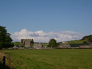
Gleaston Castle is now a Grade I listed ruin. This means it is a very important historical building. It is also a scheduled monument, which protects it even more. You can see the ruins from the road. However, it is not safe to go inside because it is falling apart. As of 2016, the castle is on Historic England's Heritage At Risk list. Its condition is described as "very bad" and "deteriorating".
Since the late 1900s, people have tried to save the site. In 1998, the Lancaster University Archaeological Unit studied the standing walls. They wanted to see if more research was possible. They also checked if the building could be opened to the public. But Historic England noted that "no agreement was reached regarding a scheme of consolidation". This means they couldn't agree on a plan to make it safe.
Because the castle was in such bad shape, it wasn't fully mapped until 2015. The Morecambe Bay Partnership paid for Greenlane Archaeology to do an aerial survey. This survey used special equipment to map the site from above. It created a visual record of the castle. From this, they could make drawings of its height and layout. The survey also found signs of buildings inside the castle that no longer exist. In 2016, the University of Central Lancashire did a geophysical survey. This survey used special tools to look underground without digging. It helped train archaeology students and volunteers. The survey showed there was likely a garden north of the castle. It also found signs of wooden buildings inside the castle walls.
Castle Design and Layout
Gleaston Castle was left empty about 100 years after it was built. Because of this, the parts of the castle that are still standing show what 14th-century castles looked like. They haven't been changed by people living there later. The castle is mostly made of limestone, which was found nearby. Sandstone was used for details like doors and windows. The sandstone might have come from a beach 3.2 kilometres (2 miles) away. There isn't any sandstone close to the castle. Using red sandstone for details can also be seen at Piel Castle near Barrow-in-Furness.
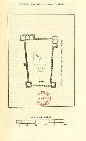
The castle was a walled area about 73 metres (240 feet) long from north to south. It was about 37 metres (120 feet) wide at the south end and 46 metres (150 feet) wide at the north end. It had four towers, one at each corner. These towers were decorated with red sandstone. The north-west tower is 26 by 16 metres (85 by 52 feet) and is 12 metres (39 feet) tall at its highest point. Only three parts of its walls are still standing. The ground slopes, so it is higher at the north end than the south.
The south-west tower is 10 by 9.4 metres (33 by 31 feet). This four-story tower is 19 metres (62 feet) tall and has a large crack in its west wall. The south-east tower is 9.5 by 13 metres (31 by 43 feet) and stands 12 metres (39 feet) high. The north-east tower has mostly fallen down. There are only earthworks left, though some parts might be in the modern farm buildings.
The western curtain wall is 3 metres (10 feet) thick. In some places, it is 9 metres (30 feet) tall. It has a ruined bastion, which is a strong part of the wall, halfway between the north-west and south-west towers. To the east, the wall has been partly built into the modern farm buildings. This has saved some of the stone walls up to 4 metres (13 feet) high. In the north and south, the wall no longer stands above ground.
Castle Surroundings
Gleaston Castle is about 1 kilometre (0.6 miles) north-west of Gleaston village. It is located in the Furness Peninsula. John Harrington was given permission to create a 600-acre park in Aldingham manor. We don't know exactly where this park was, but it might have been east of the castle. It is also likely that the manor's mill was close to the castle. This would have allowed the Harington family to control an important local resource for making flour. Experts say that figuring out how the castle related to the wider landscape is an important goal for future research.
 | Precious Adams |
 | Lauren Anderson |
 | Janet Collins |


