
Glen Arbor, Michigan facts for kids
Quick facts for kids
Glen Arbor, Michigan
|
|
|---|---|

South Lake Isle Boulevard, located off of Glen Arbor’s main road
|
|

Location within Leelanau County
|
|

Glen Arbor, Michigan
Location in Michigan

Glen Arbor, Michigan
Location in the United States
|
|
| Country | |
| State | |
| County | |
| Township | Glen Arbor |
| Area | |
| • Total | 1.04 sq mi (2.71 km2) |
| • Land | 1.03 sq mi (2.66 km2) |
| • Water | 0.02 sq mi (0.04 km2) |
| Elevation | 591 ft (180 m) |
| Population
(2020)
|
|
| • Total | 261 |
| • Density | 253.64/sq mi (97.95/km2) |
| Time zone | UTC-5 (Eastern (EST)) |
| • Summer (DST) | UTC-4 (EDT) |
| ZIP code(s) |
49636
|
| Area code(s) | 231 |
| GNIS feature ID | 626870 |
Glen Arbor is a small, charming community in Michigan, United States. It's a popular spot for tourists, especially because it's located right between the big Lake Michigan and the beautiful Glen Lake. This makes it a great place for outdoor adventures.
Glen Arbor is also very close to the amazing Sleeping Bear Dunes National Lakeshore. In 2020, about 261 people lived here. You can find Glen Arbor along M-22, a scenic road that follows the Lake Michigan shore. It even has its own post office!
Contents
History of Glen Arbor
The land around Glen Arbor was first home to Native American tribes. These included the Odawa, Ojibwe, and Potawatomi peoples. They were all part of a group called the Council of Three Fires.
Later, in the late 1800s, a lumberman named D.H. Day bought a lot of land nearby. He built a sawmill on the Crystal River. This helped the nearby town of Glen Haven grow, which then helped Glen Arbor develop too.
By the early 1900s, the area became known as a popular place for tourists. People loved to visit the beautiful lakes and forests. In 1971, much of the land that D.H. Day once owned became part of the Sleeping Bear Dunes National Lakeshore.
What's in a Name?
The name "Glen Arbor" was created by the wife of one of the first settlers in the area. It combines the name of Glen Lake with the word "arbor." An arbor is a leafy, shady place, often made by plants like grapevines growing on trees.
Geography of Glen Arbor
Glen Arbor is a small community, covering about 1.04 square miles (2.71 square kilometers). Most of this area is land, with a small part being water.
The town is surrounded by nature. To the south, you'll find the shores of Glen Lake. To the west, it borders the famous Sleeping Bear Dunes National Lakeshore. And to the north, it meets the vast Lake Michigan. The Crystal River flows east of town. It winds through many roads and hiking trails before emptying into Lake Michigan.
Main Roads in Glen Arbor
Two important highways run through or near Glen Arbor:
 M-22 is a very famous road that runs along the beautiful Lake Michigan coast. It goes right through the center of Glen Arbor.
- M-109 connects M-22 to a part of the Sleeping Bear Dunes National Lakeshore. It comes into Glen Arbor from the west and ends where it meets M-22 in the downtown area.
Population of Glen Arbor
Glen Arbor is a small community. According to the 2020 census, there were 261 people living there. This was a small increase from 229 people in the 2010 census.
| Historical population | |||
|---|---|---|---|
| Census | Pop. | %± | |
| 2010 | 229 | — | |
| 2020 | 261 | 14.0% | |
| U.S. Decennial Census | |||
Gallery
-
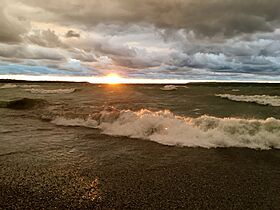
Sleeping Bear Bay
-
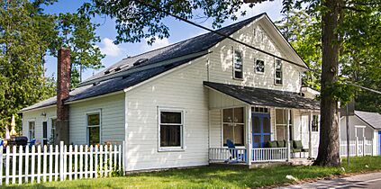
Frank E. Fisher store
-
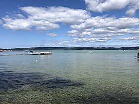
Big Glen Lake
-
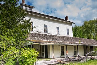
The Glen Arbor Roller Mills, once a recording studio
-
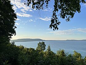
Big Glen Lake from the south, with Glen Arbor visible near the center-right


See also
 In Spanish: Glen Arbor para niños
