Glen Burnie, Maryland facts for kids
Quick facts for kids
Glen Burnie, Maryland
|
|
|---|---|
 |
|
| Nickname(s):
"Chrome City"
|
|
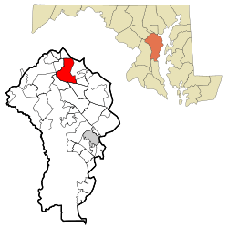
Location of Glen Burnie, Maryland
|
|
| Country | United States |
| State | Maryland |
| County | Anne Arundel |
| Founded | 1812 |
| Area | |
| • Total | 18.02 sq mi (46.67 km2) |
| • Land | 17.31 sq mi (44.84 km2) |
| • Water | 0.71 sq mi (1.84 km2) |
| Elevation | 52 ft (16 m) |
| Population
(2020)
|
|
| • Total | 72,891 |
| • Density | 4,210.43/sq mi (1,625.69/km2) |
| Time zone | UTC−5 (Eastern (EST)) |
| • Summer (DST) | UTC−4 (EDT) |
| ZIP codes |
21060-21062
|
| Area code(s) | 410, 443, and 667 |
| FIPS code | 24-32650 |
| GNIS feature ID | 0590311 |
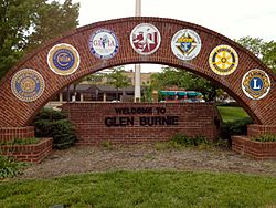
Glen Burnie is a town in Anne Arundel County, Maryland, United States. It is not officially a city but a "census-designated place" (CDP). This means it is a community that the government counts as a separate place for population statistics. Glen Burnie is a suburb of Baltimore. In 2020, about 72,891 people lived there.
Contents
History of Glen Burnie
The story of Glen Burnie began in 1812. A lawyer named Elias Glenn started a property near what is now Brooklyn Park. He called his land "Glennsburne." Over time, the name changed to "Glennsbourne Farm" and then "Glenburnie."
Later, in 1854, Elias Glenn's grandson, William Wilkins Glenn, started a mining and manufacturing company. This business grew and bought thousands of acres in northern Anne Arundel County.
After William Wilkins Glenn passed away, his family continued the business. In 1888, Glenburnie became an official town area. The Glenn family hired George T. Melvin and Henry S. Mancha to plan and promote the new town. The name finally changed to "Glen Burnie" in 1930, thanks to postmaster Louis J. DeAlba.
Some of the first buildings in Glen Burnie were First Avenue Elementary, built in 1899. The oldest church is St. Alban's Episcopal, built in 1904. Many of its bricks came from a very old chapel from the 1730s.
Important roads were built too. Crain Highway opened in 1927, and Ritchie Highway followed in 1939. Ritchie Highway was the main road for traffic going from Baltimore to Annapolis until Interstate 97 opened in the 1980s.
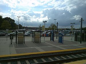
A railroad called the Baltimore and Annapolis Railroad used to serve Glen Burnie. It carried people and goods until 1950. Today, the Baltimore Light Rail system serves North Glen Burnie at the Cromwell/Glen Burnie station.
In the following years, more schools and churches were built. In 1958, Harundale Mall opened. It was the first enclosed shopping center east of the Mississippi River. It was also one of the first places to be called a "mall." Later, Glen Burnie Mall opened in 1962, and Marley Station opened in 1987.
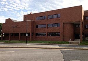
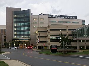
Glen Burnie also saw more development in the 1970s. New buildings like Empire Towers were built. An Anne Arundel Community College branch opened in the town center. In 1965, North Arundel Hospital opened. It later became the University of Maryland Baltimore Washington Medical Center in 2000.
Geography and Climate
Glen Burnie is located near Baltimore. Its center is where Central Avenue and Crain Highway meet.
The area covers about 46.7 square kilometers (18.02 square miles). Most of this area is land, with a small part being water.
Climate in Glen Burnie
Glen Burnie has a humid subtropical climate. This means it has hot, humid summers. Winters are generally mild to cool.
| Climate data for Baltimore/Washington International Airport (1981−2010 normals, extremes 1950−present) | |||||||||||||
|---|---|---|---|---|---|---|---|---|---|---|---|---|---|
| Month | Jan | Feb | Mar | Apr | May | Jun | Jul | Aug | Sep | Oct | Nov | Dec | Year |
| Record high °F (°C) | 75 (24) |
79 (26) |
89 (32) |
94 (34) |
98 (37) |
103 (39) |
106 (41) |
105 (41) |
100 (38) |
98 (37) |
86 (30) |
77 (25) |
106 (41) |
| Mean maximum °F (°C) | 63.5 (17.5) |
66.2 (19.0) |
76.4 (24.7) |
85.1 (29.5) |
90.1 (32.3) |
95.2 (35.1) |
97.3 (36.3) |
95.9 (35.5) |
90.8 (32.7) |
82.9 (28.3) |
74.5 (23.6) |
65.6 (18.7) |
98.6 (37.0) |
| Mean daily maximum °F (°C) | 41.4 (5.2) |
44.9 (7.2) |
53.6 (12.0) |
64.6 (18.1) |
73.9 (23.3) |
83.0 (28.3) |
87.2 (30.7) |
85.1 (29.5) |
77.9 (25.5) |
66.8 (19.3) |
56.4 (13.6) |
45.3 (7.4) |
65.1 (18.4) |
| Mean daily minimum °F (°C) | 24.4 (−4.2) |
26.6 (−3.0) |
33.5 (0.8) |
42.7 (5.9) |
52.0 (11.1) |
61.9 (16.6) |
66.8 (19.3) |
65.2 (18.4) |
57.6 (14.2) |
45.4 (7.4) |
36.5 (2.5) |
28.1 (−2.2) |
45.1 (7.3) |
| Mean minimum °F (°C) | 7.6 (−13.6) |
11.9 (−11.2) |
18.9 (−7.3) |
29.1 (−1.6) |
38.6 (3.7) |
49.4 (9.7) |
56.4 (13.6) |
54.4 (12.4) |
43.7 (6.5) |
32.0 (0.0) |
23.0 (−5.0) |
13.2 (−10.4) |
4.6 (−15.2) |
| Record low °F (°C) | −7 (−22) |
−3 (−19) |
4 (−16) |
20 (−7) |
32 (0) |
40 (4) |
50 (10) |
45 (7) |
35 (2) |
25 (−4) |
13 (−11) |
0 (−18) |
−7 (−22) |
| Average precipitation inches (mm) | 3.05 (77) |
2.90 (74) |
3.90 (99) |
3.19 (81) |
3.99 (101) |
3.46 (88) |
4.07 (103) |
3.29 (84) |
4.03 (102) |
3.33 (85) |
3.30 (84) |
3.37 (86) |
41.88 (1,064) |
| Average snowfall inches (cm) | 6.8 (17) |
8.0 (20) |
1.9 (4.8) |
trace | 0 (0) |
0 (0) |
0 (0) |
0 (0) |
0 (0) |
0 (0) |
0.4 (1.0) |
3.0 (7.6) |
20.1 (51) |
| Average precipitation days (≥ 0.01 in) | 10.2 | 8.9 | 10.4 | 10.8 | 11.4 | 10.6 | 10.0 | 8.6 | 8.5 | 8.2 | 8.7 | 9.9 | 116.2 |
| Average snowy days (≥ 0.1 in) | 3.5 | 2.8 | 1.1 | 0.1 | 0 | 0 | 0 | 0 | 0 | 0 | 0.3 | 1.7 | 9.5 |
| Average relative humidity (%) | 63.2 | 61.3 | 59.2 | 58.9 | 66.1 | 68.4 | 69.1 | 71.1 | 71.3 | 69.5 | 66.5 | 65.5 | 65.8 |
| Average dew point °F (°C) | 19.9 (−6.7) |
21.6 (−5.8) |
28.9 (−1.7) |
37.6 (3.1) |
50.4 (10.2) |
60.1 (15.6) |
64.6 (18.1) |
64.0 (17.8) |
57.6 (14.2) |
45.5 (7.5) |
35.2 (1.8) |
25.3 (−3.7) |
42.6 (5.9) |
| Mean monthly sunshine hours | 155.4 | 164.0 | 215.0 | 230.7 | 254.5 | 277.3 | 290.1 | 264.4 | 221.8 | 205.5 | 158.5 | 144.5 | 2,581.7 |
| Percent possible sunshine | 51 | 54 | 58 | 58 | 57 | 62 | 64 | 62 | 59 | 59 | 52 | 49 | 58 |
| Source: NOAA (relative humidity, dew point and sun 1961–1990) | |||||||||||||
People in Glen Burnie
| Historical population | |||
|---|---|---|---|
| Census | Pop. | %± | |
| 2010 | 67,639 | — | |
| 2020 | 72,891 | 7.8% | |
| U.S. Decennial Census | |||
Glen Burnie is home to many people from different backgrounds. In 2020, the population was 72,891.
| Population by race in Glen Burnie Maryland (2010) | ||
| Race | Population | % of Total |
|---|---|---|
| Total | 67,639 | 100 |
| White | 44,930 | 66 |
| African American | 14,856 | 21 |
| Hispanic | 5,368 | 7 |
| Asian | 2,686 | 3 |
| Two or more races | 2,413 | 3 |
| Some other race | 2,374 | 3 |
| American Indian | 260 | < 1% |
| Three or more races | 212 | < 1% |
| Native Hawaiian Pacific Islander | 120 | < 1% |
In 2000, there were about 38,922 people living in Glen Burnie. The community was made up of many different groups. About 81% of the people were White, and 13.5% were Black. About 2.4% were Asian, and 2.46% were Hispanic or Latino.
The average age of people in Glen Burnie was 36 years old. About 23.7% of the population was under 18 years old.
Education in Glen Burnie
Glen Burnie has many public schools for students of all ages. These schools serve the community and surrounding areas.
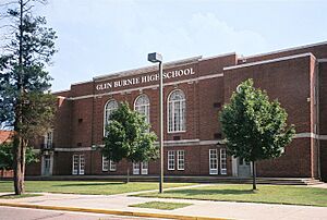
- Glen Burnie High School
- Marley Elementary
- Marley Middle
- Glendale Elementary
- Freetown Elementary
- Monarch Academy
- Point Pleasant Elementary
- Solley Elementary
- Corkran Middle
- George T. Cromwell Elementary
- Glen Burnie Park Elementary
- North County High School
- North Glen Elementary
- Oakwood Elementary
- Woodside Elementary
- Old Mill High School
- Old Mill Middle School South
- Old Mill Middle School North
- Richard Henry Lee Elementary
- Rippleing Woods Elementary
- Severn Run High School
- Northeast Middle School
- Northeast High School
There is also a private school called Monsignor Slade Catholic School. For older students, Glen Burnie has a campus of Anne Arundel Community College.
Getting Around Glen Burnie
Air Travel
Baltimore/Washington International Airport (BWI) is very close to Glen Burnie. This airport offers flights to many places, both in the U.S. and other countries.
Public Transportation
Glen Burnie is the end point for one line of the Baltimore Light Rail. There are two light rail stops in the area: Ferndale and Glen Burnie. The Glen Burnie station has a free parking area for people who want to ride the train. You can also connect to a bus route or a bike trail from this station.
The BWI Rail Station is nearby in Linthicum. From there, you can take the MARC or Amtrak for longer trips.
Major Roads
Several important roads pass through or near Glen Burnie, making it easy to travel.
- MD 2 Governor Ritchie Highway: This is a main road that runs north and south through Glen Burnie's business areas.
- MD 3 Robert Crain Highway: Another main road that connects to other highways.
- MD 10 Arundel Expressway: An expressway that helps drivers get around quickly, running north and south.
- MD 100 Paul T. Pitcher Memorial Highway: This expressway runs east and west, connecting Glen Burnie to other towns like Ellicott City.
- I-97 Glen Burnie Bypass: A major highway that connects Glen Burnie to Baltimore and Annapolis.
- I-695 Baltimore Beltway: This highway circles around the greater Baltimore area.
- Airport Loop: A set of roads that go around BWI Thurgood Marshall Airport.
Famous People from Glen Burnie
Many interesting people have connections to Glen Burnie.
- Jack Andraka, a young inventor
- Jacob M. Appel, an author
- Kevin Barnes, a football player for the Washington Redskins
- Hunt Block, an actor
- Toni Braxton, a famous singer
- Steve Clevenger, a Major League baseball player
- Bill Currier, a football player
- Bob Eberly, a big band singer
- Elwood Edwards, the voice of "You've got mail" for America Online
- James Ellsworth, a professional wrestler
- Mark E. Ferguson III, an Admiral in the U.S. Navy
- Mary Leona Gage, Miss Maryland USA and Miss USA 1957
- Rudy Gay, a basketball player for the Sacramento Kings
- Duane Gill ("Gillberg"), a professional wrestler
- Kevin Levrone, a champion bodybuilder
- Tony Saunders, a Major League Baseball pitcher
- Montel Williams, a television and radio talk-show host
See also
 In Spanish: Glen Burnie para niños


