Glencoe, Kentucky facts for kids
Quick facts for kids
Glencoe, Kentucky
|
|
|---|---|

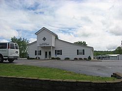
Glencoe Church of Christ
|
|

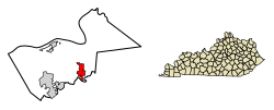
Location of Glencoe in Gallatin County, Kentucky.
|
|
| Country | United States |
| State | Kentucky |
| County | Gallatin |
| Named for | Glen Coe valley in Scotland |
| Area | |
| • Total | 1.78 sq mi (4.60 km2) |
| • Land | 1.76 sq mi (4.57 km2) |
| • Water | 0.01 sq mi (0.03 km2) |
| Elevation | 764 ft (233 m) |
| Population
(2020)
|
|
| • Total | 350 |
| • Density | 198.41/sq mi (76.62/km2) |
| Time zone | UTC-5 (Eastern (EST)) |
| • Summer (DST) | UTC-4 (EDT) |
| ZIP code |
41046
|
| Area code(s) | 859 |
| FIPS code | 21-31204 |
| GNIS feature ID | 2403702 |
Glencoe is a small city in Gallatin County, Kentucky, in the United States. It is known as a "home rule-class city," which means it has its own local government. In 2020, about 350 people lived there.
Contents
History of Glencoe
Glencoe got its name from a valley in Scotland called Glen Coe. A post office opened in the community in 1848. The area officially became a city in 1960.
Geography and Location
Glencoe is located in the southeastern part of Gallatin County. It sits in the valley of Eagle Creek. This creek forms part of the city's southern border. It also marks the line between Glencoe and Owen County.
Major Roads and Travel
U.S. Route 127 goes right through Glencoe. This road leads south about 43 miles (69 km) to Frankfort, which is Kentucky's capital city.
Kentucky Route 467 crosses US 127 in the center of Glencoe. This route goes east about 15 miles (24 km) to Dry Ridge. It also goes west about 5 miles (8 km) to Sparta.
The city limits of Glencoe stretch north from the town center for about 2 miles (3 km) along US 127. This leads to Exit 62 on Interstate 71. From this point, I-71 heads northeast about 33 miles (53 km) to Covington. It also goes southwest about 64 miles (103 km) to Louisville.
Area and Waterways
The city of Glencoe covers a total area of about 1.78 square miles (4.6 square kilometers). Only a very small part of this, about 0.01 square miles (0.03 square kilometers), is water.
Eagle Creek, which forms the southern edge of the city, flows west. It is a tributary of the Kentucky River. This means its water eventually flows into the Kentucky River, and then into the Ohio River.
Population and People
| Historical population | |||
|---|---|---|---|
| Census | Pop. | %± | |
| 1880 | 181 | — | |
| 1900 | 226 | — | |
| 1910 | 237 | 4.9% | |
| 1970 | 250 | — | |
| 1980 | 354 | 41.6% | |
| 1990 | 257 | −27.4% | |
| 2000 | 251 | −2.3% | |
| 2010 | 360 | 43.4% | |
| 2020 | 350 | −2.8% | |
| U.S. Decennial Census | |||
In 2000, there were 251 people living in Glencoe. The population density was about 910 people per square mile (351 people per square kilometer). Most residents were White.
There were 99 households in the city. About 36% of these households had children under 18 living with them. The average household had about 2.5 people.
The population was spread out by age. About 26% were under 18 years old. About 17% were 65 years or older. The average age in the city was 36 years.
Income Information
In 2000, the average income for a household in Glencoe was $38,750. For families, the average income was $49,375. The average income per person in the city was $16,053.
About 7.5% of the people in Glencoe lived below the poverty line. This included about 6.3% of those under 18 and 6.9% of those 65 or older.
See also
 In Spanish: Glencoe (Kentucky) para niños
 | Lonnie Johnson |
 | Granville Woods |
 | Lewis Howard Latimer |
 | James West |

