
Frankfort, Kentucky facts for kids
Quick facts for kids
Frankfort
|
|||||
|---|---|---|---|---|---|
|
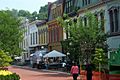
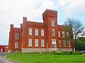
Historic District, downtown
Church of the Good Shepherd
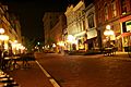
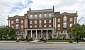
Downtown at night
Frankfort in 2009
|
|||||
|
|||||

Location of Frankfort in Franklin County, Kentucky
|
|||||

Frankfort
Location in Kentucky

Frankfort
Location in the United States
|
|||||
| Country | United States | ||||
| State | Kentucky | ||||
| County | Franklin | ||||
| Established | 1786 | ||||
| Incorporated | February 28, 1835 | ||||
| Government | |||||
| • Type | Commission/Manager | ||||
| Area | |||||
| • Total | 15.07 sq mi (39.03 km2) | ||||
| • Land | 14.77 sq mi (38.25 km2) | ||||
| • Water | 0.30 sq mi (0.78 km2) | ||||
| Elevation | 505 ft (154 m) | ||||
| Population
(2020)
|
|||||
| • Total | 28,602 | ||||
| • Estimate
(2022)
|
28,391 | ||||
| • Density | 1,897.9/sq mi (732.82/km2) | ||||
| Time zone | UTC−05:00 (EST) | ||||
| • Summer (DST) | UTC−04:00 (EDT) | ||||
| ZIP Code |
40601-40604, 40618-40622
|
||||
| Area code(s) | 502 | ||||
| FIPS code | 21-28900 | ||||
| GNIS feature ID | 517517 | ||||
| Website | City website | ||||
_(cropped).jpg)


.jpg)
.svg)


Frankfort is the capital city of Kentucky, a state in the United States. It is also the main city of Franklin County. In 2020, about 28,602 people lived there, making it the 13th largest city in Kentucky. Frankfort is located along the Kentucky River.
Before Frankfort was a city, it was a place where people could cross the Kentucky River easily. This crossing was part of old trails used by buffalo and early American settlers. English explorers first visited the area in the 1750s. The city got its name in 1780 after a pioneer named Stephen Frank was killed in a fight with Native Americans. The crossing was then called "Frank's Ford" in his memory.
In 1786, the Virginia government officially made Frankfort a town. When Kentucky became a state in 1792, Frankfort was chosen as its capital.
The city is in the inner Bluegrass region of Kentucky. The Kentucky River flows through the middle of the city. Downtown and South Frankfort are on opposite sides of the river. The areas outside the river valley are known as East and West Frankfort. Frankfort has four different seasons. Winters are cool with some snow, and summers are hot and humid.
Because it's on the Kentucky River, Frankfort has experienced many floods. The biggest floods happened in 1937 and 1978. To protect the city, levees and floodwalls were built. Five bridges cross the river in downtown Frankfort, including the St. Clair Street bridge. Important places to see include the Kentucky State Capitol building, the Capital City Museum, and Fort Hill, which offers great views of downtown.
As of 2016, the biggest job sector in Frankfort was public administration, with 28% of people working for the government. Manufacturing made up over 12% of jobs. Frankfort is close to Interstate 64, and Interstate 75 is also nearby. You can fly into Capital City Airport for smaller planes, or Blue Grass Airport in Lexington for bigger commercial flights.
Contents
History of Frankfort
Early Beginnings (Pre-1900)
The name Frankfort likely came from an event in the 1780s. Early European settlers were attacked by Native Americans near the Kentucky River. A pioneer named Stephen Frank was killed there. So, the settlers started calling the crossing "Frank's Ford," which later became Frankfort.
In 1786, a man named James Wilkinson bought land on the north side of the Kentucky River. This land became downtown Frankfort. He thought Frankfort would be a great place for trade because the Kentucky River could be used to ship goods.
When Kentucky became the 15th state in 1792, a group of five people chose Frankfort as the state capital. Frankfort won because it offered a log house for the capitol building, some town lots, and money for building supplies.

Frankfort had a United States post office by 1794. Daniel Weisiger was the first postmaster.
John Brown, a lawyer and statesman, built a home called Liberty Hall in Frankfort in 1796. He helped Kentucky become a state. Later, he became one of Kentucky's first U.S. Senators.
In 1796, money was set aside to build a house for the governor. It was finished two years later. The Old Governor's Mansion is believed to be the oldest official governor's home still used in the U.S. In 1829, Gideon Shryock designed the Old Capitol. This building served as Kentucky's capitol from 1830 to 1910. The area known as South Frankfort became part of the city in 1850.
During the American Civil War, the Union Army built forts on Fort Hill to protect Frankfort. The Confederate Army also took control of Frankfort for a short time in 1862. This was the only time Confederate forces captured a Union state capital.
From the 1880s until 1928, there was a public school for African American students called the Clinton Street High School.
20th and 21st Centuries
.jpg)
On February 3, 1900, William Goebel was shot in Frankfort while walking to the capitol. He was the 34th Governor of Kentucky.
The Mayo–Underwood School was another public school for African American students in Frankfort. It operated from 1929 until 1964. This school was later taken down to build the Capital Plaza.
The Capital Plaza included the Capital Plaza Office Tower, which was the tallest building in the city. It also had a hotel and shops. The office tower opened in 1972. By the early 2000s, the plaza needed repairs.
Frankfort grew a lot in the 1960s as the state government expanded. A new part of the State Office Building was finished in 1967. This building was built where the old Kentucky State Penitentiary used to be. Some of the stone from the old prison was used for the walls around the office building.
While Frankfort saw fast growth in the 1960s, it slowed down in the 1980s and has been pretty steady since then.
In 2008, state officials decided to tear down the Capital Plaza Office Tower. The demolition was completed on March 11, 2018, and was shown live on TV and online. The nearby convention center was also taken down. State officials replaced the old office tower with a smaller building called the Mayo–Underwood Building in 2019. This was done to make the area more friendly for people walking around.
Frankfort is home to three distilleries: the Buffalo Trace Distillery (known for Kentucky Bourbon), Castle & Key Distillery, and Three Boys Farm Distillery.
In 2018, many teachers protested in the city. They were upset about a new law called Senate Bill 151. The Kentucky Supreme Court later said the bill was against the state's rules, so it did not become law.
Frankfort's Geography

Frankfort is located in the inner Bluegrass region of Central Kentucky. The city is divided by the Kentucky River. The river makes an S-shape as it flows through the center of town. This creates four different parts of the city. Downtown and South Frankfort are on opposite sides of the river. A small area called Bellepoint is on the west side of the river, north of Benson Creek. The areas outside the river valley are called the "West Side" and "East Side."
The city covers about 14.6 square miles (37.8 square kilometers). About 14.3 square miles (37.0 square kilometers) is land, and 0.3 square miles (0.8 square kilometers) is water.
Frankfort does not have a large commercial airport. Travelers usually fly into Blue Grass Airport in Lexington, which is the closest. Other options are Cincinnati/Northern Kentucky International Airport or Louisville Muhammad Ali International Airport. The Capital City Airport is used for smaller planes and military flights.
Frankfort's Climate
Frankfort has a humid subtropical climate with four clear seasons. Winter is usually cool with some snow. Spring and fall are mild and warm, with plenty of rain and thunderstorms. Summers are hot and humid.
| Climate data for Frankfort Capital City Airport, Kentucky (1991–2020 normals, extremes 1996–present) | |||||||||||||
|---|---|---|---|---|---|---|---|---|---|---|---|---|---|
| Month | Jan | Feb | Mar | Apr | May | Jun | Jul | Aug | Sep | Oct | Nov | Dec | Year |
| Record high °F (°C) | 73 (23) |
80 (27) |
84 (29) |
87 (31) |
91 (33) |
100 (38) |
103 (39) |
103 (39) |
99 (37) |
97 (36) |
84 (29) |
73 (23) |
103 (39) |
| Mean maximum °F (°C) | 65.0 (18.3) |
68.8 (20.4) |
76.0 (24.4) |
82.7 (28.2) |
87.5 (30.8) |
92.1 (33.4) |
94.0 (34.4) |
93.7 (34.3) |
91.8 (33.2) |
84.0 (28.9) |
73.8 (23.2) |
66.5 (19.2) |
96.0 (35.6) |
| Mean daily maximum °F (°C) | 43.1 (6.2) |
47.6 (8.7) |
57.2 (14.0) |
68.5 (20.3) |
76.7 (24.8) |
84.7 (29.3) |
87.6 (30.9) |
87.1 (30.6) |
81.1 (27.3) |
69.5 (20.8) |
56.7 (13.7) |
46.8 (8.2) |
67.2 (19.6) |
| Daily mean °F (°C) | 34.1 (1.2) |
37.8 (3.2) |
46.2 (7.9) |
56.7 (13.7) |
65.5 (18.6) |
73.7 (23.2) |
77.2 (25.1) |
76.1 (24.5) |
69.2 (20.7) |
57.6 (14.2) |
46.1 (7.8) |
38.1 (3.4) |
56.5 (13.6) |
| Mean daily minimum °F (°C) | 25.1 (−3.8) |
28.0 (−2.2) |
35.3 (1.8) |
44.8 (7.1) |
54.4 (12.4) |
62.8 (17.1) |
66.8 (19.3) |
65.1 (18.4) |
57.3 (14.1) |
45.7 (7.6) |
35.6 (2.0) |
29.3 (−1.5) |
45.8 (7.7) |
| Mean minimum °F (°C) | 2.0 (−16.7) |
8.2 (−13.2) |
14.9 (−9.5) |
26.7 (−2.9) |
37.0 (2.8) |
48.7 (9.3) |
55.7 (13.2) |
53.5 (11.9) |
43.1 (6.2) |
28.8 (−1.8) |
18.9 (−7.3) |
10.2 (−12.1) |
0.0 (−17.8) |
| Record low °F (°C) | −8 (−22) |
−21 (−29) |
−10 (−23) |
21 (−6) |
28 (−2) |
42 (6) |
50 (10) |
48 (9) |
35 (2) |
22 (−6) |
9 (−13) |
−3 (−19) |
−21 (−29) |
| Average precipitation inches (mm) | 3.27 (83) |
3.40 (86) |
4.72 (120) |
4.55 (116) |
5.10 (130) |
4.34 (110) |
4.69 (119) |
3.15 (80) |
3.35 (85) |
3.64 (92) |
3.36 (85) |
3.77 (96) |
47.34 (1,202) |
| Average precipitation days (≥ 0.01 in) | 11.2 | 11.4 | 12.3 | 12.9 | 13.6 | 12.6 | 11.9 | 10.9 | 9.4 | 10.1 | 10.1 | 12.0 | 138.4 |
| Source: NOAA | |||||||||||||
| Climate data for Downtown Frankfort, Kentucky (1981–2010 normals, extremes 1895–present) | |||||||||||||
|---|---|---|---|---|---|---|---|---|---|---|---|---|---|
| Month | Jan | Feb | Mar | Apr | May | Jun | Jul | Aug | Sep | Oct | Nov | Dec | Year |
| Record high °F (°C) | 80 (27) |
80 (27) |
87 (31) |
95 (35) |
99 (37) |
106 (41) |
111 (44) |
105 (41) |
106 (41) |
98 (37) |
84 (29) |
78 (26) |
111 (44) |
| Mean daily maximum °F (°C) | 41.5 (5.3) |
46.0 (7.8) |
55.8 (13.2) |
66.5 (19.2) |
75.2 (24.0) |
83.6 (28.7) |
87.3 (30.7) |
86.7 (30.4) |
80.4 (26.9) |
69.5 (20.8) |
57.3 (14.1) |
45.0 (7.2) |
66.2 (19.0) |
| Daily mean °F (°C) | 31.7 (−0.2) |
35.3 (1.8) |
43.5 (6.4) |
53.5 (11.9) |
62.7 (17.1) |
71.5 (21.9) |
75.5 (24.2) |
74.6 (23.7) |
67.5 (19.7) |
56.2 (13.4) |
45.6 (7.6) |
35.4 (1.9) |
54.4 (12.4) |
| Mean daily minimum °F (°C) | 21.9 (−5.6) |
24.7 (−4.1) |
31.2 (−0.4) |
40.5 (4.7) |
50.1 (10.1) |
59.5 (15.3) |
63.8 (17.7) |
62.5 (16.9) |
54.6 (12.6) |
43.0 (6.1) |
34.0 (1.1) |
25.9 (−3.4) |
42.6 (5.9) |
| Record low °F (°C) | −27 (−33) |
−16 (−27) |
−3 (−19) |
16 (−9) |
27 (−3) |
36 (2) |
48 (9) |
41 (5) |
30 (−1) |
20 (−7) |
−1 (−18) |
−17 (−27) |
−27 (−33) |
| Average precipitation inches (mm) | 3.70 (94) |
3.07 (78) |
4.39 (112) |
3.74 (95) |
4.01 (102) |
4.06 (103) |
4.14 (105) |
3.45 (88) |
2.90 (74) |
2.53 (64) |
3.29 (84) |
3.49 (89) |
42.77 (1,086) |
| Average snowfall inches (cm) | 3.4 (8.6) |
2.8 (7.1) |
1.2 (3.0) |
0.0 (0.0) |
0.0 (0.0) |
0.0 (0.0) |
0.0 (0.0) |
0.0 (0.0) |
0.0 (0.0) |
0.0 (0.0) |
0.4 (1.0) |
1.6 (4.1) |
9.4 (24) |
| Average precipitation days (≥ 0.01 in) | 11 | 10 | 11 | 11 | 11 | 10 | 9 | 8 | 7 | 7 | 9 | 10 | 114 |
| Source 1: NOAA | |||||||||||||
| Source 2: Southeast Regional Climate Center (precipitation, snow 1895–2002) | |||||||||||||
People of Frankfort
| Historical population | |||
|---|---|---|---|
| Census | Pop. | %± | |
| 1800 | 628 | — | |
| 1810 | 1,099 | 75.0% | |
| 1820 | 1,679 | 52.8% | |
| 1830 | 1,682 | 0.2% | |
| 1840 | 1,917 | 14.0% | |
| 1850 | 3,308 | 72.6% | |
| 1860 | 3,702 | 11.9% | |
| 1870 | 5,396 | 45.8% | |
| 1880 | 6,958 | 28.9% | |
| 1890 | 7,892 | 13.4% | |
| 1900 | 9,487 | 20.2% | |
| 1910 | 10,465 | 10.3% | |
| 1920 | 9,805 | −6.3% | |
| 1930 | 11,626 | 18.6% | |
| 1940 | 11,492 | −1.2% | |
| 1950 | 11,916 | 3.7% | |
| 1960 | 18,365 | 54.1% | |
| 1970 | 21,902 | 19.3% | |
| 1980 | 25,973 | 18.6% | |
| 1990 | 25,968 | 0.0% | |
| 2000 | 27,741 | 6.8% | |
| 2010 | 25,527 | −8.0% | |
| 2020 | 28,602 | 12.0% | |
| 2022 (est.) | 28,391 | 11.2% | |
| U.S. Decennial Census 2020 | |||
In 2020, Frankfort had 28,602 people living in 12,434 households. About 27.9% of these households had children under 18. The average household had 2.12 people.
The people in Frankfort were:
- 75.1% White or European American
- 13.3% Black or African American
- 2.6% Asian
- 1.8% from other races
- 4.8% from two or more races
- 5.2% were Hispanic or Latino (of any race)
The median age in Frankfort was 36.7 years old. About 19.8% of the population was under 18.
Frankfort is the main city of a "micropolitan statistical area." This area includes Frankfort, Franklin County, and nearby Anderson County. Frankfort is the fourth least populated capital city in the United States.
Parks and Fun Activities
Frankfort has nine city parks for everyone to enjoy:
- Capitol View Park: Has playing fields, nature trails, and picnic areas.
- Cove Spring Park: A large park with 240 acres (97 hectares) of nature trails, picnic areas, and an archery range.
- Dolly Graham Park: Features basketball courts, picnic spots, a community garden, and a playground.
- East Frankfort Park: Offers nature trails, a dog park, picnic areas, playgrounds, a volleyball court, and an 18-hole disc golf course.
- Juniper Hill Park: Covers 124 acres (50 hectares) and has a pool, a golf course, play areas, picnic areas, and war memorials.
- Lakeview Park: Run with Franklin County, it has ball fields, a golf course, a horse show arena, and a skatepark.
- Leslie Morris Park on Fort Hill: This park is an American Civil War battlefield with wilderness forests, old forts, and trails.
- River View Park: A picnic area along the Kentucky River with a walking trail that shows historic sites. It also has an amphitheatre, a boat ramp, and a farmers market.
- Todd Park: Includes a trail, picnic areas, and a community garden.
Other fun things to do in the area:
- Walk/Bike Frankfort: A group that helps make the city better for walking and biking.
- Josephine Sculpture Park: Offers art education and creative experiences for the community.
- The Folkbike Re-Cyclery: A group that fixes old bicycles and gives them to people who cannot afford to buy one.
Education in Frankfort
Kentucky State University (KSU) is located in Frankfort. KSU is a public university that was started to serve African American students. It is also an 1890 land-grant institution.
Two public school districts serve the city:
- Frankfort Independent School District serves the downtown areas. It includes The Early Learning Academy (a preschool), Second Street School (for primary and middle grades), Frankfort High School, and Panther Transition Academy (a special high school program).
- Franklin County Public Schools serves the rest of the city and county. It has seven elementary schools, two middle schools, and two high schools (Franklin County High School and Western Hills High School).
There are also several private schools in the area, such as Capital Day School, Frankfort Christian Academy, and Good Shepherd Catholic School.
Frankfort has a lending library called the Paul Sawyier Public Library. It was named in 1965 after the artist Paul Sawyier, who painted many scenes of the area's history.
Places to Visit

- Kentucky State Capitol building: Built in 1909, this is where Kentucky's government works.
- Kentucky Governor's Mansion: The home of the Governor of Kentucky, built in 1914.
- Old State Capitol building: Built in 1837, it's now a museum.
- Courthouse: Built in 1887.
- Singing Bridge: A 125-year-old bridge that crosses the Kentucky River, built in 1893.
- Liberty Hall: A historic house museum built in 1796.
- Fort Hill: A hill overlooking downtown, important during the American Civil War, now a park.
- Frankfort Cemetery: A historic cemetery with military monuments and graves of famous people, started in 1844.
- Buffalo Trace Distillery: A famous distillery built in 1792.
- Capital City Museum: A museum that tells the history of Frankfort and Franklin County.
- Leestown, Kentucky: A historical site from 1775, now part of Frankfort.
Getting Around Frankfort
Frankfort Transit offers bus services around the city.
Major roads like U.S. Route 60 and U.S. Route 460 go through Frankfort from east to west. U.S. Route 127 and U.S. Route 421 go north to south. Interstate 64 passes south of the city.
The Capital City Airport is about 1 mile (1.6 km) southwest of downtown Frankfort. For commercial flights, the closest airport is Blue Grass Airport, about 22 miles (35 km) southeast of Frankfort.
Frankfort Union Station used to be a busy passenger train station for trains going through central Kentucky.
Famous People from Frankfort

- William Wirt Adams (1819−88): A general in the Confederate Army.
- Will Chase: An actor and singer known for Broadway shows and the TV series Nashville.
- Elijah Craig: An early bourbon distiller who moved to Frankfort in the 1780s.
- Tim Farmer: An outdoorsman and TV host of Kentucky Afield.
- William Goebel: The 34th Governor of Kentucky.
- John Marshall Harlan: A U.S. Supreme Court justice.
- Elizabeth Ann Hulette: A professional wrestling manager.
- Paul Sawyier (1865−1917): A Kentucky Impressionist artist.
- George Graham Vest (1830−1904): A U.S. Senator known for saying a dog is a man's best friend.
- George C. Wolfe (1954−): A Broadway producer, playwright, and film director.
- Wan'Dale Robinson: A professional football player for the New York Giants.
Sister City
 Shimamoto, Osaka Prefecture, Japan
Images for kids
-

The floral clock near the Capitol building
-
Downtown Frankfort
-
Downtown Frankfort at night
-
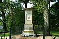
Grave site of pioneer Daniel Boone and his wife at Frankfort Cemetery
-
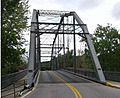
Singing Bridge
-
Jackson Hall of Kentucky State University
-
Whitaker Bank building
-
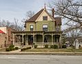
Gooch House


See also
 In Spanish: Frankfort (Kentucky) para niños
