Glencoe, Queensland facts for kids
Quick facts for kids GlencoeQueensland |
|||||||||||||||
|---|---|---|---|---|---|---|---|---|---|---|---|---|---|---|---|

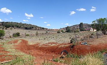
Rural home and fields, 2014
|
|||||||||||||||
| Population | 304 (2021 census) | ||||||||||||||
| • Density | 16.00/km2 (41.4/sq mi) | ||||||||||||||
| Postcode(s) | 4352 | ||||||||||||||
| Area | 19.0 km2 (7.3 sq mi) | ||||||||||||||
| Time zone | AEST (UTC+10:00) | ||||||||||||||
| Location |
|
||||||||||||||
| LGA(s) | Toowoomba Region | ||||||||||||||
| State electorate(s) | Condamine | ||||||||||||||
| Federal Division(s) | Groom | ||||||||||||||
|
|||||||||||||||
Glencoe is a small rural area, also called a locality, in the Toowoomba Region of Queensland, Australia. It's a quiet place where people live in the countryside. In 2021, about 304 people called Glencoe home. This area used to be known as Gowrie Scrub.
Contents
Glencoe's Geography
Glencoe has a mountain called Storey. It's in the western part of the area. Storey mountain rises to about 687 meters (2,254 feet) high.
A Look at Glencoe's History
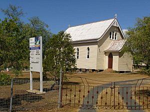
The Bethlehem Lutheran Church first opened its doors in 1880. This church celebrated its 125th birthday in 2005.
Glencoe also had a school called Glencoe State School. It opened around 1882 but closed its doors around 1941. The old school was located at 62 Glencoe Yalangur Road.
On July 29, 1900, a church called St Jude's Church of England was officially opened. It was opened by Bishop William Webber. This church was built on a one-acre site on the side of Glencoe Mountain, which is now called Storey. Its location was 341 Glencoe Yalangur Road.
The first burial in the Glencoe general cemetery happened on October 25, 2004.
Who Lives in Glencoe?
This section tells us about the people living in Glencoe. In 2016, Glencoe had a population of 322 people. By 2021, the population was 304 people.
Schools Near Glencoe
There are no schools located directly in Glencoe. However, students can attend schools in nearby areas.
- Primary Schools: The closest government primary schools are Kingsthorpe State School, Meringandan State School, and Gowrie State School.
- Secondary Schools: For high school, students can go to Highfields State High School, Oakey State High School, or Wilsonton State High School.
Places to Visit in Glencoe
The Glencoe Lutheran Church, which used to be called Bethlehem Lutheran Church, is located at 317 Gowrie Glencoe Road.
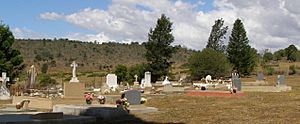
There are also two cemeteries next to each other on Glencoe Road. One cemetery is connected to the Lutheran Church. The other is a general cemetery, meaning it's open to everyone, and it's managed by the Toowoomba Regional Council.
 | Misty Copeland |
 | Raven Wilkinson |
 | Debra Austin |
 | Aesha Ash |


