Glendive, Montana facts for kids
Quick facts for kids
Glendive, Montana
|
|
|---|---|
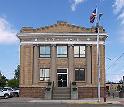
Glendive City Hall
|
|
| Nickname(s):
Gate City
|
|
| Motto(s):
Good People Surrounded by Badlands
|
|
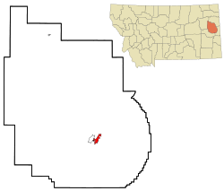
Location of Glendive, Montana
|
|
| Country | United States |
| State | Montana |
| County | Dawson |
| Area | |
| • Total | 3.50 sq mi (9.06 km2) |
| • Land | 3.47 sq mi (9.00 km2) |
| • Water | 0.02 sq mi (0.06 km2) |
| Elevation | 2,064 ft (629 m) |
| Population
(2020)
|
|
| • Total | 4,873 |
| • Density | 1,402.71/sq mi (541.60/km2) |
| Time zone | UTC−7 (Mountain (MST)) |
| • Summer (DST) | UTC−6 (MDT) |
| ZIP code |
59330
|
| Area code(s) | 406 |
| FIPS code | 30-31450 |
| GNIS feature ID | 0771800 |
Glendive is a city in Montana, United States. It is the main city and county seat of Dawson County. Glendive is also home to Dawson Community College.
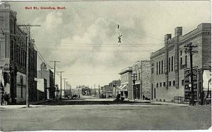
This city started thanks to the Northern Pacific Railway. They built a huge railroad across the western United States. Glendive became an important center for the railroad, managing hundreds of miles of tracks.
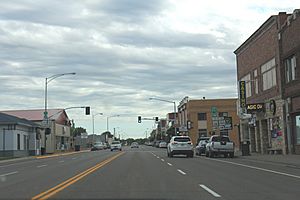
Today, Glendive is a hub for farming and ranching in eastern Montana. It is located between the Yellowstone River and an area called the Badlands. Makoshika State Park is just east of Glendive. In 2020, about 4,873 people lived in Glendive.
Contents
History of Glendive
The name "Glendive" comes from a local stream. In 1855, a rich Irish sportsman named Sir George Gore named this stream. It was in his favorite hunting spot. The town later took its name from this stream.
The Northern Pacific Railway officially established Glendive. At first, the settlement had mostly tents and log cabins. But in 1881, the first load of lumber arrived. This started a building boom, and the town grew quickly.
In 1869, Montana created Dawson County. However, it did not name a county seat right away. Instead, it was managed by Meagher County. In 1881, the people of Glendive asked for their town to be the county seat.
In January 2015, there was an oil spill from a pipeline near Glendive. This spill affected the Yellowstone River and the city's drinking water. On October 24, 2023, a fire destroyed two historic buildings. These were the Jordan Inn and the Rose Theater. They were in the Merrill Avenue Historic District. The Inn was completely lost.
Geography and Location
Glendive is located at an elevation of about 2,064 feet (629 meters). Interstate 94 goes through the city. You can get to town from exits 215, 224, and 231. Montana Highway 16 starts in West Glendive. The Yellowstone River flows right through the city.
The city covers about 3.35 square miles (9.06 square kilometers). Most of this area is land, with a small part being water.
Glendive's Climate
Glendive has a semi-arid climate. This means it has long, cold, and dry winters. Summers are hot and wetter. Glendive holds the state record for the highest temperature ever recorded. On July 20, 1893, it reached 117°F (47°C).
On June 29, 1961, a very strong tornado hit Glendive. It caused a lot of damage to the city.
| Climate data for Glendive, Montana, 1991–2020 normals, extremes 1893–present | |||||||||||||
|---|---|---|---|---|---|---|---|---|---|---|---|---|---|
| Month | Jan | Feb | Mar | Apr | May | Jun | Jul | Aug | Sep | Oct | Nov | Dec | Year |
| Record high °F (°C) | 64 (18) |
73 (23) |
85 (29) |
94 (34) |
104 (40) |
110 (43) |
117 (47) |
113 (45) |
106 (41) |
95 (35) |
80 (27) |
72 (22) |
117 (47) |
| Mean maximum °F (°C) | 50.3 (10.2) |
54.4 (12.4) |
69.8 (21.0) |
80.6 (27.0) |
87.6 (30.9) |
96.0 (35.6) |
101.0 (38.3) |
100.6 (38.1) |
95.7 (35.4) |
82.8 (28.2) |
65.0 (18.3) |
51.6 (10.9) |
103.0 (39.4) |
| Mean daily maximum °F (°C) | 29.0 (−1.7) |
33.8 (1.0) |
46.2 (7.9) |
58.9 (14.9) |
69.1 (20.6) |
78.5 (25.8) |
87.7 (30.9) |
87.2 (30.7) |
76.3 (24.6) |
59.5 (15.3) |
43.5 (6.4) |
32.0 (0.0) |
58.5 (14.7) |
| Daily mean °F (°C) | 19.1 (−7.2) |
23.1 (−4.9) |
34.6 (1.4) |
46.5 (8.1) |
56.9 (13.8) |
66.4 (19.1) |
74.0 (23.3) |
72.5 (22.5) |
62.1 (16.7) |
47.7 (8.7) |
33.6 (0.9) |
22.7 (−5.2) |
46.6 (8.1) |
| Mean daily minimum °F (°C) | 9.2 (−12.7) |
12.5 (−10.8) |
23.0 (−5.0) |
34.2 (1.2) |
44.7 (7.1) |
54.3 (12.4) |
60.3 (15.7) |
57.8 (14.3) |
47.9 (8.8) |
35.9 (2.2) |
23.7 (−4.6) |
13.3 (−10.4) |
34.7 (1.5) |
| Mean minimum °F (°C) | −20.2 (−29.0) |
−12.5 (−24.7) |
−2.1 (−18.9) |
18.2 (−7.7) |
30.1 (−1.1) |
43.1 (6.2) |
50.1 (10.1) |
44.9 (7.2) |
33.3 (0.7) |
18.8 (−7.3) |
1.7 (−16.8) |
−14.1 (−25.6) |
−26.4 (−32.4) |
| Record low °F (°C) | −48 (−44) |
−50 (−46) |
−30 (−34) |
−6 (−21) |
16 (−9) |
29 (−2) |
37 (3) |
32 (0) |
14 (−10) |
−13 (−25) |
−27 (−33) |
−42 (−41) |
−50 (−46) |
| Average precipitation inches (mm) | 0.42 (11) |
0.36 (9.1) |
0.52 (13) |
1.50 (38) |
2.57 (65) |
2.40 (61) |
2.20 (56) |
1.53 (39) |
1.43 (36) |
1.09 (28) |
0.46 (12) |
0.41 (10) |
14.89 (378.1) |
| Average snowfall inches (cm) | 4.0 (10) |
5.3 (13) |
3.1 (7.9) |
2.0 (5.1) |
0.5 (1.3) |
0.0 (0.0) |
0.0 (0.0) |
0.0 (0.0) |
0.0 (0.0) |
1.4 (3.6) |
2.0 (5.1) |
4.3 (11) |
22.6 (57) |
| Average precipitation days (≥ 0.01 in) | 6.1 | 5.9 | 6.0 | 7.9 | 11.4 | 11.7 | 9.2 | 7.0 | 6.7 | 7.5 | 5.1 | 6.0 | 90.5 |
| Average snowy days (≥ 0.1 in) | 4.5 | 4.0 | 2.9 | 0.9 | 0.2 | 0.0 | 0.0 | 0.0 | 0.0 | 0.6 | 2.2 | 3.5 | 18.8 |
| Source 1: NOAA | |||||||||||||
| Source 2: National Weather Service | |||||||||||||
People of Glendive
In the early 1950s, Glendive had a brief oil boom. This happened after oil was found in the Williston Basin. But it was hard and costly to move the oil out. So, the boom ended by 1954. In the 2000s, the North Dakota oil boom caused a small increase in Glendive's population.
| Historical population | |||
|---|---|---|---|
| Census | Pop. | %± | |
| 1880 | 500 | — | |
| 1890 | 720 | 44.0% | |
| 1900 | 1,200 | 66.7% | |
| 1910 | 2,428 | 102.3% | |
| 1920 | 3,816 | 57.2% | |
| 1930 | 4,629 | 21.3% | |
| 1940 | 4,524 | −2.3% | |
| 1950 | 5,254 | 16.1% | |
| 1960 | 7,058 | 34.3% | |
| 1970 | 6,305 | −10.7% | |
| 1980 | 5,978 | −5.2% | |
| 1990 | 4,802 | −19.7% | |
| 2000 | 4,729 | −1.5% | |
| 2010 | 4,935 | 4.4% | |
| 2020 | 4,873 | −1.3% | |
| source: U.S. Decennial Census |
|||
Population Details
In 2010, Glendive had 4,935 people living there. There were 2,060 households. Most people were White (94.4%). About 2.4% were Native American.
The average age in Glendive was 41.2 years. About 19.9% of residents were under 18 years old. And 18.8% were 65 years or older.
Education in Glendive
Glendive Public Schools teach students from kindergarten through 12th grade. The sports teams at Dawson County High School are called the Red Devils.
Glendive is also home to Dawson Community College. This college started in 1940. It offers two-year degrees and certificate programs. It helps meet the education needs of eastern Montana.
The Glendive Public Library serves the local area.
Transportation and Services
Dawson Community Airport is located five miles northwest of Glendive. You can also find intercity bus service in the city. This service is provided by Jefferson Lines.
Media and News
Glendive has three local radio stations:
- KGLE AM 590
- KXGN AM 1400
- KDZN FM 96.5
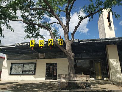
Glendive is the smallest TV market in the United States. It has one TV station, KXGN channel 5. This station shows CBS programs. It also broadcasts local and state news.
The Glendive Ranger-Review is the local newspaper.
Famous People from Glendive
- Herbert Aldinger – An author.
- Tim M. Babcock – He was the 16th Governor of Montana. He grew up in Glendive.
- Kamran Ince – A Turkish-American music composer.
- Clyde Lamb – A cartoonist.
- Alfred E. Perlman – A president of two major railroads.
- Mike Person – An offensive lineman for the San Francisco 49ers.
- Matt Rosendale – A politician who served as Montana State Auditor and U.S. Representative.
- Diana Thomas – A mathematician and nutritionist.
- Joyce Woodhouse – A Democratic member of the Nevada Senate.
- Hank Worden – A cowboy actor.
- Adam Morrison – An NBA Basketball Player.
See also
 In Spanish: Glendive (Montana) para niños
 | Roy Wilkins |
 | John Lewis |
 | Linda Carol Brown |


