Golemani Peak facts for kids
Golemani Peak (which is vrah Golemani in Bulgarian) is a tall mountain peak in Antarctica. It stands about 2,800 meters (or roughly 9,186 feet) high! This peak is part of the Bangey Heights in the central northern area of the Sentinel Range. The Sentinel Range itself is found within the larger Ellsworth Mountains.
Golemani Peak is a really important landmark because it stands high above several large ice rivers, called glaciers. It overlooks the Patleyna Glacier to its southwest, the Marsa Glacier to its north, and the Padala Glacier to its east.
How Did Golemani Peak Get Its Name?
This amazing peak was named after two small towns in Northern Bulgaria. These towns are called Golemani and Golemanite. It's a way to honor places far away in a very distant and icy land!
Where is Golemani Peak Located?
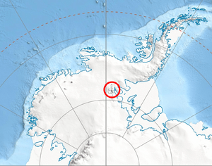
Golemani Peak is located at 78°03′12″S 85°41′44″W. It's quite a distance from other well-known peaks in the area. For example, it is about 3.23 kilometers (2 miles) north of Bezden Peak. It's also about 6.17 kilometers (3.8 miles) northeast of Mount Todd.
Other nearby peaks include Mount Goldthwait, which is about 7.87 kilometers (4.9 miles) to the southeast. Mount Schmid is about 5.06 kilometers (3.1 miles) to the south-southwest. Finally, Zimornitsa Peak is about 12.17 kilometers (7.6 miles) to the west-northwest. Maps of this area were first made by the United States in 1961 and then updated in 1988.
Maps of the Area
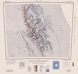
- Vinson Massif. Scale 1:250 000 topographic map. Reston, Virginia: US Geological Survey, 1988.
 | Jewel Prestage |
 | Ella Baker |
 | Fannie Lou Hamer |


