Granville, Indiana facts for kids
Quick facts for kids
Granville, Indiana
|
|
|---|---|

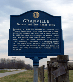
The historical marker near Granville.
|
|

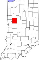
Tippecanoe County's location in Indiana
|
|
| Country | United States |
| State | Indiana |
| County | Tippecanoe |
| Township | Wayne |
| Elevation | 550 ft (170 m) |
| Time zone | UTC-5 (Eastern (EST)) |
| • Summer (DST) | UTC-4 (EDT) |
| ZIP code |
47909
|
| Area code(s) | 765 |
Granville is a ghost town in Indiana, United States. It is located in Wayne Township, which is part of Tippecanoe County. Today, only a few signs of the old town remain.
Contents
History of Granville
Granville was started in 1834 by two men named Thomas W. Treckett and Thomas Concannon. They chose a spot on the south side of the Wabash and Erie Canal, close to the Wabash River. This area was also near an old Native American village called Ouiatenon.
Town Planning and Early Days
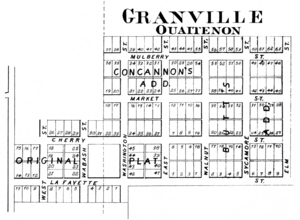
The founders carefully planned the town. They laid out 153 building lots, a public square, and several streets. These streets had names like Lafayette, Cherry, Wabash, and Washington. Even today, if you look at county maps, you can still see where these old lots and streets were planned.
Name Change and Growth
In 1850, the town's name was changed to Weaton. This new name honored the local Wea Indians, who had mostly moved west by then. Some maps even spelled it incorrectly as "Wheaton." Later, the name was changed back to Granville. For a while, Granville was a very busy place. It was an important shipping center because of its location on the canal. Boats would carry goods to and from the town.
Decline of the Town
However, Granville's success did not last. In the mid-1850s, railroads became more popular. Trains could move goods faster and more cheaply than canal boats. This new competition meant less business for the canal. As canal traffic slowed down, Granville's economy also suffered greatly. By 1878, the town had almost completely disappeared. It became what we call a ghost town.
What Remains Today
Even though the town is gone, some places still carry its name. The cemetery to the east of where the town once stood is called Granville Cemetery. There is also a bridge across the Wabash River named Granville Bridge. These areas are now considered part of West Point, Indiana for postal services.
Geography of Granville
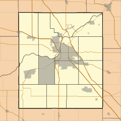
Granville was located at a specific point on the map: 40°24′25″ North latitude and 87°01′53″ West longitude. Its elevation, or height above sea level, was about 550 feet. This location is within Wayne Township. It's not far west of the city of Lafayette and close to a modern-day place called Shadeland.
 | Lonnie Johnson |
 | Granville Woods |
 | Lewis Howard Latimer |
 | James West |


