Ouiatenon facts for kids
Quick facts for kids
Ouiatenon
Waayaahtanonki
|
|
|---|---|
|
Village
|
|
| Country | United States |
| State | Indiana |
| County | Tippecanoe |
| Settled | c. 1680s |
| Destroyed | 1 June 1791 |
| Elevation | 600 ft (200 m) |
| Highest elevation | 600 ft (200 m) |
| Lowest elevation | 500 ft (200 m) |
Ouiatenon (pronounced "wee-ah-teh-non") was an important village for the Wea tribe of Native Americans. Its name, also spelled Ouiatanon or Oujatanon, comes from the Wea language. It means "place of the people of the whirlpool."
Ouiatenon usually refers to a group of villages. These villages were located along the Wabash River in what is now western Tippecanoe County, Indiana.
Contents
The Story of Ouiatenon
How Ouiatenon Began
By the late 1600s, the Miami-speaking tribes, including the Wea, returned to their homeland. This area was the Wabash River Valley. They had been forced out earlier by the Iroquois tribe.
The Wea tribe settled in the middle part of the Wabash Valley. This was between the Eel River to the north and the Vermilion River to the south. Ouiatenon was the largest of the Wea's five main settlements. In 1791, U.S. General James Wilkinson called it "the chief town of the Ouiatenon Nation."
The location of Ouiatenon was excellent for trade and living. It was on a rich, flat area near where large boats could travel on the Wabash River. The area also had plenty of fish near Wea Creek and lots of wild animals.
Ouiatenon included two large villages and two or three smaller ones. They were spread out along the Wabash River for about five miles (8 km). One village, across the river from the main Ouiatenon town, was mainly home to the Kickapoo tribe.
The French Arrive
In 1717, the French built a military post called Fort Ouiatenon. This was on the north bank of the Wabash River, across from the main Ouiatenon village. They did this to stop the British from gaining too much power in the area.
Not many European settlers lived around the fort. This was because the French commanders did not give out land to settlers. However, Fort Ouiatenon became one of the most successful trading posts in the region. In 1760, the French gave control of the area to the British.
The Village is Destroyed
On March 9, 1791, U.S. Secretary of War Henry Knox gave orders from President George Washington. Brigadier General Charles Scott of Kentucky was to lead a military trip against the Wea villages.
On June 1, 1791, Scott and 760 Kentucky volunteers reached the Wea Plains. They saw two villages and sent a small group to destroy them. General Scott and most of his soldiers continued towards the main Ouiatenon village. They could see smoke from cooking fires.
Scott's forces found the Ouiatenon town in the low-lying land near the Wabash River. They attacked, causing great fear among the people. Some tried to escape in canoes to the Kickapoo village across the river. However, they were stopped by soldiers. Forty-one women and children were captured. The rest were either killed, scattered, or managed to escape. Scott then burned the town and hundreds of acres of corn fields.
What Happened After
Even after its destruction, signs of Ouiatenon could be seen for many years. People could easily find old items after the grass was burned in the fall.
In 1834, a small town called Granville (or Weaton) was started near where the westernmost Ouiatenon village used to be. It grew because the Wabash and Erie Canal was built through the area in the 1840s. However, both the canal and the town became less important in the 1850s and were gone by the 1870s.
Today, the towns of Glen Hall and Shadeland are still located near the plain. Tippecanoe Labs, a large chemical company operated by Evonik Industries, is just east of Wea Creek. The site of the main Ouiatenon town is owned by the labs and is part of the Tippecanoe Labs Wildlife Habitat.
Geography of Ouiatenon
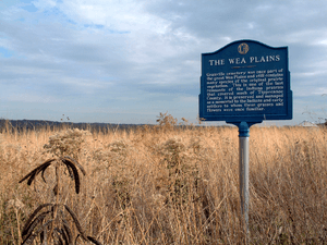
The villages of Ouiatenon were located in a rich area called the Wea Plains. This area is about 25 square miles (65 km2) in what is now northern Wayne and Union townships.
The land was described like this:
- To the north were the Indian Hills, covered with trees and many deep valleys.
- The Wabash River flowed along the southern edge of these hills, winding gracefully. It was bordered by a narrow line of trees.
- To the east was Wea Creek, which curved sharply into the plain before flowing to the river.
- Inside this area of woods and streams were the meadows where the Ouiatenons lived.
Lost Creek, a small stream with no clear end, flows west-northwest through the Wea Plains.
 | Audre Lorde |
 | John Berry Meachum |
 | Ferdinand Lee Barnett |


