Graysville, Tennessee facts for kids
Quick facts for kids
Graysville, Tennessee
|
|
|---|---|
 |
|

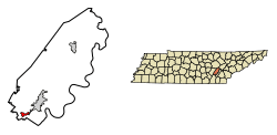
Location of Graysville in Rhea County, Tennessee.
|
|
| Country | United States |
| State | Tennessee |
| County | Rhea |
| Named for | William Gray, early settler |
| Area | |
| • Total | 1.18 sq mi (3.05 km2) |
| • Land | 1.18 sq mi (3.05 km2) |
| • Water | 0.00 sq mi (0.00 km2) |
| Elevation | 748 ft (228 m) |
| Population
(2020)
|
|
| • Total | 1,471 |
| • Density | 1,248.73/sq mi (482.25/km2) |
| Time zone | UTC-5 (Eastern (EST)) |
| • Summer (DST) | UTC-4 (EDT) |
| ZIP code |
37338
|
| Area code(s) | 423 |
| FIPS code | 47-30760 |
| GNIS feature ID | 1286033 |
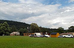
Graysville is a small town located in Rhea County, Tennessee, in the United States. It's a place with a rich history, especially linked to the railroad and coal mining. In 2020, about 1,471 people called Graysville home.
Contents
Exploring Graysville's Past
The town of Graysville is named after William Gray. He was an early settler who became the local postmaster in 1875. The town grew quite a bit in the 1880s. This was when the railroad arrived, bringing with it new industries.
The Rise of Coal Mining
With the railroad came the coal mining business. The Dayton Coal and Iron Company started a big operation in Graysville. Coal dug from nearby mines was turned into a special fuel called coke. This coke was then used in large furnaces, called blast furnaces, to make pig iron. Pig iron is a basic type of iron used to make other metal products. This important industry continued until the 1930s. The Great Depression, a time of economic hardship, caused the industry to collapse.
Graysville's Location and Landscape
Graysville is located at 35°26′52″N 85°4′57″W / 35.44778°N 85.08250°W. It sits between two interesting land features. To the west is Walden Ridge, which is a steep slope of the Cumberland Plateau. To the east is Blackoak Ridge. The town is just north of the border between Rhea and Hamilton counties.
Major Roads in Graysville
Two main roads pass through Graysville. U.S. Route 27 goes through the eastern part of the town. State Route 303 runs right through the downtown area. According to the United States Census Bureau, the town covers an area of about 3.05 square kilometers (1.18 square miles), and all of it is land.
Population Changes Over Time
| Historical population | |||
|---|---|---|---|
| Census | Pop. | %± | |
| 1920 | 786 | — | |
| 1930 | 793 | 0.9% | |
| 1940 | 846 | 6.7% | |
| 1950 | 820 | −3.1% | |
| 1960 | 838 | 2.2% | |
| 1970 | 951 | 13.5% | |
| 1980 | 1,380 | 45.1% | |
| 1990 | 1,301 | −5.7% | |
| 2000 | 1,411 | 8.5% | |
| 2010 | 1,502 | 6.4% | |
| 2020 | 1,471 | −2.1% | |
| Sources: | |||
The number of people living in Graysville has changed over the years. In 2020, the town had 1,471 residents. This was a slight decrease from 2010, when the population was 1,502. The census also showed that there were 669 households and 428 families living in Graysville in 2020.
Learning in Graysville
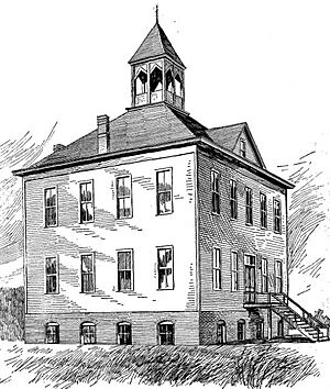
Rhea County Schools is the local school district for Graysville. Children in the community attend Graysville Elementary School. Even though the school is in Graysville, it has a Dayton mailing address. Older students attend Rhea County High School, which is the only high school in the district.
See also
 In Spanish: Graysville (Tennessee) para niños
 | William M. Jackson |
 | Juan E. Gilbert |
 | Neil deGrasse Tyson |


