Walden Ridge facts for kids
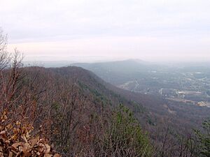
Walden Ridge is a long mountain ridge in Tennessee, United States. It forms the eastern edge of the Cumberland Plateau. This ridge is about 74 miles (119 km) long and runs from north to south. Its highest point is Hinch Mountain, which is 3,048 feet (929 meters) above sea level. You can find Hinch Mountain near Crossville, Tennessee.
Walden Ridge is much higher than the land around it. Its eastern side drops sharply, over 1,000 feet (305 meters), down to the Tennessee Valley. Because of this steep drop, Walden Ridge is sometimes called the "Cumberland Escarpment." To the west of the southern part of the ridge is the Sequatchie Valley, where the Sequatchie River flows. To the east, you'll see the Ridge-and-Valley Appalachians and the Tennessee River. Geologically, Walden Ridge continues south into Georgia and Alabama as Sand Mountain.
The part of Walden Ridge near Chattanooga, Tennessee is often called "Signal Mountain." This name comes from a few things. There are many broadcasting towers on its eastern side. Also, in the past, Native Americans and later Civil War soldiers used this area as a signal point. They would send signals to Lookout Mountain, which is across the Tennessee River. Walden Ridge is part of the larger Appalachian Plateau region. The United States Geological Survey (USGS) also knows this ridge by names like Waldens Ridge and Wallens Ridge.
 | Jewel Prestage |
 | Ella Baker |
 | Fannie Lou Hamer |


