Sequatchie River facts for kids
Quick facts for kids Sequatchie River |
|
|---|---|

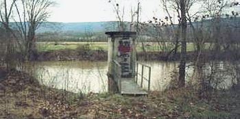
A stream gage along the Sequatchie River near Whitwell, Tennessee
|
|

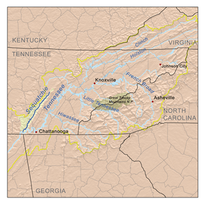
The Sequatchie drainage basin
|
|
| Country | United States |
| State | Tennessee |
| Physical characteristics | |
| Main source | Brady Mountain in Cumberland County, Tennessee 2,460 ft (750 m) 35°49′17″N 84°58′40″W / 35.82139°N 84.97778°W |
| River mouth | Tennessee River near Jasper, Tennessee 597 ft (182 m) 35°01′31″N 85°38′07″W / 35.02528°N 85.63528°W |
| Length | 116 mi (187 km) |
| Basin features | |
| Basin size | 602 sq mi (1,560 km2) |
| Tributaries |
|
The Sequatchie River is a long waterway in Tennessee. It stretches about 116 miles (187 km) and flows through the Sequatchie Valley. This valley is a big part of the Cumberland Plateau. The river eventually joins the Tennessee River near the border of Tennessee and Alabama. It flows past Chattanooga.
Contents
About the Sequatchie River
The Sequatchie River starts from several springs. These springs are found near a place called Devilstep Hollow Cave. One important spring is named Head of the Sequatchie. Scientists have used special dyes to show that the water for these springs comes from Grassy Cove. Grassy Cove is a large, bowl-shaped area to the northeast.
Journey Through the Valley
The Sequatchie River flows southwest, following the shape of the Sequatchie Valley. It travels for about 182 kilometers (113 miles). The river first enters Bledsoe County near where the valley begins. U.S. Route 127 runs alongside much of the river's path.

The first main town the river reaches is Pikeville. This town is the county seat of Bledsoe County. Here, State Route 30 crosses the river. This route comes down from a high area called Walden's Ridge.
Flowing South
As the river continues, it enters Sequatchie County. It then flows into the town of Dunlap. Just north of Dunlap, U.S. Route 127 turns away from the river. It starts to climb up Walden Ridge towards Chattanooga.
For most of its remaining journey, State Route 28 runs next to the Sequatchie River. Another road, State Route 283, also follows the base of Walden's Ridge for some miles.
Reaching the Tennessee River
The river then flows into Marion County. The town of Whitwell is located just a few miles into Marion County. Further downstream, near a small community also called Sequatchie, the river gets more water. This water comes from the Little Sequatchie River, which flows down from the Cumberland Plateau to the west.
Near the town of Jasper, the river flows close to a railroad junction. East of Jasper, U.S. Highway 41 crosses State Route 28 and the river. A short distance south of the Interstate 24 bridge, the Sequatchie River finally empties into Guntersville Lake. This lake is part of the larger Tennessee River.
 | Selma Burke |
 | Pauline Powell Burns |
 | Frederick J. Brown |
 | Robert Blackburn |

