Grassy Cove facts for kids
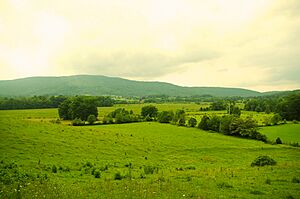
Grassy Cove is a special valley in Cumberland County, Tennessee, United States. It's famous for its unique landforms called karst formations, which are so special they've been named a National Natural Landmark. A small community also calls Grassy Cove home.
Grassy Cove is located on top of the Cumberland Plateau. It's about 5 miles (8 km) east of Crossville and 5 miles (8 km) west of the edge of the plateau, known as Walden Ridge. The mountains around the cove are part of the southern Cumberland Mountains. This valley is connected geologically to the Sequatchie Valley, a large, narrow valley just south of these mountains. Tennessee State Route 68 goes through the northern part of Grassy Cove, which is the main road into the valley.
Contents
Understanding Grassy Cove's Geology
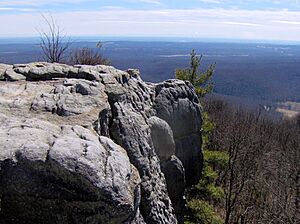
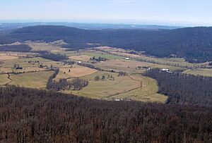
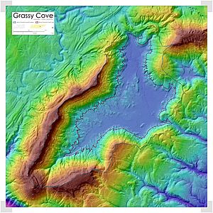
Grassy Cove is surrounded by mountains. To the west is Brady Mountain, about 2,930 feet (893 m) tall. To the east is Bear Den Mountain, also about 2,930 feet (893 m) tall. To the north is Black Mountain, which is about 2,828 feet (862 m) high. Brady and Bear Den mountains meet in a V-shape, closing off the cove to the south. Just beyond where they meet, Hinch Mountain rises to 3,048 feet (929 m). This is the highest point in Cumberland County. The southern slopes of Hinch Mountain drop sharply down to the Sequatchie Valley. Grassy Cove is about 1,500 feet (457 m) above sea level, while the Sequatchie Valley is much lower, around 900 feet (274 m).
Both the Sequatchie Valley and Grassy Cove were once part of a large upward bend in rock layers, called an anticline. This happened about 250 million years ago during the Paleozoic era, when the Earth's crust pushed up the rocks. Over millions of years, rain and water slowly wore away the softer limestone layers that were exposed. This process created many sinkholes. Eventually, these sinkholes joined together to form the long Sequatchie Valley. Grassy Cove is one of these large sinkholes that hasn't yet joined up with the rest of the Sequatchie Valley.
Underground Water and Caves
Grassy Cove's water drains completely underground. The main stream, Grassy Cove Creek, flows north across the valley. Then, it disappears into a cave called Mill Cave on the side of Brady Mountain. Scientists have used dyes to track the water. They found that it flows south through a series of caves. It then comes out at the beginning of the Sequatchie Valley at Devilstep Hollow Cave. Here, it forms the start of the Sequatchie River.
Grassy Cove Saltpeter Cave, located on the eastern side of Brady Mountain, is a very long cave. It's the sixteenth longest cave in Tennessee and one of the 100 longest caves in the United States. Other caves in the area include Windlass Cave, Bristow Cave, Mill Cave, Run to the Mill Cave, and Milksick Cave.
Grassy Cove Sinkhole Facts
Grassy Cove is known as North America's largest sinkhole. Here are some facts about its size:
- Watershed Area: The area that collects water for the cove is about 12.8 sq mi (33.2 km²).
- Sinkhole Area: The main sinkhole itself covers about 5.1 sq mi (13.3 km²).
- Sinkhole Depth: The deepest part of the sinkhole is about 131 ft (40 m) from the highest point within the sinkhole.
- Sinkhole Volume: The total volume of the sinkhole is roughly 37,736,946 cubic meters (1,332,600,000 cu ft).
History of Grassy Cove
Even though no big archaeological digs have happened here, early farmers found old tools and arrowheads when plowing their fields. This suggests that Native Americans lived in Grassy Cove a very long time ago. Also, settlers who arrived in the early 1800s said the valley floor was already cleared and covered only in tall grass. That's how it got its name: Grassy Cove!
Early Settlers and Community Life
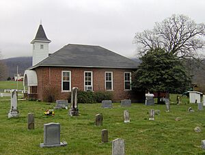
The first European-American settlers came to Grassy Cove in 1801. Most of these families were from Fluvanna County, Virginia. By 1803, they had built a log church and started the Grassy Cove United Methodist Church. This was one of the first churches in the entire Cumberland Plateau area.
Important early settlers included John Ford, who founded the community, and Weatherston Greer, who arrived around 1830. Greer started the first post office in the cove. He also ran a sawmill and a gristmill, which ground grain. He owned a lot of land in the cove until the American Civil War. Today, many descendants of the Kemmer family own much of the land in Grassy Cove.
Grassy Cove During Wartime
During both the War of 1812 and the American Civil War, the caves in Grassy Cove were very important. They were a valuable source of saltpeter. Saltpeter was a key ingredient used to make gunpowder for weapons.
According to old records, William Kelly mined saltpeter in Grassy Cove Saltpeter Cave in 1812. There's also a local legend about a Confederate soldier. The story says that after the Civil War, the body of a Confederate soldier, still in his uniform, was found in a petrified (turned to stone) state in one of the caves. When no one claimed the body, it was buried in the Grassy Cove Methodist Cemetery. However, some residents claimed to see the soldier's ghost in the church. When people started to stop coming to church because of this, the soldier's body was dug up and reburied in a secret location.
The Cumberland Trail Segment
In 1998, the state of Tennessee created the Justin P. Wilson Cumberland Trail State Park. This is a long, narrow park that will eventually include the 300-mile (483 km) Cumberland Trail. The trail is still being built.
The trail now includes a 15-mile (24 km) section called the "Grassy Cove Segment." This part of the trail goes along the tops of Black Mountain and Brady Mountain. This segment will eventually connect the Crab Orchard Segment (which is still being planned) with the Stinging Fork segment (which is partly finished) to the south.
- Larry E. Matthews, Caves of Grassy Cove, National Speleological Society, August 2014. ISBN: 978-1-879961-49-4
 | Lonnie Johnson |
 | Granville Woods |
 | Lewis Howard Latimer |
 | James West |


