Greenleaf Peak facts for kids
Quick facts for kids Greenleaf Peak |
|
|---|---|

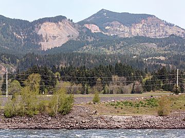
Southeast slope of Greenleaf Peak, Red Bluffs and the Columbia River from Bonneville Dam
|
|
| Highest point | |
| Elevation | 3,424 ft (1,044 m) NAVD 88 |
| Geography | |
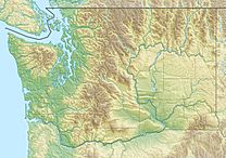
| Location | Skamania County, Washington, U.S. |
| Parent range | Cascade Range |
| Topo map | USGS Bonneville Dam |
Greenleaf Peak is a mountain found in the Cascade Range in the state of Washington, USA. It sits on the north side of the Columbia River, close to Table Mountain. This area is part of the beautiful Columbia River Gorge National Scenic Area, near the Bonneville Dam.
Greenleaf Peak stands tall at about 3,424 feet (1,044 meters) high. An interesting fact is that in September 1825, a botanist named David Douglas climbed to its top. This was the first recorded time someone reached the summit of a mountain in what is now Washington state!
Contents
What Makes Greenleaf Peak Special?
Greenleaf Peak is known for its amazing natural features and history. It's not just a mountain; it's part of a very active landscape shaped by powerful forces of nature.
Red Bluffs: A Dramatic Cliff
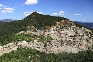
Just south of Greenleaf Peak's summit, there's a huge, steep cliff called Red Bluffs. This cliff connects Greenleaf Peak to Table Mountain. It's like a giant wall of rock! About 1,300 feet (400 meters) of a rock layer called the Eagle Creek formation can be seen here.
How Red Bluffs Were Formed
The Red Bluffs were created when parts of Greenleaf Peak and Table Mountain repeatedly collapsed. Over time, huge landslides have fallen from these mountains. These slides formed a large area of rocky debris known as the Cascade Landslide Complex. This area covers about 12 to 14 square miles (31 to 36 square kilometers).
The most famous and largest of these landslides is called the Bonneville Slide. This massive slide created a natural land bridge, which people later called the Bridge of the Gods. It also formed fast-moving water called the Cascade Rapids in the Columbia River. The land in this landslide area is bumpy and uneven, with rolling hills and sudden slopes. It all gently slopes south towards the Columbia River. Scientists think there might have been a small volcano (a cinder cone) between Greenleaf Peak and Table Mountain that collapsed during the Bonneville Slide.
The Eagle Creek Formation and Landslides
The reason why the area south of Greenleaf Peak and Table Mountain often has landslides is because of the Eagle Creek formation. This rock layer stretches for about 30 miles (48 kilometers) along the Columbia River Gorge. It's made up of old landslides, volcanic mud flows, and ash from volcanoes.
How Water Causes Slides
On top of the Eagle Creek formation, there's a layer of hard rock called basalt. Water can seep through this basalt layer and soak into the softer Eagle Creek formation below. When the Eagle Creek formation gets very wet and is on a slope, it can become slippery. This causes the material to slide away, carrying the basalt layer with it. This is why landslides happen in this area.
Greenleaf Basin: A Hidden Wetland
Between Greenleaf Peak and Table Mountain, above the Red Bluffs, lies a special area called Greenleaf Basin. This basin is about 2,040 feet (620 meters) high and is covered with beautiful forested wetlands. Greenleaf Creek flows through this basin, heading south. It then dramatically plunges over the Red Bluffs cliff as a waterfall!
Recent Landslide Activity
In the winter of 2007-2008, a big landslide happened on the south side of Greenleaf Peak. This was in the Table Mountain Natural Resources Conservation Area, which is protected land. A rocky cliff covered in trees, about 3 to 5 acres (1.2 to 2 hectares) in size, slid down. This slide buried about 30 acres (12 hectares) of forest under rocks and dirt. The landslide was estimated to be about 750 feet (230 meters) wide and half a mile (0.8 kilometers) long.
 | John T. Biggers |
 | Thomas Blackshear |
 | Mark Bradford |
 | Beverly Buchanan |


