Grover Hill, Ohio facts for kids
Quick facts for kids
Grover Hill, Ohio
|
|
|---|---|
|
Village
|
|

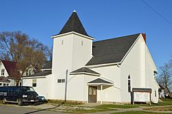
Bible Baptist Church
|
|

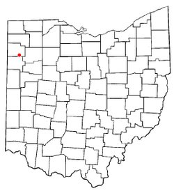
Location of Grover Hill, Ohio
|
|

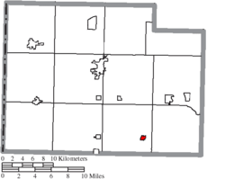
Location of Grover Hill in Paulding County
|
|
| Country | United States |
| State | Ohio |
| County | Paulding |
| Township | Latty |
| Area | |
| • Total | 0.28 sq mi (0.71 km2) |
| • Land | 0.28 sq mi (0.71 km2) |
| • Water | 0.00 sq mi (0.00 km2) |
| Elevation | 728 ft (222 m) |
| Population
(2020)
|
|
| • Total | 382 |
| • Estimate
(2023)
|
380 |
| • Density | 1,384.06/sq mi (534.30/km2) |
| Time zone | UTC-5 (Eastern (EST)) |
| • Summer (DST) | UTC-4 (EDT) |
| ZIP code |
45849
|
| Area code(s) | 419 |
| FIPS code | 39-32620 |
| GNIS feature ID | 2398214 |
Grover Hill is a small village located in Paulding County, Ohio, in the United States. In 2020, the village had a population of 382 people. Grover Hill was named after Grover Cleveland, who was a U.S. President.
Contents
History of Grover Hill
Grover Hill started as a "boomtown." This means it grew very quickly because of the railroad. It became an important stop along the train tracks. A person who lived in Grover Hill for a long time, Laurence R. Hipp, wrote a detailed history about the town and nearby areas.
Geography and Location
Grover Hill is a small place. According to the United States Census Bureau, the village covers an area of about 0.28 square miles (0.71 square kilometers). All of this area is land, with no water.
Population and Demographics
| Historical population | |||
|---|---|---|---|
| Census | Pop. | %± | |
| 1900 | 655 | — | |
| 1910 | 676 | 3.2% | |
| 1920 | 530 | −21.6% | |
| 1930 | 414 | −21.9% | |
| 1940 | 478 | 15.5% | |
| 1950 | 463 | −3.1% | |
| 1960 | 547 | 18.1% | |
| 1970 | 536 | −2.0% | |
| 1980 | 486 | −9.3% | |
| 1990 | 518 | 6.6% | |
| 2000 | 412 | −20.5% | |
| 2010 | 402 | −2.4% | |
| 2020 | 382 | −5.0% | |
| 2023 (est.) | 380 | −5.5% | |
| U.S. Decennial Census | |||
Grover Hill Population in 2010
In 2010, a census counted 402 people living in Grover Hill. These people lived in 159 households, and 110 of these were families.
The village had about 1,435.7 people per square mile. There were 183 housing units, which means places where people could live.
Most of the people in the village (98.5%) were White. A small number (0.2%) were African American. About 1.2% of the population identified as being from two or more races. Around 1.0% of the people were Hispanic or Latino.
Households and Families
Out of the 159 households:
- 34.6% had children under 18 living with them.
- 52.2% were married couples living together.
- 12.6% had a female head of the household with no husband present.
- 4.4% had a male head of the household with no wife present.
- 30.8% were not families (meaning individuals living alone or unrelated people living together).
About 25.8% of all households were made up of people living alone. Of these, 11.3% were individuals aged 65 or older. On average, each household had about 2.53 people, and each family had about 3.03 people.
Age Distribution
The average age of people in the village was 37.1 years old.
- 28.6% of residents were under 18 years old.
- 7.4% were between 18 and 24 years old.
- 22.4% were between 25 and 44 years old.
- 26.6% were between 45 and 64 years old.
- 14.9% were 65 years or older.
The village had slightly more males (51.0%) than females (49.0%).
See also
In Spanish: Grover Hill (Ohio) para niños
 | Shirley Ann Jackson |
 | Garett Morgan |
 | J. Ernest Wilkins Jr. |
 | Elijah McCoy |

