Gurnard Bay facts for kids
Quick facts for kids Gurnard Bay |
|
|---|---|
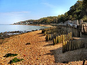
 Gurnard Bay with the village of Gurnard is seen in the distance. |
|
| Civil parish | |
| Ceremonial county | |
| Region | |
| Country | England |
| Sovereign state | United Kingdom |
| EU Parliament | South East England |
| UK Parliament |
|
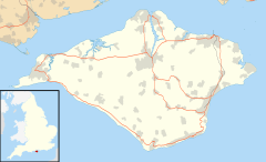
Gurnard Bay is a cool bay on the northwest coast of the Isle of Wight, England. It's part of the western side of the Solent, which is the sea channel between the Isle of Wight and mainland Britain. The bay is named after the nearby village of Gurnard, which is just to its northwest.
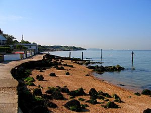
Its shoreline is about 1.25 miles (2 km) long and has a gentle curve. It stretches from Gurnard Head in the west all the way to Egypt Point in the east. You can get an amazing view of the bay and Gurnard village from ferries heading to Cowes or East Cowes from the Solent.
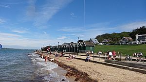
The bay has a beach made of pebbles and small stones, lined with colorful beach huts owned by the local council. Lots of people enjoy watersports here, and the Gurnard Sailing Club is right at the eastern end of the bay. The best way to see and get to the bay is from the green area in Gurnard village.
Exploring Gurnard Bay's Geography
The bottom of the bay is a mix of mud and sand. It's home to Gurnard Ledge, which is a natural reef made of clay and limestone. This reef can be dangerous for boats, so it's marked with a special buoy to warn sailors.
A small stream called Gurnard Luck flows into the bay at its southwestern end. The mouth of this stream acts like a tiny harbor for small fishing boats. Long ago, people believed that escaped prisoners sometimes used Gurnard Luck to find boats and get away to the mainland.
In the past, the land west of Gurnard Marsh reached much further into the sea. It formed a big piece of land sticking out. However, over the last few centuries, the sea has worn away a lot of this land through coastal erosion.
A Look into Gurnard Bay's History
The land that used to be west of Gurnard Marsh was once a main harbor for boats traveling to the mainland. To protect this harbor, a place called Gurnard Fort was built around the year 1600. But by the 1600s, the fort was no longer used. This was because Cowes had quickly grown into the main port for the island.
The remains of Gurnard Fort were found again in 1864. This happened during an excavation of a Roman villa that stood in the same spot. The area where the fort and villa once stood has now been washed away by the sea. It lies some distance out in the bay today.
There's also the wreckage of a German bomber from World War II in the bay. It lies not too far from Egypt Point.
 | Kyle Baker |
 | Joseph Yoakum |
 | Laura Wheeler Waring |
 | Henry Ossawa Tanner |


