Haarlemmerliede en Spaarnwoude facts for kids
Quick facts for kids
Haarlemmerliede en Spaarnwoude
|
|||
|---|---|---|---|
|
Former municipality
|
|||

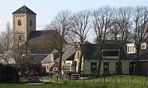
Spaarnwoude town centre
|
|||
|
|||

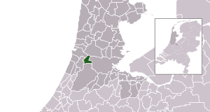
Location in North Holland
|
|||
| Country | Netherlands | ||
| Province | |||
| Established | 8 September 1857 | ||
| Disestablished | 1 January 2019 | ||
| Area | |||
| • Total | 21.19 km2 (8.18 sq mi) | ||
| • Land | 19.24 km2 (7.43 sq mi) | ||
| • Water | 1.95 km2 (0.75 sq mi) | ||
| Elevation | 0 m (0 ft) | ||
| Population
(May 2014)
|
|||
| • Total | 5,540 | ||
| • Density | 288/km2 (750/sq mi) | ||
| Time zone | UTC+1 (CET) | ||
| • Summer (DST) | UTC+2 (CEST) | ||
| Postcode |
1165, 2064–2065
|
||
| Area code | 020 | ||
Haarlemmerliede en Spaarnwoude was a special area in the Netherlands. It was like a small county or district with its own local government. This area was located in the province of North Holland.
In August 2017, about 5,760 people lived there. But on January 1, 2019, Haarlemmerliede en Spaarnwoude joined with a bigger area called Haarlemmermeer. So, it is no longer a separate municipality.
Contents
Where Was Haarlemmerliede en Spaarnwoude?
This former municipality was surrounded by several other places. To the north, it was next to Zaanstad. To the east, it bordered the big city of Amsterdam. South of it was Haarlemmermeer, and to its west was Haarlem. Finally, to the northwest, it was near Velsen.
Towns and Villages Inside
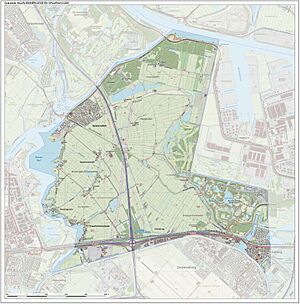
Haarlemmerliede en Spaarnwoude included several smaller towns and villages. These were Haarlemmerliede, Halfweg, Penningsveer, part of Spaarndam, Spaarnwoude, and Vinkebrug.
A Look Back: Its History
Haarlemmerliede en Spaarnwoude has an interesting past with many changes to its size and shape.
How It Started
The municipality was officially created on September 8, 1857. This happened when two smaller areas, Haarlemmerliede and Spaarnwoude, decided to join together.
Changes Over Time
Later, in 1863, two more areas called Houtrijk en Polanen and Zuidschalkwijk became part of the municipality. However, Zuidschalkwijk soon became part of the city of Haarlem.
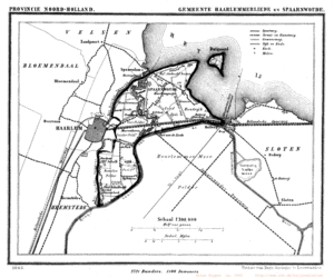
A big change happened when the North Sea Canal was built. This canal was finished in 1867. During its construction, large parts of the IJ Bay were turned into new land. This new land, called polders, made the municipality much bigger. But over the years, Haarlemmerliede en Spaarnwoude also lost some of its land to the cities of Haarlem and Amsterdam in 1927, 1963, and 1970.
The Final Merger
On January 1, 2019, the municipality of Haarlemmerliede en Spaarnwoude officially stopped being a separate area. It joined completely with the municipality of Haarlemmermeer.
International Friends
Haarlemmerliede en Spaarnwoude had a special friendship with a town called Saxilby. Saxilby is located in Lincolnshire, in the United Kingdom. This kind of friendship between towns is called "twinning."
See also
 In Spanish: Haarlemmerliede en Spaarnwoude para niños
 | Leon Lynch |
 | Milton P. Webster |
 | Ferdinand Smith |


