Hamhaugh Island facts for kids
Hamhaugh Island is a beautiful island in the River Thames in England. It's located south of Shepperton Lock, in a town called Shepperton, Surrey. Long ago, it was known simply as Stadbury.
Where is Hamhaugh Island?
This island is special because it's at the very southernmost part of the River Thames. Hamhaugh Island is mostly shaped like a rectangle. It is about 690 metres long and between 100 to 120 metres wide. The southern part of the island curves like a horseshoe and is called Hamhaugh Point. This is where the island becomes its narrowest.
The island is about 800 metres from the main churches of Shepperton and Weybridge. While Shepperton's main street is a bit further away, Weybridge's main street is very close to its church. This means the island is quite near to Weybridge's shops and services.
You can reach the nearby town by boat. If you travel by car, you would use Walton Bridge, which is more than 3 miles away. The area around Shepperton Lock has a family-friendly restaurant, two boat shops, and a lovely indoor and outdoor tea room.
Crossing the River Thames
A small ferry boat runs from the Shepperton Lock area to the northern part of Weybridge. This ferry connects to the Thames Path National Trail, which is a long walking path along the river. You can cross for a small fee, usually less than £1.
What is on the Island?
Hamhaugh Island is mostly a place where people live. It has 46 houses and a shared green space for everyone. There are also places for boats to dock. A small area of woodland with a path runs along the north side.
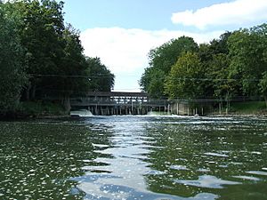
You can get to the island by walking or carrying your bicycle from Shepperton Lock. You cross over Lock Island and then walk across a weir (a small dam that controls water flow). Another weir connects Hamhaugh Island to the right bank of the river at Hamm Point, which is part of the Hamm Court area in Addlestone. However, you cannot walk across this second weir.
Island History
Hamhaugh Island was not always an island! It was created when a wide channel was dug to its north. This digging also made Lock Island, which is smaller and to the north. Before this, both Hamhaugh and Lock Island were part of the mainland. This happened before most parish boundaries were set, which was before the year 1700. That's why Hamhaugh Island is still part of the Shepperton area, even with the new wide channel.
Before many of the Thames locks were built (like those from Windsor down to Teddington starting in 1805), the river here used to flood. The combined island would get flooded, especially in the north, when high tides mixed with a lot of rainwater. This was similar to how Penton Hook Island and Desborough Island used to be, as they were also originally peninsulas (land almost surrounded by water).
The new locks and river cuts helped control the water. They also made river journeys much shorter.
In the 1700s, the City of London Corporation was in charge of the river downstream from Staines. They had to fix breaks in the river banks at Stadbury (Hamhaugh Island). They also had to remove illegal fish-weirs. Records show there was a weir at Shepperton as early as 1086 and another in the 1300s.
 | Janet Taylor Pickett |
 | Synthia Saint James |
 | Howardena Pindell |
 | Faith Ringgold |


