Addlestone facts for kids
Quick facts for kids Addlestone |
|
|---|---|
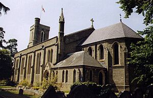 St. Paul's Church, Addlestone |
|
| Area | 4.87 km2 (1.88 sq mi) |
| Population | 15,883 (2011 census; Addlestone Built-up Area, which excludes New Haw and Woodham in the post town) |
| • Density | 3,261/km2 (8,450/sq mi) |
| OS grid reference | TQ052644 |
| • London | 18+1⁄2 mi (30 km) |
| District |
|
| Shire county | |
| Region | |
| Country | England |
| Sovereign state | United Kingdom |
| Post town | Addlestone |
| Postcode district | KT15 |
| Dialling code | 01932 |
| Police | Surrey |
| Fire | Surrey |
| Ambulance | South East Coast |
| EU Parliament | South East England |
| UK Parliament |
|
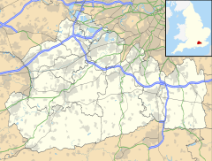
Addlestone is a town in Surrey, England. It is about 18.5 miles (30 km) southwest of London. Addlestone is the main town in the Borough of Runnymede. It is also the largest town in the area.
Contents
Geography of Addlestone
Addlestone is about 10 miles (16 km) northeast of Guildford. It is also 18.5 miles (30 km) southwest of London.
Small green areas separate Addlestone from nearby towns like Weybridge and Chertsey. There is no clear border with New Haw to the south.
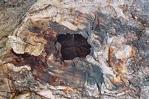
Addlestone is famous for the ancient Crouch Oak tree. People say Queen Elizabeth I once had a picnic under this tree. It used to mark the edge of Windsor Forest.
Land and Water
The land in Addlestone is mostly flat, ranging from 11 to 40 meters high. The highest point is on Row Hill. The lowest parts are near the River Thames.
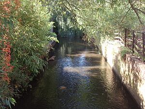
The main stream in the town is called The Bourne. It starts as the Windle Brook and flows past places like the McLaren Technology Centre.
Long ago, during the Ice Ages, ice sheets did not reach Surrey. But sand and gravel were carried by rivers. These materials formed layers of soil in the lower areas.
The soil here is mostly "loamy," which means it's a mix of sand, silt, and clay. It often has a lot of water underground.
People of Addlestone
In 2001, Addlestone had 16,657 people living there. This made it the biggest town in the Runnymede area.
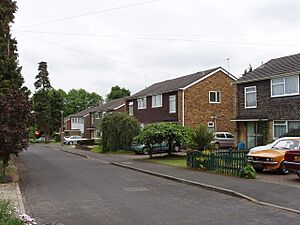
Most homes in Addlestone are owned by the people who live in them. Some homes are rented privately or from the council. There are not as many offices or factories here compared to other areas near London. Instead, you will find many parks, playing fields, and woodlands.
History of Addlestone
The name Addlestone likely comes from "Attel's Denu." This means "the valley belonging to a Saxon person named Attel."
Addlestone was once part of the Chertsey church area. In 1241, it was called "Attelsdene." By 1610, maps showed it as "Adleston."
The Crouch Oak tree is a very old symbol of the town. It is thought to be from the 11th century. It used to mark the edge of Windsor Great Park. A legend says Queen Elizabeth I had a picnic under it. The tree is so important that many local businesses use its name. It even survived a fire in 2007.
Ongar Hill was once a large country house and farm. Now it has smaller homes and a motorway nearby.
Sayes Court was another country house in Addlestone. It is now a junior school and homes.
Woburn Park History
Addlestone, including the grounds of St George's College at Woburn Park, was part of Chertsey Manor. This land belonged to Chertsey Abbey from the years 666 to 675 CE.
After the monasteries were closed, the land was leased out. Many important people rented the land over the centuries. For example, the Duke of Bridgwater leased it from 1779 to 1803. Later, Prince Frederick, Duke of York and Albany was a tenant until 1827.
In the 1740s, a famous gardener named Philip Southcote built a house called Woburn Park. He created a special garden with fields, statues, and temples. Much of this garden is still part of St George's College today.
Addlestone Since 1800
A workhouse for the poor was built in Addlestone in 1836–38. The Village Hall was built in 1887. The Princess Mary Village Homes were set up in 1871. These were schools for girls whose parents were in prison or who needed help.
Many schools were started in Addlestone during this time. St. Paul's Primary School was built in 1841. A boys' school was added in 1901.
By 1911, Addlestone had grown a lot. It had more people than Chertsey, which was the original center of the area.
A large Blériot aircraft factory was built here in 1917. It made airplanes that were taken to Brooklands for testing. Later, the site was used to build buses and taxis. In the 1990s, Marconi used the site. These companies were big employers in the town.
Today, this site is a business park called Aviator Park. Some offices have been turned into homes.
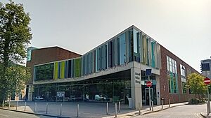
The Runnymede Civic Centre opened in 2008. It holds the offices for Runnymede Borough Council, the local police station, and the library.
Education in Addlestone
Addlestone has several state-funded primary schools. These include St Paul's C of E Primary School and The Holy Family Catholic Primary School. There are also nurseries for younger children.
There are two state-funded secondary schools in Addlestone: Chertsey High School and Jubilee High School.
Philip Southcote School is a special school in Addlestone.
St George's College is a private school. It moved to Woburn Park in Addlestone in 1884. The school's main campus is on the grounds of Woburn Park.
Landmarks in Addlestone
The George Inn
The George Inn is a very old building. It is a Grade II listed building. This means it is a special building that is protected. It is a Tudor Period building with changes made later. It has three pointed roofs facing the road.
Woburn Hill House
Woburn Hill is a large house built in 1815. It has three floors. It features a fancy porch with Greek-style columns. Above the porch is a balcony.
Areas of Addlestone
Rowhill
Rowhill, also called Row Hill, is a living area with shops. These shops include a butcher, a baker, and an electrical store. They are on Ongar Hill and are sometimes called "Top shops."
Addlestone Moor
Addlestone Moor has a mobile home park and sports fields. It is also home to the Runnymede Rockets BMX Club. A large roundabout here helps people get to the motorway.
Sport in Addlestone
Addlestone has a lawn bowls club called Addlestone Victory Park. In 2022, it won an award for its amazing comeback. The club's president, Barrie de Suys, walked many laps during lockdown. He raised over £10,000 for charity. The club grew from 5 members to 105 members in just two years. It also has the biggest junior section in Bowls Surrey.
Abbey Rangers football club plays at Addlestone Moor. Lyne FC plays at Jubilee High School.
The old football team, Addlestone & Weybridge Town, played in Liberty Lane until 1985. Now, homes are built on their old ground.
Perpetual Motion Squad
This is a Rocket League esports team. It is managed by local gamers from Addlestone.
Community and Culture
Addlestone is mentioned in H. G. Wells' famous book The War of the Worlds. In the story, one of the alien invasion ships lands at the Addlestone Golf Links.
Addlestone Library is located in the Runnymede Civic Centre. The Civic Centre also houses the Runnymede Borough Council offices and the Addlestone Police Station. It opened in 2008.
Station Road is the main road in Addlestone. It has many shops, two supermarkets, and a doctor's surgery. The Aviator business park is also on this road.
In 2015, a big project called "Addlestone ONE" started. It is rebuilding parts of the town center. When finished, it will have new homes, a hotel, a supermarket, a cinema, and new public spaces.
Transport in Addlestone
Roads
Station Road connects to main roads that lead in all directions. The M25 can be reached from Addlestone at junction 11. This motorway connects to many other parts of England.
Trains
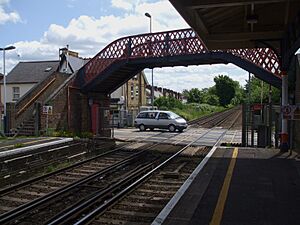
Addlestone railway station is run by South Western Railway. Trains run between London Waterloo and Guildford. A train ride to London Waterloo takes about 30 to 50 minutes.
Air Travel
London Heathrow Airport is about 10.8 miles (17.4 km) from Addlestone. You can get there by bus or by using the M25 motorway.
Buses
Addlestone has several bus services. Bus 51 goes to Slough via Staines upon Thames and Windsor. Bus 461 runs from Chertsey to Kingston upon Thames. Bus 446 travels between Woking and Staines upon Thames.
River Travel
The Wey Navigation canal runs southeast of the town. Coxes lock is a deep lock on this canal.
Nearest Towns
 |
across The Chertsey Bourne Chertsey |
across Chertsey Meads and the River Thames Shepperton |
across the Weybridge Islands and the River Thames Shepperton |
 |
| Ottershaw | Weybridge | |||
| across a belt of farms Woodham |
across Crockford Bridge Farm and Moated Farm New Haw |
across The Bourne and The River Wey Weybridge and Brooklands |
See also
 In Spanish: Addlestone para niños
 | Emma Amos |
 | Edward Mitchell Bannister |
 | Larry D. Alexander |
 | Ernie Barnes |


