
River Bourne, Addlestone facts for kids

The River Bourne is a river in northwest Surrey, England. It flows into the famous River Thames. The Bourne has a longer stream that feeds into it, called the Windle Brook. This brook starts near Bagshot Park in Berkshire. The two rivers meet as they flow through villages north of Woking. Finally, the River Bourne joins the Thames near Weybridge.
Contents
Where the River Flows
The River Bourne starts in a place called Bisley Common, southwest of Bisley. Here, it meets the Trulley Brook, which collects water from Colony Bog and the Pirbright Ranges. The river then flows between West End and Bisley. It goes around the south of Chobham and makes a curve into the countryside north of Woking.
Further along, the River Bourne meets the longer Mill Bourne, east of Chobham. It then flows between Woodham and Addlestone, and then New Haw and Addlestone.
The river eventually reaches St George's College in Addlestone. Here, it joins another river also called the River Bourne (the Chertsey branch). From there, a man-made channel guides the river east. It joins the River Thames below the southern weir (a small dam) of Shepperton Lock.
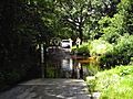
As the river gets closer to the Thames, especially past St George's College, it becomes more like a canal. It flows through many gardens of the Hamm Court estate before reaching the Thames.
Smaller Rivers Joining the Bourne
Rivers that flow into a larger river are called tributaries. The River Bourne has several important tributaries.
Windle Brook: A Key Tributary
The Windle Brook is a small river that starts at New England Hill in Swinley Forest, Berkshire. More water comes from nearby areas in Bagshot, Surrey. Other small streams from Windlesham join the Windle Brook below the Windlesham Golf Club. The brook then flows through the Windlesham Arboretum, which is a public park.
The Windle Brook runs north of Chobham and through Windlesham, giving the town its name. Along its path, it forms a few lakes, including Rapley Lake. There's also a private lake with a weir in the royal Bagshot Park.
This stream flows east until it reaches the M3. Then, it turns southeast. When the Hale Bourne joins it from the southwest, the main river is sometimes called the Hale Bourne.
The Hale Bourne: From Lightwater to Chobham
The Hale Bourne starts in Lightwater, in a hilly, wooded area next to the Pirbright Ranges. It forms a small lake in Lightwater, surrounded by houses. The Hale Bourne gets much bigger when the Windle Brook joins it. This happens below Broadway Green, Windlebrook, and Rectory Farms in Lightwater.
The larger Hale Bourne then flows into Chobham. Here, another tributary joins it, and the river becomes known as the Mill Bourne.
The Mill Bourne: Flowing Through Chobham
Once the Clappers Brook joins it in west Chobham, the Hale Bourne officially becomes the Mill Bourne. It flows past a recreation ground and under Millbourne Bridge, right through the center of Chobham village. It picks up two more main tributaries from the north.
The Mill Bourne passes by Town Mill, the Chobham Museum, Sow Moor, and Emmett's Mill. Finally, it meets the River Bourne. This meeting point is located between the McLaren Technology Centre grounds and Fairoaks Airport.
Knaphill and Parley Brooks
Another stream starts at Waterer's Park in Knaphill, a northern part of Woking. This stream flows north and joins the River Bourne west of Horsell Common. Just before this meeting, the Parley Brook, which starts from the Goldsworth Park recreation ground, also joins in.
When the River Floods
From August 12 to 14, 2006, many parts of Chobham experienced serious floods. This happened because the River Bourne and the Mill Bourne overflowed their banks. The floods were caused by very heavy rainfall and thunderstorms in the area.
Two months' worth of rain fell in just one night! The local rivers and streams couldn't handle all the water. This caused water to run across the land, flooding homes, businesses, and roads. There were also power cuts.
Some people in Chobham were worried that the flooding was made worse in a small area. This was because a field near Pennypot Lane, which used to be a "water meadow" (a natural area that absorbs floodwater), had been covered with hard material. This made it harder for the land to soak up the extra water from the River Bourne.
Land Around the River
The land around the two main rivers, once past Lightwater and Bisley, is mostly sandy. This area is known as the Bagshot or Western Surrey formation. It has sand and organic material over clay. The soil is described as "slowly permeable loamy or peat soils" or "loamy and clayey soils with naturally high groundwater." On higher land, there are "free-draining naturally wet heath" areas. These uplands are unique, with heather, gorse, and pine trees mixed with bogs and small streams.
In Chobham, the land around the river is wider and more fertile. It's used for farming because it's drained by ditches and is less acidic.
Here's how high the river and nearby towns are above sea level:
| Elevation of Bourne at centre | Settlement passed | Elevations of centre of settlement |
|---|---|---|
| 53m ("Windle Brook") | Bagshot | 55-91m |
| 41.5m ("Windle Brook") | Windlesham Arboretum | 42-46m |
| 43.5m ("Hale Bourne") | Lightwater | 45.3-60m |
| 31—33m (River Bourne) | Bisley | 36m-55m |
| 30—32m (River Bourne) | West End | 31.7-42m (mostly 33-42m) |
| 25m (River Bourne) | Chobham (High Street south of Church) | 26—27.2m |
| 27.2m ("Mill Bourne") | Chobham (High Street and all areas off Windsor Road north of Church) | 27.5-39m |
| 15–15.5m | New Haw Golf Fun and Driving Range | 15.5-16.2m |
| 11.5–14m | Addlestone | 13-21m |
The area usually gets about 635 millimeters of rain each year.
Fishing in the River
The River Bourne is not a navigable river, meaning boats can't easily travel on it. This allows landowners next to the river to grant private fishing rights. So, several fishing groups use the river without needing special government permits.
One example is Bourne Anglers, a small fishing club and conservation group started in 2013. The club works to keep the river healthy. With permission from various landowners, they have kept parts of the river open for free fishing.
Images for kids
-
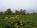
Field adjoining the Mill Bourne
-
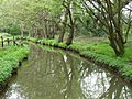
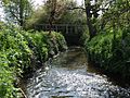
Mill Bourne
east stretch
at Emmett's Mill -
Mill Bourne
west stretch by the Village Mill -
Mill Bourne
west stretch -
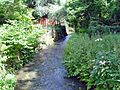
Ford at Lovelands Lane across the river Bourne, south of Penny Pot, Chobham


