Hardwicke Bay facts for kids
Quick facts for kids Hardwicke Bay |
|
|---|---|
| Location | Spencer Gulf, South Australia |
| Coordinates | 34°44′21.24″S 137°20′17.48″E / 34.7392333°S 137.3381889°E |
| Type | Bay |
| Etymology | Earl of Hardwicke |
| Part of | Spencer Gulf |
| Basin countries | Australia |
| Designation | Marine Parks: Eastern Spencer Gulf Southern Spencer Gulf |
| Max. length | about 45 km (28 mi) (north-south) |
| Max. width | about 33 km (21 mi) (NE-SE) |
| Max. depth | 29 m (95 ft) |
| Islands | Wardang |
| Settlements | Corny Point, The Pines, Point Turton, Hardwicke Bay, Bluff Beach, Port Rickaby, Port Victoria (settlements listed from south-west to north east) |
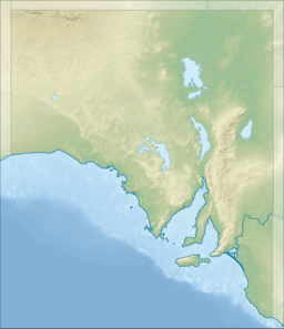
Hardwicke Bay is a large bay in South Australia. It is located on the west coast of the Yorke Peninsula. This bay is part of the bigger Spencer Gulf.
Contents
About Hardwicke Bay
Hardwicke Bay is found on the western side of the Yorke Peninsula. It stretches from Corny Point in the south. In the north, it reaches the southern tip of Wardang Island.
Water Depth and Coastline
The water in Hardwicke Bay is usually between 14 and 20 meters deep. However, near Wardang Island, the depth can change a lot. The bay is a good place for boats to anchor. This is especially true when strong winds blow from the south. Most of the bay has a rocky bottom, which helps boats stay in place.
The coastline of Hardwicke Bay is mostly made of sandy beaches. These beaches often lead up to low sandhills. These hills are covered with woodlands. You can also find rocky areas along the coast.
There are a few important lights that help boats navigate the bay. The Corny Point Lighthouse is at Corny Point. There is also a light on Wardang Island. These lights help guide ships safely.
History of the Bay
The bay was named by a British explorer named Matthew Flinders. He named it on March 19, 1802. Flinders named the bay after the Earl of Hardwicke.
Towns and Ports
Many small towns are located along the coast of Hardwicke Bay. If you travel from the southwest to the northeast, you will find:
Jetties and Boat Ramps
The bay has several places where boats can dock or be launched.
- Jetties (long piers for boats) are at Point Turton, Port Rickaby, and Port Victoria.
- Boat ramps (slopes for launching boats) are found at The Pines, Point Souttar, Point Turton, Hardwicke Bay, Port Minlacowie, Bluff Beach, Port Rickaby, and Port Victoria.
What the Bay is Used For
Hardwicke Bay is used for a special type of farming called aquaculture. This is where people raise fish or other sea creatures in the water. Some areas in the southern part of the bay are set aside for this purpose. There are also plans for more aquaculture in the northern part of the bay.
Protecting the Bay
Parts of Hardwicke Bay are protected areas. These areas help keep the bay's natural environment safe.
- The Eastern Spencer Gulf Marine Park covers the northern end of the bay.
- The Southern Spencer Gulf Marine Park protects the southern end.
- The Leven Beach Conservation Park is next to the bay near Point Turton. These parks help protect the marine life and habitats in the bay.
 | Roy Wilkins |
 | John Lewis |
 | Linda Carol Brown |


