Harper Pass facts for kids
Quick facts for kids Harper Pass |
|
|---|---|

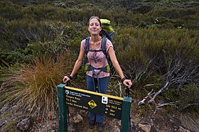
Tramper at the pass in 2014
|
|
| Elevation | 962 m (3,156 ft) |
| Traversed by | Harper Pass Track; part of Te Araroa |
| Location | New Zealand |
| Range | Southern Alps / Kā Tiritiri o te Moana |
| Coordinates | 42°43′40.8″S 171°52′58.2″E / 42.728000°S 171.882833°E |
Harper Pass is a mountain pass in New Zealand. It sits high up in the Southern Alps / Kā Tiritiri o te Moana. This pass connects the Canterbury side with the West Coast. It was once a very important route for Māori people. They used it to get a special green stone called pounamu.
The pass was first known as Hurunui Pass or Taramakau Pass. In 1857, a European explorer named Leonard Harper crossed it. The pass was then named after him. Later, it became a key path for European settlers, especially during the West Coast Gold Rush. Today, Harper Pass is a popular route for hikers. It is part of the long Te Araroa trail.
History of Harper Pass

For Māori people, Harper Pass was the most important way to cross the Southern Alps / Kā Tiritiri o te Moana. They used it to collect pounamu (greenstone) from the West Coast. The pass was only used during certain seasons. Māori knew the pass by the names of the rivers flowing from it: the Taramakau River on the west and the Hurunui River on the east.
The first Europeans crossed the pass in 1857. In September of that year, Edward Dobson led a group over the pass. They had to turn back because of bad weather.
Just two months later, on November 4, 1857, Leonard Harper set out to cross the pass. He traveled with Mr. Loch and four Māori guides. They faced floods and built a special raft from flax stalks. They reached the West Coast after 23 days. The journey back took 14 days. After this trip, the pass became known as Harper Pass.
The Gold Rush Era
In 1861, gold was found in Otago. This led to a search for gold in Canterbury. The Canterbury government offered a reward for finding gold near Christchurch. At that time, the West Coast was part of Canterbury.
A track was cut to Harper Pass to make the West Coast more reachable. In March 1863, the government decided a better way to the West Coast was urgently needed. More work was done on the Harper Pass track.
In August 1864, the government ordered work on the track to stop. They also wanted to close supply depots on the West Coast. But just five days before these orders arrived, a track cutter named Albert Hunt found a lot of gold. This started the famous West Coast Gold Rush.
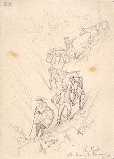
By February 1865, news of the gold rush reached Christchurch. About 2,500 gold miners then traveled over Harper Pass. The journey from Christchurch to the Taramakau River was about 270 kilometers (170 miles).
The trip was very difficult. The first part was a road for wagons. The middle part was a steady climb, but the last part was dangerous. It involved a steep downhill path and a risky river crossing.
The track became so bad that by March 1865, the government warned people not to use it. However, it was still the only way from Christchurch to the West Coast. This led to a search for a better route over the Southern Alps.
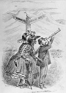
Soon, a route explored by Arthur Dobson was chosen: Arthur's Pass. By October 1865, a rough track over Arthur's Pass opened for wagons. This meant fewer people used Harper Pass. On March 20, 1866, the road over Arthur's Pass opened for coaches. It was a much easier route, and Harper Pass was no longer used for transport.
Tramping the Harper Pass Track
In the 1930s, the New Zealand government wanted to reopen the Harper Pass track. They hoped it would be another popular hiking trail, like the Milford Track. Some huts were built along the way at that time.
Today, the Department of Conservation looks after the route. They say it is a four or five-day hike. Hikers need to be prepared for anything, as the area is remote. It can also flood easily.
It is best to start the hike from the West Coast side. The path along the Taramakau River depends on low river levels. So, starting from the west means you can check the weather forecast more reliably. The hike begins at Aickens on State Highway 73. A footbridge helps hikers cross the Ōtira River.
After crossing Harper Pass, the track follows the Hurunui River to Lake Sumner. Then, it follows the Hope River to State Highway 7. The entire Harper Pass Track is part of Te Araroa, a very long walking trail across New Zealand.
See also
 In Spanish: Paso de Harper para niños
 | Calvin Brent |
 | Walter T. Bailey |
 | Martha Cassell Thompson |
 | Alberta Jeannette Cassell |


