Harrells, North Carolina facts for kids
Quick facts for kids
Harrells, North Carolina
|
|
|---|---|
| Country | United States |
| State | North Carolina |
| Counties | Duplin, Sampson |
| Area | |
| • Total | 3.15 sq mi (8.15 km2) |
| • Land | 3.15 sq mi (8.15 km2) |
| • Water | 0.00 sq mi (0.00 km2) |
| Elevation | 85 ft (26 m) |
| Population
(2020)
|
|
| • Total | 160 |
| • Density | 50.86/sq mi (19.64/km2) |
| Time zone | UTC-5 (Eastern (EST)) |
| • Summer (DST) | UTC-4 (EDT) |
| ZIP code |
28444
|
| Area codes | 910, 472 |
| FIPS code | 37-29680 |
| GNIS feature ID | 2406647 |
Harrells is a small town in North Carolina, United States. It is special because it is located across two different counties: Duplin County and Sampson County. In 2020, about 160 people lived in Harrells. A few years earlier, in 2010, the population was a bit higher, with 202 residents.
Contents
History of Harrells
Harrells has some interesting history! Two old places, the Lewis Highsmith Farm and the Dr. John B. Seavey House and Cemetery, are important enough to be listed on the National Register of Historic Places. This means they are special places worth protecting. Also, a private school called Harrells Christian Academy started in the town in 1969.
Geography and Location
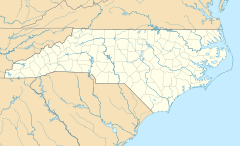
Harrells is mostly found in the southeastern part of Sampson County. A smaller part of the town is in the southwestern area of Duplin County.
Roads and Travel
U.S. Route 421 goes right through Harrells. If you travel north on this road, you'll reach Clinton, which is about 22 miles away. Clinton is the main town for Sampson County. If you go south on the same road, you'll get to Wilmington, which is about 40 miles away.
Another important road, North Carolina Highway 41, also passes through Harrells. Going east on this highway will take you to Wallace, about 14 miles away. If you head west, you'll reach Elizabethtown, which is about 26 miles from Harrells.
Land Area
The town of Harrells covers a total area of about 3.15 square miles (or 8.2 square kilometers). All of this area is land; there are no large bodies of water within the town limits.
Most of Harrells is located within the Franklin Township in Sampson County. The part of Harrells that is in Duplin County falls within the Rockfish Township.
Population Changes
| Historical population | |||
|---|---|---|---|
| Census | Pop. | %± | |
| 1880 | 68 | — | |
| 1950 | 147 | — | |
| 1960 | 259 | 76.2% | |
| 1970 | 249 | −3.9% | |
| 1980 | 255 | 2.4% | |
| 1990 | 187 | −26.7% | |
| 2000 | 187 | 0.0% | |
| 2010 | 202 | 8.0% | |
| 2020 | 160 | −20.8% | |
| U.S. Decennial Census | |||
The population of Harrells has changed over many years.
- In 1880, there were only 68 people living in the town.
- By 1960, the population grew to 259 people.
- In 2000, the town had 187 residents.
- The population was 202 in 2010.
- In the most recent count in 2020, the population was 160 people.
People of Harrells
Based on information from the year 2000, there were 187 people living in Harrells. The town had 80 households and 58 families.
The people living in Harrells came from different backgrounds. About 55% of the residents were White, and about 40% were African American. A small number of people were Native American or from other races. About 5% of the population identified as Hispanic or Latino.
The average age of people in Harrells in 2000 was 44 years old. About 17% of the population was under 18 years old, and about 22% were 65 years or older.
See also
 In Spanish: Harrells para niños
 | Jackie Robinson |
 | Jack Johnson |
 | Althea Gibson |
 | Arthur Ashe |
 | Muhammad Ali |


