Hartland Point facts for kids

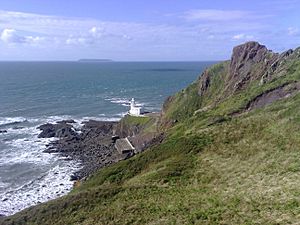
Hartland Point is a tall, rocky piece of land on the very edge of the Devon coast in England. It stands about 325 feet (99 meters) high. This point is about three miles (5 km) north-west of the village of Hartland.
Hartland Point is important because it marks where the Bristol Channel ends on the English side. To its west, you'll find the wide Atlantic Ocean. Long ago, the Romans knew this place as the "promontory of Hercules."
Contents
Hartland Point Lighthouse
Trinity House is in charge of lighthouses in England and Wales. They built a lighthouse right at the tip of Hartland Point. The Hartland Point Lighthouse was finished in 1874. It was designed by Sir James Douglass.
The lighthouse tower is 18 meters (59 feet) tall. Its lamp shines from 37 meters (121 feet) above the sea. This bright light could be seen up to 25 miles (40 km) away. A special blessing for the lighthouse was given by Frederick Temple, who later became the Archbishop of Canterbury.
The lighthouse became automatic in 1984. This means no people live there anymore. It is now controlled from a center in Harwich in Essex. Before it was automated, the lighthouse had homes for four keepers and their families. These homes were later taken down. A helipad was built instead. This was needed because the road to the lighthouse often had falling rocks and landslides. Now, it's very hard to drive there, and the gates are usually locked. Large concrete tanks near the lighthouse used to hold fresh water for the keepers.
Lighthouse Signals
| Light | The light flashes white six times every fifteen seconds. |
|---|---|
| Fog horn | A loud horn blasts for five seconds every minute when it's foggy. |
Coastguard Station
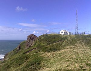
HM Coastguard has a small station on top of Hartland Point. It is near the lighthouse. This station is usually not staffed by people anymore.
The South West Coast Path is a long walking trail. It used to help the Coastguard travel between their stations on foot. They could watch the sea for smugglers. The path stays very close to the cliff edge as it goes through Hartland Point. It's a great way to see the area and its beautiful views.
Radar Station
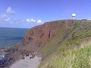
The UK's Ministry of Defence once had a radar system here. It was controlled from a nearby air force base. Today, the UK Civil Aviation Authority runs the radar. It helps control air traffic for both military and civilian planes. You can see its unusual white dome from up to 10 miles (16 km) away.
The MS Johanna Shipwreck
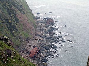
On December 31, 1982, a ship named MS Johanna crashed into the rocks near Hartland Point. The ship was from Panama and owned by a Dutch company. It was carrying wheat from the Netherlands to Cardiff in the Bristol Channel.
Four of the crew members were saved by a helicopter from RAF Chivenor. Later that day, three officers were rescued by the RNLI lifeboat from Clovelly. You can still see the old, decaying parts of the ship's hull today.
See also
 In Spanish: Punta de Hartland para niños
 | Tommie Smith |
 | Simone Manuel |
 | Shani Davis |
 | Simone Biles |
 | Alice Coachman |


